Japan reports Chinese drones and a Y-9 aircraft transit Miyako Strait; ASDF scrambles fighters
What happened
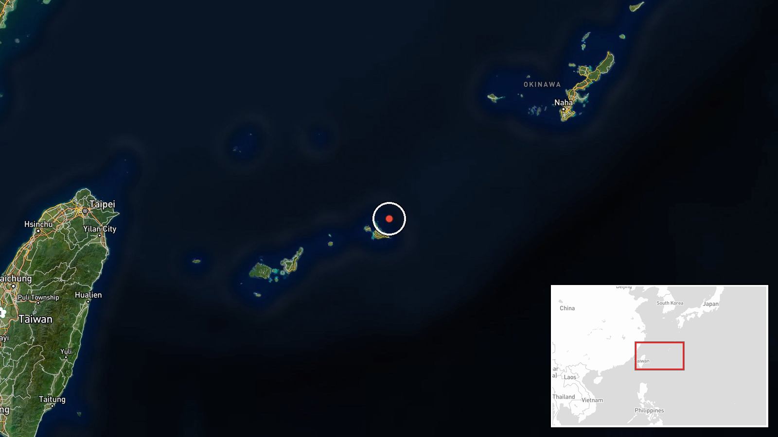
Japan's Joint Staff reported on X that Chinese military drones and an intelligence-gathering aircraft flew through the Miyako Strait area on 19 October 2026, according to the event data. The Joint Staff said a BZK-005 reconnaissance drone and a Y-9 surveillance aircraft came from the East China Sea, passed between Okinawa Main Island and Miyako Island, reached the Pacific, turned around, and flew back through the same gap toward the continent. Separately, a TB-001 reconnaissance and strike drone reportedly transited between Yonaguni and Taiwan, flew as far as the waters off Amami Oshima, then reversed and also returned through the Okinawa-Miyako gap. The reporting places the activity from the morning into the afternoon. Japan's Air Self-Defense Force Southwestern Air Defense Force scrambled fighter aircraft in response. These details follow the original Japanese-language statement.
Context and assessment
The Miyako Strait is one of the main passages linking the East China Sea with the western Pacific, and the gap between Okinawa and Miyako is a routine route for Chinese military aircraft and ships moving between the continent and open ocean. Yonaguni lies close to Taiwan, so drone flights through that channel bring surveillance activity near the Taiwan Strait area into Japan's southwestern island chain. This event fits a recent pattern in the same area. In a related event on 16 October, Japan's Joint Staff confirmed three PLA Navy vessels south of Miyako, a destroyer, a frigate and a supply ship, operating in the Philippine Sea before moving on. Taken together, air and naval movements in the same few days suggest sustained, multi-domain monitoring of Japanese defenses and the surrounding waters. Such flights may serve intelligence collection on radar, communications and Japanese response times, or simply establish a persistent presence. The data does not show intent, and these readings remain provisional.
Sources and confidence
The report comes from a single channel, the official X account of Japan's Joint Staff Office, which is a government source with a generally consistent record of publishing tracking details of this kind. No independent cross-confirmation is present in the event data, and the confidence score of 6.1 reflects that single-source status and the lack of corroborating detail on altitude, flight paths or timing. Confidence would rise with a follow-up Japanese Ministry of Defense release, reporting from Japanese or regional media quoting officials, or independent flight-tracking and radar analysis matching the routes. It would fall if the statement were corrected or if the aircraft identifications were disputed.
Location
The coordinates are a broad regional point at roughly 24.95 N, 125.45 E, placed at the center of the Miyako Strait, so the location is approximate rather than tied to a settlement or facility. The setting is a narrow maritime channel within the Ryukyu island chain, separating the East China Sea from the Pacific. Miyako Island and Okinawa Main Island border the passage, and Yonaguni, closer to Taiwan, lies to the west, while Amami Oshima is referenced as the drones' northern turning point.
Related events nearby
- Japan's Joint Staff confirmed three PLA Navy ships (Luyang III destroyer 122, Jiangkai II frigate 576, Fuchi s2026-10-19 09:34 UTC · Naval · Philippine Sea, ~220 km south of Miyako Island, Ok
▶ View this event on the live map

Intel Mapper aggregates open-source reports from monitored Telegram and X channels, geolocates them, cross-checks duplicates across sources and assigns a confidence score. Entries are updated as new confirmations arrive. Read how we verify events.