Sudan War Monitor Reports Continued Grave Violations Against Civilians in Central Darfur
What happened
On 19 October 2026, the Sudan War Monitor account on X posted an Arabic-language statement reporting the continuation of serious violations in areas of Central Darfur State. The post, marked with a warning symbol, quotes a named commentator, rendered in the transliteration as Adam Rjal, who calls the protection of civilians a moral duty. The post does not describe a specific incident, date of attack, perpetrator, or number of victims. Its wording is general and characterizes the situation as ongoing rather than documenting a single event. The report is therefore best read as an advocacy statement about a broad area and not as a verified account of a particular attack. It was published at 20:07 UTC and has not yet been matched by a second source in the event record.
Context and assessment
Central Darfur sits in western Sudan, adjacent to the Jebel Marra massif, where the Sudanese Armed Forces and the Rapid Support Forces have contested control and where civilian displacement has been recurrent. Several related events logged the same day point to a wider pattern in the region. Thousands of displaced people in Bili Serif, in East Jebel Marra, were reported to be living in the open with severe shortages of food, water and health care. A drone strike attributed to the RSF near Bir Siliba in West Darfur reportedly killed several civilians, including six women, and injured five more, with most victims described as displaced agricultural workers. In Blil, South Darfur, an RSF detention of a trader was also recorded. Taken together, these events suggest that civilians across several Darfur states face simultaneous pressures from armed violence, aerial attacks, detention and displacement. Operationally, the pattern may indicate contested movement corridors and areas where displaced populations concentrate, though the available data does not establish the specific actors or intent behind the general claim in the Central Darfur post.
Sources and confidence
The event rests on a single X account, Sudan War Monitor, which is recorded as the only reporting channel. No independent outlet, humanitarian agency or verified local observer in the record repeats the claim, so cross-confirmation is absent and the confidence score of 6.0 reflects that limitation. The post's generic wording also makes it hard to test against specific incidents. Confidence would rise with named locations, dates and casualty descriptions corroborated by agencies such as OCHA or UNICEF, by independent monitoring groups, or by geolocated imagery. It would fall if the account cannot be tied to direct observation or if the claims are contradicted by other reporting.
Location
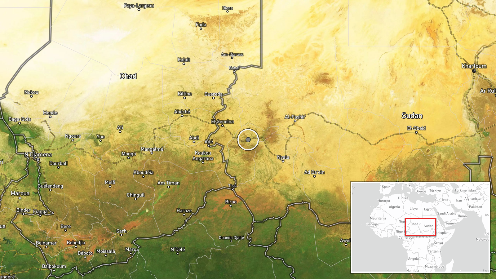
The location is recorded only at region level, Central Darfur State, with coordinates of 12.9 and 23.47 and a low location confidence. These points indicate a broad area rather than a settlement, camp or facility, and should not be read as a specific site of violence. The state lies in western Sudan, bordering Chad to the west and containing parts of the Jebel Marra highlands to the east. The geographic setting combines dry plains with mountainous terrain that has historically shaped displacement routes and access for aid.
Related events nearby
- Thousands of displaced people in Bili Serif, East Jebel Marra, live in the open amid severe shortages of food,2026-10-19 15:36 UTC · Displacement · Bili Serif, East Jebel Marra, Darfur, Sudan
- Drone strike attributed to RSF killed several civilians, including six women, and injured five in Bir Saliba, 2026-10-19 13:18 UTC · UAS Strike · Sanaqit, near Bir Siliba, Sirba Locality, West Dar
- RSF forces arrested trader Saif al-Din Mohamed while he travelled from Blil to Nyala; he has been missing abou2026-10-19 13:18 UTC · Police Operation · Blil, South Darfur, Sudan
▶ View this event on the live map

Intel Mapper aggregates open-source reports from monitored Telegram and X channels, geolocates them, cross-checks duplicates across sources and assigns a confidence score. Entries are updated as new confirmations arrive. Read how we verify events.