Army drones reportedly strike Al-Mujlad market and Al-Dabab area in West Kordofan, Sudan
What happened
A post relayed on X by the monitoring account @sudanwarmonitor, which reproduces an Arabic message from the Emergency Lawyers group, reports that army drones struck the Al-Mujlad market in West Kordofan on 17 October 2026 and an area around Al-Dabab on 18 October, killing dozens, including civilians and children, and wounding others. The Arabic wording attributes the strikes to the army, and the group condemns them while demanding civilian protection and accountability for violations. The entry's summary dates the Al-Dabab attack to 18 October, while related reports on the page describe a strike on a mourners' vehicle in Al-Dabab with a considerably higher reported toll, and a separate drone strike on a forestry office in Al-Muglad. The casualty figures are unverified and are reported as stated by the sources.
Context and assessment
The Sudanese army and the Rapid Support Forces have been fighting since April 2023, and Kordofan has become one of the main fronts as fighting spread beyond Khartoum and Darfur. West Kordofan sits between areas of RSF influence and army-held towns, and Al-Muglad is a town of commercial and logistical importance in a region with oil infrastructure in the surrounding Muglad basin. Markets and gatherings are recurring features of civilian harm reporting in this conflict, and the related events on this page show a cluster of drone activity in Al-Muglad and Al-Dabab within roughly a day, including a strike on a mourning procession. That pattern suggests repeated use of armed drones across a short period in the same district rather than a single isolated incident. Operationally, such clustering may point to recurring strikes against towns where the other side is believed to be present, but it may equally reflect inaccurate targeting or misidentification of civilian gatherings. The available data cannot distinguish between these explanations, and attribution to the army rests on suspected linkage rather than confirmed identification of the launching unit.
Sources and confidence
All material on this entry traces to one channel, the X account @sudanwarmonitor, which passed on a message attributed to Emergency Lawyers. No independent outlet in the dataset corroborates the strikes, dates, or death toll, which is why the confidence score is low at 6.0. Confidence would rise with confirmation from local Sudanese media, hospital or health ministry records, UN or humanitarian reporting, or verified imagery of the market and Al-Dabab sites. It would fall if the original Emergency Lawyers post cannot be located, or if the casualty figures in related reports prove inconsistent with other accounts.
Location
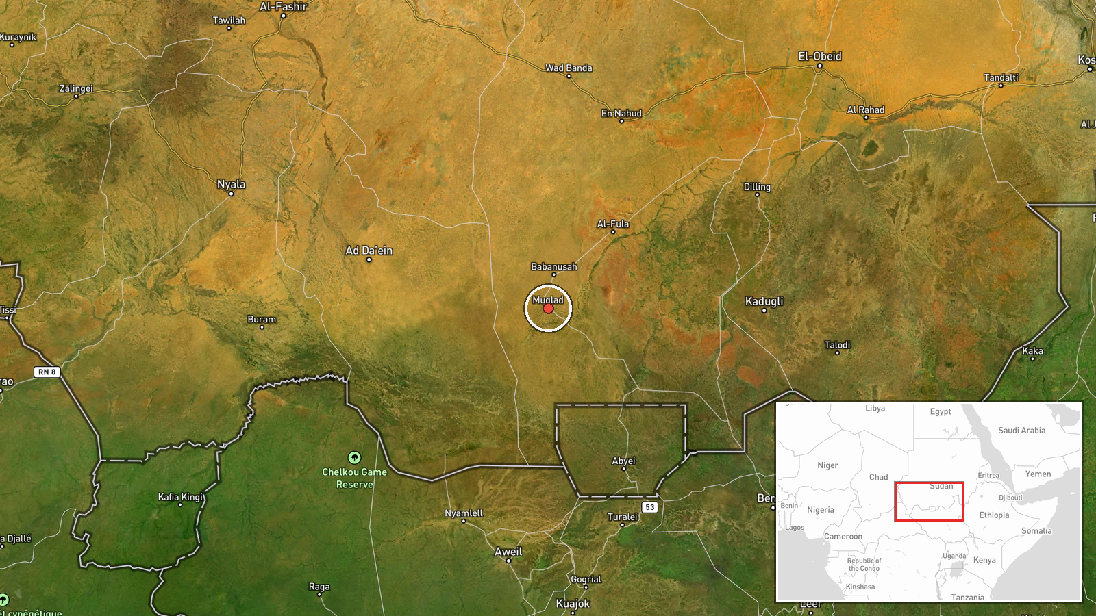
The coordinates correspond to the Al-Mujlad market at settlement precision, and the location confidence is recorded as high because the town is named directly in the source. The Al-Dabab area is not pinned separately in this entry, so its exact position is less certain. West Kordofan is a semi-arid savanna region in western Sudan, and Al-Muglad lies within the Muglad basin, an area associated with oil production and pipeline routes.
Related events nearby
- Drone struck a government forestry office near Al-Muglad's Al-Amal girls' school in West Kordofan, causing no 2026-10-19 13:18 UTC · UAS Strike · Al-Muglad, West Kordofan, Sudan
- Suspected SAF-linked drones struck a Jumbo van carrying about 200 mourners and a mourning tent in Al-Dabab, ki2026-10-19 06:27 UTC · UAS Strike · Al-Mujlad, West Kordofan, Sudan
▶ View this event on the live map

Intel Mapper aggregates open-source reports from monitored Telegram and X channels, geolocates them, cross-checks duplicates across sources and assigns a confidence score. Entries are updated as new confirmations arrive. Read how we verify events.