Drone strikes reportedly kill 21 in Al-Adiya and Abu Zabad, Sudan, per single-source report
What happened
A post on X from the account @sudanwarmonitor reports that drone strikes killed 21 people in Al-Adiya and Abu Zabad, Sudan, on 23 October 2026 at 05:51 UTC. The Arabic-language post pairs the casualty claim with an appeal from the Government of Peace in Nyala, which urges immediate international action. The text names no perpetrator, does not specify the drone type or launch method, and gives no breakdown of the dead by civilian or combatant status. The report refers to Al-Adiya, but the event record places the coordinates at Abu Zabad. Because the claim rests on one channel, the casualty figure should be treated as reportedly rather than confirmed.
Context and assessment
Abu Zabad lies in West Kordofan, one of the regions where the war between the Sudanese Armed Forces and the Rapid Support Forces has moved in recent months, and control of towns and transport routes there matters to both sides. The Government of Peace in Nyala is the parallel administration associated with the RSF, so its appeal signals that the strike is being framed politically as well as militarily. A related event the day before, reported by the United Nations, describes civilians killed in drone strikes that hit a market and homes elsewhere in Sudan, with no location or perpetrator given. Two reports of drone-related civilian deaths within about a day suggest a pattern of uncrewed aircraft being used against populated areas, though the link between the two events is not confirmed. Operationally, drones are cheap, can be launched from distance, and are useful against towns, markets and gatherings. Strikes of this kind may point to a deliberate campaign against civilian-adjacent targets or to opportunistic use by a party with limited air capability. Without a named operator or independent imagery, these readings remain hypotheses.
Sources and confidence
The only source in the record is a single X account, @sudanwarmonitor, with no wire agency, local outlet or official statement carrying the same figure. The related UN report from 22 October describes civilian drone deaths but does not confirm this location or the 21 figure, so it supports the pattern rather than the event itself. The confidence score of 5.4 reflects a single unverified channel, an unnamed actor and no imagery. Confidence would rise with corroboration from a wire service, UN OCHA or a Sudanese health authority giving named locations and counts, or with satellite imagery of impact sites. It would fall if the account is shown to recycle older claims or if no other outlet reports the event within a few days.
Location
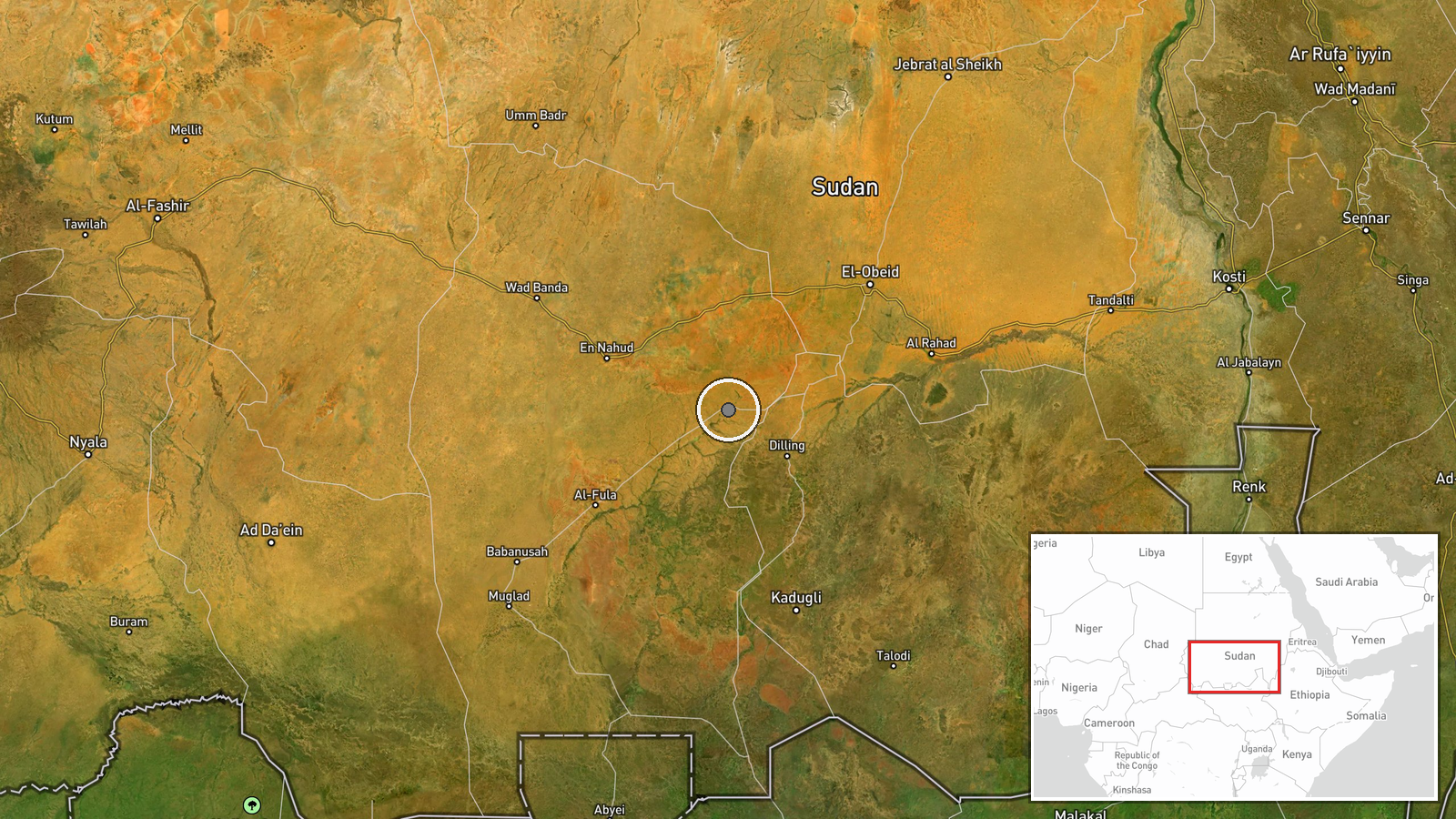
Coordinates are set at settlement level for Abu Zabad in West Kordofan, and the location confidence is recorded as high. Al-Adiya is not separately placed in the data, so the event point may not represent that site. The setting is flat savanna with sparse settlements and few natural landmarks, linked by roads and tracks that connect Kordofan with Darfur and the wider Nile region. Such terrain offers little cover, so strikes on settlements there are often visible from afar.
Related events nearby
- UN reports civilians killed in drone strikes that hit a market and homes in Sudan; perpetrator not identified 2026-10-22 10:19 UTC · UAS Strike · Sudan (location not reported)
▶ View this event on the live map

Intel Mapper aggregates open-source reports from monitored Telegram and X channels, geolocates them, cross-checks duplicates across sources and assigns a confidence score. Entries are updated as new confirmations arrive. Read how we verify events.