Cargo ship KHORYV sinks after drone strike in Black Sea off Romania's Constanța coast
What happened
A cargo ship identified as KHORYV (IMO 8138712) capsized and sank in the Black Sea about 13 nautical miles off Constanța, Romania, after being struck by a drone, according to a report on X from the account @Osint613. The report says the attack took place outside Romania's territorial waters but close to the border. It gives the crew as 13 people, 10 Ukrainians and three Azerbaijanis. One death has been confirmed, three sailors are missing, and nine crew members were injured. The post does not say who launched the drone, so the attacker is recorded as unattributed. The event is timestamped 11:09 UTC on 23 October 2026. Because this account is the only source logged, the sinking, the crew breakdown and the casualty figures should be read as reported rather than independently verified.
Context and assessment
The Black Sea has been a contested maritime space since Russia's full-scale invasion of Ukraine in 2022, with both sides and their supply routes exposed to naval and aerial attacks. Constanța is Romania's largest port and a NATO member's key Black Sea gateway, so an incident close to its approaches carries weight beyond a single vessel. The most relevant related event is a separate monitoring report from roughly nine hours earlier, at 02:17 UTC, in which Ukrainian air monitoring recorded one Shahed-type drone passing over the Black Sea and heading north. That report does not link the drone to the ship, and the data provides no direct evidence that the same aircraft struck the vessel. Still, a northbound drone over the same body of water is consistent with the kind of long-range transit that has been reported in this area before. Operationally, a strike on a merchant ship in open water outside territorial limits may point to deliberate targeting of commercial traffic, or to a misidentification, and the available data cannot distinguish between these. Any assessment of intent would require information about the vessel's cargo, routing and prior activity, none of which is included here.
Sources and confidence
The event is logged from a single channel, the X account @Osint613, and the source count is one. No second outlet in the data confirms the sinking, the casualty figures or the crew breakdown. The confidence score of 6.8 reflects a report with specific and internally consistent detail, including the vessel name, IMO number, distance from port, and crew counts that reconcile to one dead, three missing and nine injured, but it lacks corroboration. Confidence would rise with statements from Romanian maritime or coast guard authorities, vessel tracking records, flag state or operator confirmation, or wire service reporting. It would fall if the IMO number fails registry checks or if the vessel's identity or position is disputed.
Location
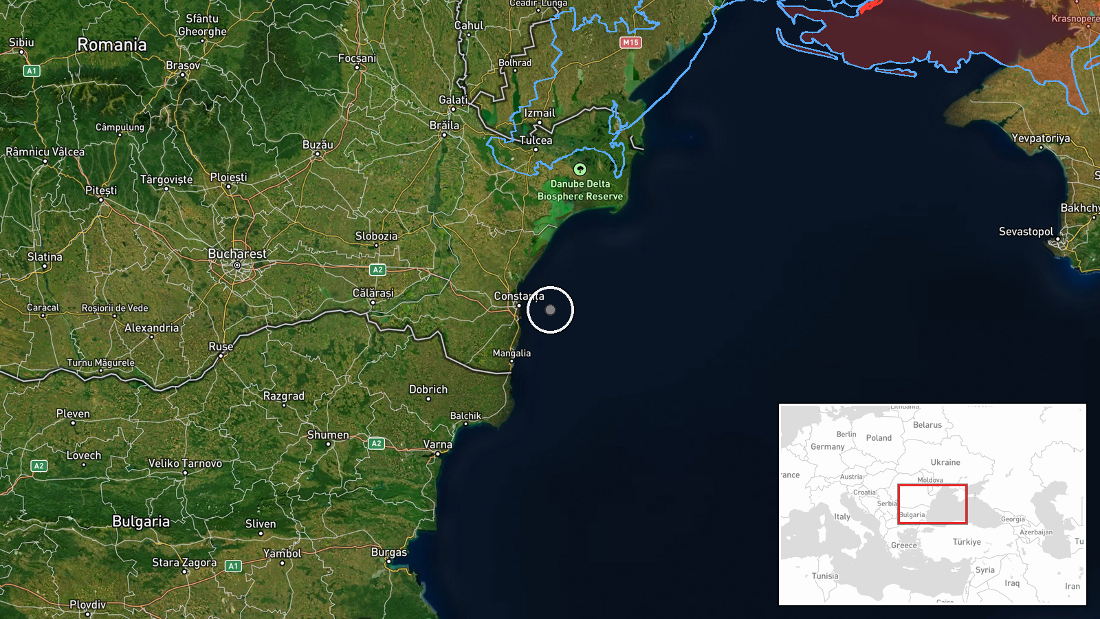
The coordinates, 44.15 N and 28.93 E, are approximate. They are derived from the stated distance of about 13 nautical miles from Constanța rather than from a fixed incident position or an AIS track, so the location is recorded at settlement-level precision. The point lies offshore in the western Black Sea, east of Constanța and beyond Romania's territorial waters. Nearby features include the port of Constanța, the Romanian continental shelf and the shipping approaches to the Romanian coast.
Related events nearby
- Ukrainian air monitoring: 1 Russian Shahed-type drone passing Black Sea, heading north.2026-10-23 02:17 UTC · Drone Transit · Black Sea, Ukraine
▶ View this event on the live map

Intel Mapper aggregates open-source reports from monitored Telegram and X channels, geolocates them, cross-checks duplicates across sources and assigns a confidence score. Entries are updated as new confirmations arrive. Read how we verify events.