Russian Geran-2 drone destroys Ukrainian 35D6 air defense radar in Poltava
What happened
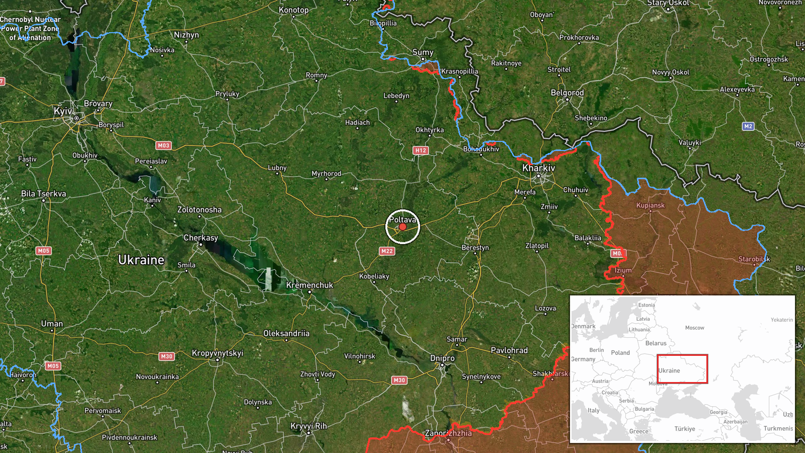
A Russian Geran-2 (Shahed-136) kamikaze drone reportedly struck and destroyed a Ukrainian 35D6 air defense radar system in Poltava Oblast on September 4 at approximately 22:37 UTC. The 35D6 is a Soviet-era surveillance radar used for detecting aircraft and coordinating air defense. The attack occurred amid a broader Russian drone campaign across central and eastern Ukraine, with multiple Geran-2 variants and reactive Shahed-type drones reported in transit through Sumy, Poltava, and Dnipropetrovsk oblasts during the same timeframe.
Context and assessment
The 35D6 radar represents critical early-warning infrastructure for Ukrainian air defense networks. Destruction of such systems degrades Ukraine's ability to detect and track incoming Russian aircraft and cruise missiles, potentially creating gaps in coverage that attackers can exploit. The September 4 strike follows a pattern of sustained Russian drone operations across central Ukraine, including simultaneous transit reports over Sumy, Poltava, and Dnipropetrovsk oblasts, as well as ballistic missile activity near Kamyanske. Targeting air defense radars is consistent with Russian strategy to suppress Ukrainian air defenses ahead of larger strikes, though the distributed nature of these reports suggests either a coordinated multi-axis attack or continued day-to-day attrition operations.
Sources and confidence
Reported by X account @ConflictTR via Turkish-language post. Single-source report with no independent cross-confirmation visible in available data. Confidence score of 6.0 reflects plausible claim aligned with established Russian targeting patterns but limited corroboration. Score would increase with Ukrainian official confirmation or additional independent channel reporting; would decrease if the radar location or strike confirmation cannot be verified.
Location
Poltava Oblast, central Ukraine, coordinates 49.59°N, 34.55°E (region-level precision). The oblast is a major logistics and infrastructure hub; the 35D6 radar location was likely positioned to provide early warning coverage for central Ukrainian airspace and coordinate with other air defense nodes in the region.
Related events nearby
- Two Russian reactive (jet-powered) Shahed-variant kamikaze drones detected transiting toward Kremenchuk Water 2026-09-04 23:05 UTC · Drone Transit · Kremenchuk Water Reservoir, Poltava Oblast, Ukrain
- Twelve Russian Geran-2 (Shahed-136) kamikaze drones detected transiting through Okhtyrka District, Sumy Oblast2026-09-04 21:11 UTC · Drone Transit · Okhtyrka District, Sumy Oblast, Ukraine
- Two Russian reactive (jet-powered) Shahed-variant kamikaze drones detected transiting through Dnipropetrovsk O2026-09-04 22:45 UTC · Drone Transit · Samar, Dnipropetrovsk Oblast, Ukraine
- Russian ballistic missile strike reported on Kamyanske, Dnipropetrovsk Oblast. Fourth alert of ballistic missi2026-09-04 22:24 UTC · Ballistic Missile · Kamyanske, Dnipropetrovsk Oblast, Ukraine
- Russia conducted overnight (4-5 Sept) mass drone and missile attack on Ukraine. Attack included 5× KN-23 balli2026-09-05 05:50 UTC · Ballistic Missile · Ukraine, nationwide attack (multiple oblasts)
▶ View this event on the live map
Intel Mapper aggregates open-source reports from monitored Telegram and X channels, geolocates them, cross-checks duplicates across sources and assigns a confidence score. Entries are updated as new confirmations arrive. Read how we verify events.