Israeli forces establish temporary checkpoint on Daraa road in southern Syria
What happened
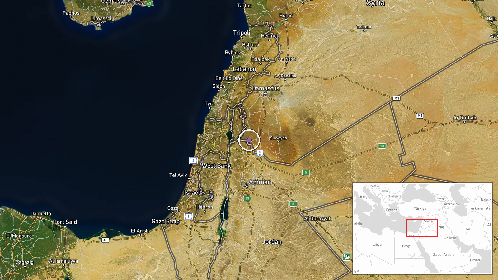
Israeli occupation forces set up a temporary checkpoint and conducted inspections of vehicles and travelers on the road connecting Jamlah and Saysoun villages in rural Daraa Governorate, Syria, on September 3. The operation was reported by local sources via Telegram. No details on the duration of the checkpoint, number of personnel involved, or specific inspection procedures were provided in available reports.
Context and assessment
The checkpoint operation occurs amid a broader pattern of Israeli military activity in southern Syria's border regions. Related reports document Israeli patrols in nearby Quneitra Governorate on September 2 and ongoing security operations across the region. Daraa Governorate, located along Israel's southwestern border, has been an area of recurring Israeli military presence and occasional interventions since Syria's civil war. This checkpoint may indicate heightened security concerns, regional monitoring operations, or responses to perceived threats in the adjacent border zone. The timing coincides with Israeli military statements regarding broader operations in Lebanon and the West Bank.
Sources and confidence
Reported by local sources through Telegram channel @AJSyriaNow on September 3. Single-source reporting limits independent verification; no cross-confirmation from other channels documented. Confidence score of 7.5 reflects credible local sourcing but lack of corroborating reports. Confirmation from additional independent sources or Israeli statements would strengthen confidence. Contradictory reports or absence of follow-up activity would lower confidence.
Location
The checkpoint was positioned on the road between Jamlah and Saysoun villages in Daraa's countryside, approximately 32.7°N, 36.0°E. Both settlements are located in rural southern Daraa near the Israeli-Syrian border zone. The road serves as local transportation infrastructure connecting communities in the southwestern border region of Syria.
Related events nearby
- One person killed in armed altercation in Sheikh Miskin, western Daraa. Brawl escalated to gunfire.2026-09-02 21:04 UTC · Security · Sheikh Miskin, Daraa Governorate, Syria
- Israeli occupation forces patrol of approximately 10 vehicles advancing toward Ain Ziyawan village in southern2026-09-02 19:14 UTC · Deployment · Ain Ziyawan, Quneitra Governorate, Syria
- Israeli Defense Minister Katz claims Israeli forces destroyed areas in southern Lebanon and ruined dozens of v2026-09-02 08:51 UTC · Statement · Southern Lebanon
- Israeli Defense Minister Katz claims IDF conquered refugee camps in West Bank, evacuated 40,000 residents, des2026-09-02 08:51 UTC · Statement · West Bank, Palestine
- Syrian authorities begin rehabilitation work on Mezzeh Airport next week, transitioning it from military to ci2026-09-02 10:40 UTC · Humanitarian Aid · Mezzeh Airport, Damascus, Syria
▶ View this event on the live map
Intel Mapper aggregates open-source reports from monitored Telegram and X channels, geolocates them, cross-checks duplicates across sources and assigns a confidence score. Entries are updated as new confirmations arrive. Read how we verify events.