Syrian traffic police deploy drones to enforce traffic laws in Rif Dimashq
What happened
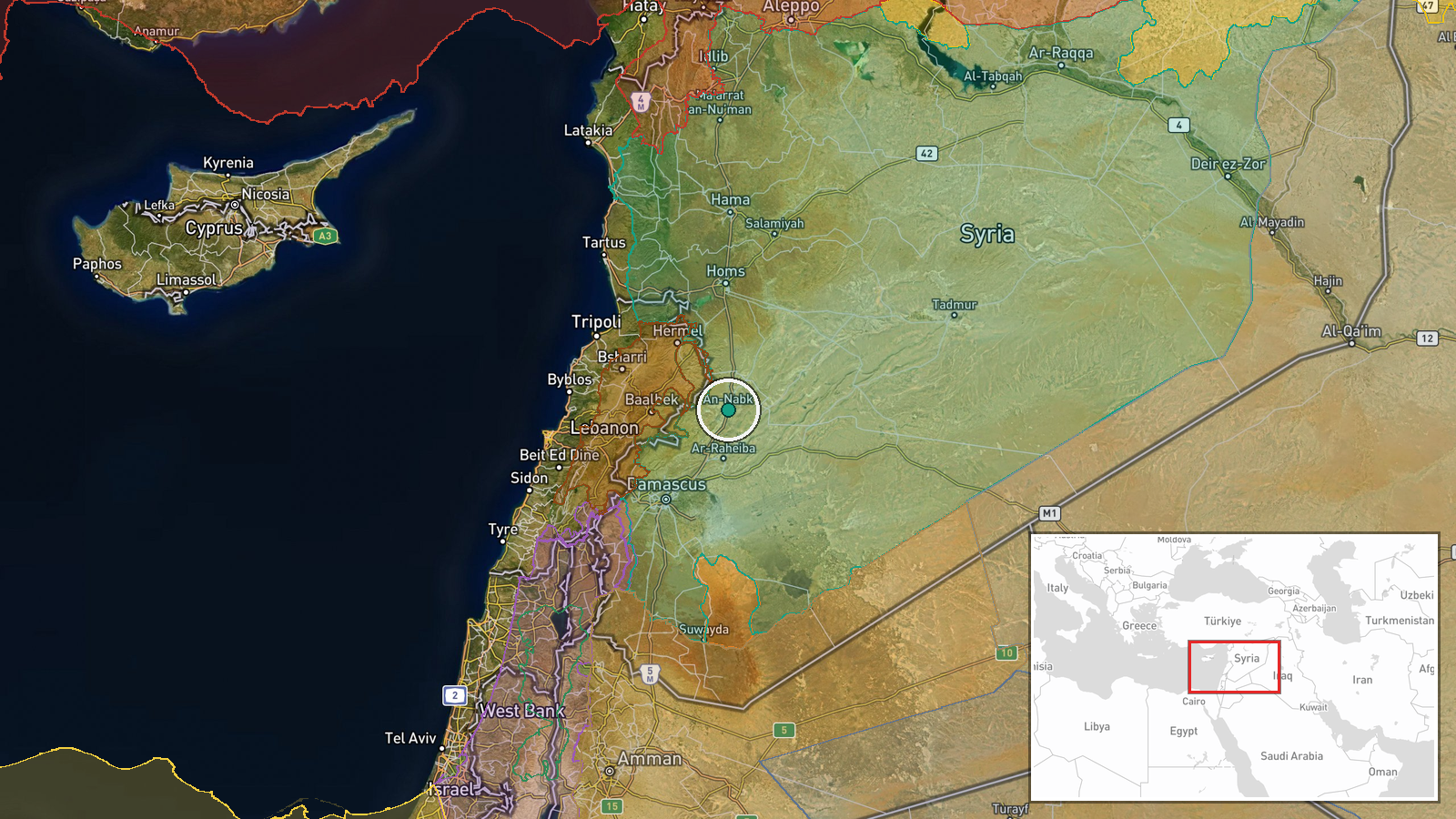
Syrian traffic police in Nabek and Ybroud, towns in Rif Dimashq Governorate north of Damascus, reportedly deployed unmanned aerial vehicles to monitor and enforce traffic regulations. According to a Telegram report from AJSyriaNow, the drones were used to identify motorcycles operating illegally and to document cases of dangerous stunting or racing behavior. The operation represents a use of surveillance technology for civilian law enforcement purposes in areas under Syrian government control.
Context and assessment
The deployment reflects efforts by Syrian authorities to establish administrative control and restore civilian governance functions in areas around Damascus following recent political transitions. Rif Dimashq, the Damascus countryside, has historically been contested terrain but remains under government authority. The use of drones for traffic enforcement, while presented as routine policing, follows a broader pattern of security operations in Syria documented over recent days, including arrests of military figures and counter-narcotics operations by HTS forces in Homs. This suggests authorities are consolidating institutional control through both security measures and everyday administrative functions.
Sources and confidence
Reported by Telegram channel AJSyriaNow. Single source, no cross-confirmation from independent observers or other channels documented. Confidence score of 7.5 reflects the source's track record but limited corroboration. Confirmation from visual evidence of drone operations or official Syrian government statements would strengthen confidence; contradictory reports from residents would lower it.
Location
Nabek and Ybroud are towns in Rif Dimashq Governorate, the rural hinterland north and northeast of Damascus. The region sits at approximately 34°N, 36°44'E in the Anti-Lebanon foothills. Nabek lies on the main highway corridor linking Damascus to northern Syria and Turkey, historically significant for both commerce and military logistics.
Related events nearby
- Syrian Interior Security Forces arrested retired Brigadier General Ahmad Muhammad Ismail, a former senior comm2026-09-19 19:09 UTC · Security · Damascus, Syria
- Al Jazeera's Open Source Unit reports intensive movement of international airlines over Syria's new shortened 2026-09-19 11:15 UTC · Statement · Damascus, Syria
- HTS anti-narcotics directorate neutralized a major drug trafficking leader in Homs who resisted arrest and ope2026-09-19 13:49 UTC · Security · Homs, Homs Governorate, Syria
- IDF reports two soldiers sustained minor injuries from an IED explosion in the southern Lebanese security zone2026-09-19 12:05 UTC · Security · Marjayoun, South Lebanon
- Israeli aircraft conducted four airstrikes on the town of Nabatieh al-Fawqa in southern Lebanon.2026-09-19 11:16 UTC · Airstrike · Nabatieh al-Fawqa, South Governorate, Lebanon
▶ View this event on the live map
Intel Mapper aggregates open-source reports from monitored Telegram and X channels, geolocates them, cross-checks duplicates across sources and assigns a confidence score. Entries are updated as new confirmations arrive. Read how we verify events.