Unknown explosion reported in Al-Harak, eastern Daraa Countryside
What happened
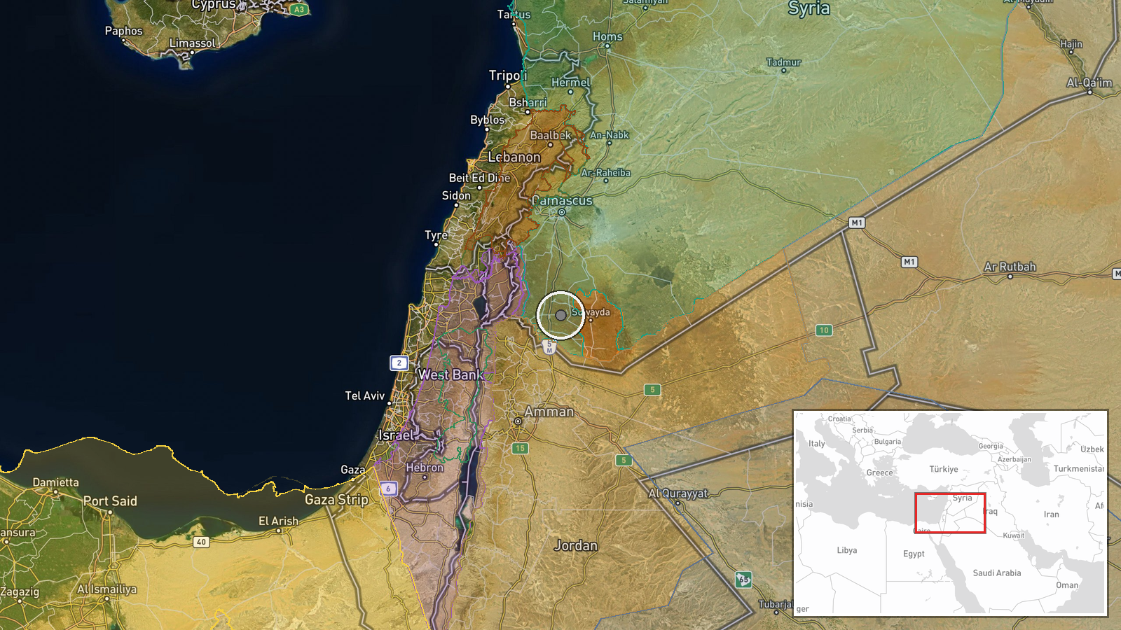
An explosion of unknown origin was reported in Al-Harak town in the eastern Daraa Countryside on September 21 at 00:22 UTC, according to the Telegram channel Syria Now. The report provided no details on the blast's cause, responsible party, or any resulting casualties or damage. The circumstances and nature of the explosion remain unconfirmed pending further investigation.
Context and assessment
Al-Harak lies in southern Syria's Daraa Governorate, a region that has experienced sustained military activity over the past 24 hours. The explosion occurred amid an intensifying pattern of Israeli military operations across southern Syria, including airstrikes on regime military positions near Mount Hermon, artillery strikes on Quneitra villages, and ground incursions in western Daraa's Wadi al-Ruqqad. The Naseeb Border Crossing with Jordan, recently expanded by Syrian authorities, remains operational nearby. The unattributed nature of this explosion suggests either ordnance from ongoing operations in the region, secondary detonations of stored munitions, or potential accidents. Clarification of the blast's origin would help contextualize its relationship to broader military activity.
Sources and confidence
Single-source report from Telegram channel AJSyriaNow. No cross-confirmation from other outlets or independent verification of the explosion's characteristics has been identified. The confidence score of 7.5 reflects the report's credibility as a named channel but is tempered by the absence of corroborating sources and the incomplete information provided. Independent video documentation, witness accounts, or reports from international monitors would substantially increase confidence.
Location
Al-Harak is located in the eastern Daraa Countryside at coordinates 32.748°N, 36.300°E, approximately 50 kilometers south of Damascus. The settlement sits in southern Syria's volatile border region, roughly 25 kilometers from the Jordanian frontier at Naseeb. The area forms part of rural Daraa, characterized by agricultural lands and scattered towns amid rolling terrain.
Related events nearby
- Syrian authorities expanded Naseeb Border Crossing with Jordan, improving border-crossing infrastructure, oper2026-09-20 14:14 UTC · Humanitarian Aid · Naseeb Border Crossing, Daraa, Syria
- Video documentation shows two Israeli tanks and two military armored vehicles advancing into Wadi al-Ruqqad re2026-09-20 15:09 UTC · Combat · Wadi al-Ruqqad, Daraa Countryside, Syria
- Israeli artillery shelling targets southern agricultural lands of Rafid village in Quneitra Governorate, Syria2026-09-20 13:30 UTC · Artillery · Rafid, Quneitra, Syria
- Israeli military patrol of 8 armored vehicles with troops deployed from Tel Ahmar base toward villages of Kudn2026-09-20 10:43 UTC · Deployment · Tel Ahmar, Golan Heights, Syria
- Israel conducted airstrikes on military positions belonging to the former Assad regime near Qalaat Jandal on M2026-09-20 15:35 UTC · Airstrike · Qalaat Jandal, Mount Hermon, Daraa Countryside, Sy
▶ View this event on the live map
Intel Mapper aggregates open-source reports from monitored Telegram and X channels, geolocates them, cross-checks duplicates across sources and assigns a confidence score. Entries are updated as new confirmations arrive. Read how we verify events.