Israeli mortar fire targets Tel Ahmar area in eastern Quneitra
What happened
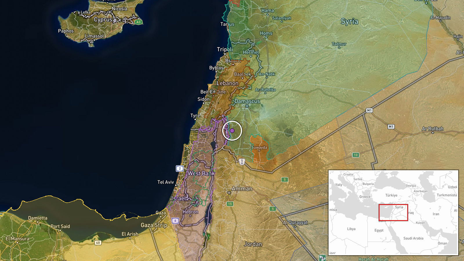
Israeli forces struck the area around Tel Ahmar in eastern Quneitra Governorate using mortar fire on October 6, according to local sources reporting via Telegram. The incident occurred at 16:42 UTC. Local sources characterize the strike as part of ongoing Israeli military escalation in the region, though the report does not specify casualties or damage. Tel Ahmar is located in the southern countryside of Quneitra, near the Israeli-occupied Golan Heights.
Context and assessment
The strike on Tel Ahmar reflects sustained Israeli military pressure in Quneitra Governorate during early October 2026. This incident follows an earlier killing of a Syrian youth in Quneitra Countryside on October 5 and coincides with multiple reports of Israeli military activity in southern Syria. On the same day, Israeli tanks and vehicles conducted incursion operations in the Daraa Governorate countryside, while statements emerged regarding Israeli work on fortifications in occupied territory. The pattern suggests possible Israeli efforts to maintain security in areas adjacent to the Golan Heights or respond to perceived threats in the border region, though Israeli operational objectives remain unclear from available reporting.
Sources and confidence
Single source: Telegram channel @AJSyriaNow reporting local Syrian sources. No cross-confirmation from additional independent channels or Israeli military statements. Confidence score of 7.5 reflects the single-source limitation and typical reliability of local Telegram reporting. Confirmation from Syrian government sources, humanitarian organizations, or multiple independent channels would strengthen confidence. Israeli military acknowledgment or additional regional media corroboration would also raise confidence.
Location
Tel Ahmar is located in eastern Quneitra Governorate's southern countryside at approximately 33.07°N, 35.99°E. The settlement sits in the rugged terrain of the southern Golan region, roughly 12–15 kilometers from the Israeli-occupied sector of the Golan Heights. The area is part of Syria's borderland with Israeli-controlled territory. Precision is assessed as regional rather than pinpoint due to single-source reporting.
Related events nearby
- Israeli forces killed a Syrian youth in Quneitra Countryside; Syrian Internal Security seized a weapons cache 2026-10-05 18:42 UTC · Security · Quneitra Countryside, Quneitra, Syria
- Analyst at Al-Jazeera Centre for Studies comments on Israeli military resumption of work on Line 'Sofa 53' in 2026-10-06 16:52 UTC · Statement · Quneitra Governorate, Syria
- Arab Parliament President Al-Yamahi condemns continued Israeli violations in Syria, specifically activities on2026-10-06 07:22 UTC · Statement · Quneitra Governorate, Syria
- Syrian Network for Human Rights documents at least 69 deaths caused by Israeli forces in southern Syria betwee2026-10-06 17:20 UTC · Report · Southern Syria
- Israeli military tanks and vehicles conducting incursion operations in al-Dariyat area (Daraa countryside). Is2026-10-06 05:32 UTC · Deployment · Daraa Governorate, Syria
▶ View this event on the live map
Intel Mapper aggregates open-source reports from monitored Telegram and X channels, geolocates them, cross-checks duplicates across sources and assigns a confidence score. Entries are updated as new confirmations arrive. Read how we verify events.