Israeli artillery strikes agricultural land in Quneitra countryside
What happened
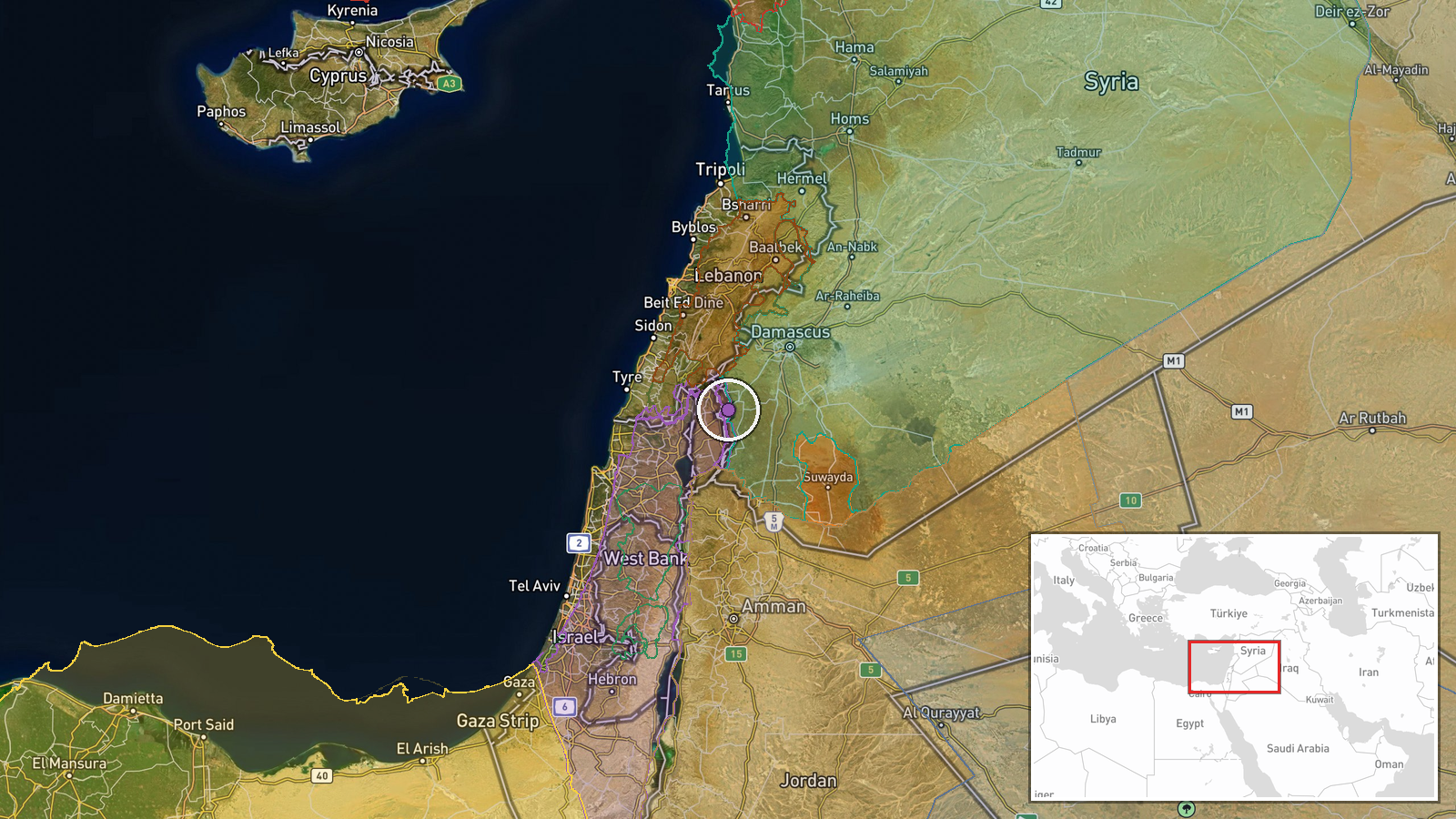
Israeli occupation forces fired two artillery rounds at agricultural land near Al-Samdaniyah ash-Sharqiyah village in Quneitra countryside on 7 October at 19:22 UTC, according to Quneitra Media Directorate reporting via Telegram. No immediate casualties were reported from the strike. The target was farmland in the vicinity of the village rather than a civilian or military structure.
Context and assessment
The strike occurred within a pattern of Israeli military activity across Quneitra Governorate documented on 7 October alone. Earlier that day, Israeli forces conducted an incursion into nearby Jubata Al-Khashab resulting in a detainee, carried out trench-digging operations near Al-Rafid village, and displayed an Israeli flag on Mount Hermon's peak. The agricultural targeting in Quneitra's countryside reflects broader Israeli operations in southern Syria since the collapse of the Assad regime, documented by the Syrian Network for Human Rights as resulting in at least 69 Syrian deaths. These actions suggest consolidation of Israeli military presence and control over territory in the Golan Heights region.
Sources and confidence
Single source: Telegram channel @AJSyriaNow, citing Quneitra Media Directorate. No corroborating reports from other channels identified. Confidence score of 7.5/10 reflects official Syrian media attribution but lack of independent cross-confirmation. Additional reports from humanitarian monitors or Israeli military statements would strengthen confidence. Absence of casualty reports may indicate uninhabited target area.
Location
Al-Samdaniyah ash-Sharqiyah village lies in Quneitra Governorate's countryside, located at approximately 33.16°N, 35.89°E in southwestern Syria. The Golan Heights region has been under Israeli military control since 1967 and remains disputed territory. The village sits in agricultural lowland terrain typical of the Quneitra plain, near the demilitarized zone separating Syrian and Israeli-controlled areas.
Related events nearby
- Israeli occupation forces shot and detained a young man during incursion into Jubata Al-Khashab village, Qunei2026-10-07 08:28 UTC · Security · Jubata Al-Khashab, Quneitra, Syria
- Israeli occupation forces continue military trench-digging operations in agricultural lands near Al-Rafid vill2026-10-07 16:41 UTC · Security · Al-Rafid, Quneitra, Syria
- Israeli occupation forces painted Israeli flag colors on a military position atop Mount Hermon (Jabal al-Sheik2026-10-07 10:50 UTC · Security · Mount Hermon (Jabal al-Sheikh), Quneitra, Syria
- Israeli forces questioned Bedouin herders during an incursion into Wadi al-Raqad, Daraa Governorate, southern 2026-10-07 11:42 UTC · Security · Wadi al-Raqad, Daraa, Syria
- Syrian Network for Human Rights (SNHR) documents 69 Syrian deaths attributed to Israeli occupation forces in s2026-10-06 20:34 UTC · Report · South Syria, Daraa Governorate, Syria
▶ View this event on the live map
Intel Mapper aggregates open-source reports from monitored Telegram and X channels, geolocates them, cross-checks duplicates across sources and assigns a confidence score. Entries are updated as new confirmations arrive. Read how we verify events.