Israeli forces penetrate Tel Ahmar ash-Sharqi in southern Quneitra after Tel Kurum withdrawal
What happened
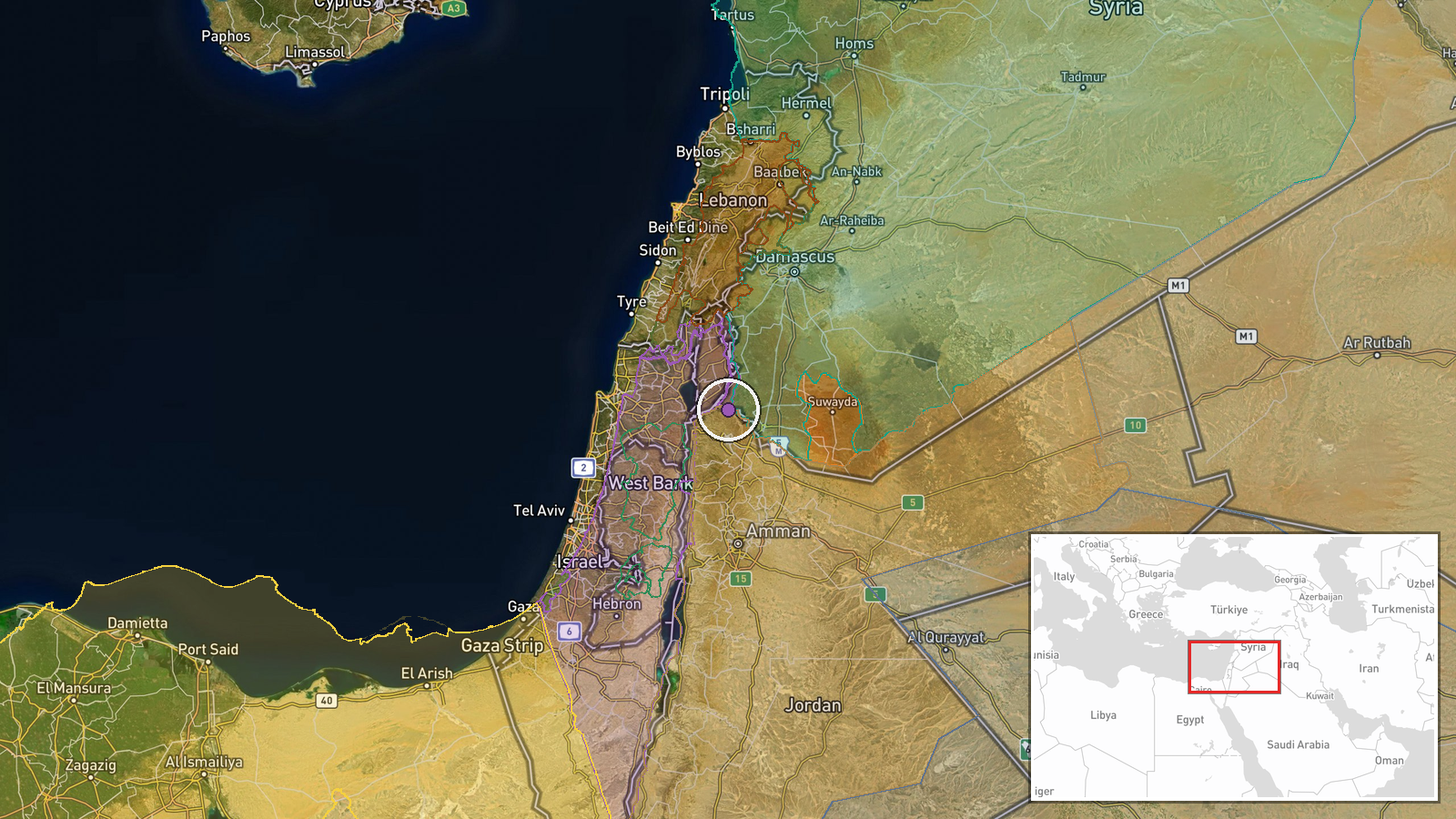
Israeli occupation forces reportedly moved three tanks and military vehicles into Tel Ahmar ash-Sharqi in southern Quneitra Governorate on October 8, according to Syria Now correspondent. The incursion follows an earlier Israeli withdrawal from Tel Kurum in central Quneitra on the same day. The report does not specify the duration of the penetration or whether the force remains in position.
Context and assessment
The operation in Tel Ahmar ash-Sharqi is part of a broader pattern of Israeli ground movement across Quneitra Governorate on October 7–8. Related incidents on October 8 include armored vehicle penetrations between Jaba and Umm Batna, and reported firing on shepherds near Kudna. On October 7, Israeli forces conducted trench-digging near Al-Rafid and artillery strikes on agricultural land near Al-Samdaniyah ash-Sharqiyah. These actions suggest sustained Israeli military activity across southern and central Quneitra, potentially indicating either operational repositioning, consolidation of control, or response to a specific tactical situation. The pattern of withdrawal from one position followed by penetration of another suggests fluid tactical movements rather than a fixed defensive posture.
Sources and confidence
Single source: Telegram channel Syria Now (@AJSyriaNow). No cross-confirmation from independent outlets, Israeli military statements, or other opposition channels documented. Confidence score of 7.5 reflects the single-source basis and absence of visual corroboration or secondary reporting. Confidence would increase with video documentation or reporting from additional independent channels; it would decrease if contradicted by Israeli or Syrian government statements.
Location
Tel Ahmar ash-Sharqi is located in southern Quneitra Governorate, Syria, near the Israeli-occupied Golan Heights frontier. Coordinates place it in the southern sector of the governorate. The location is determined at regional precision level based on settlement naming rather than facility-specific identification. Nearby areas include Al-Rafid and surrounding agricultural zones.
Related events nearby
- Israeli occupation forces continue military trench-digging operations in agricultural lands near Al-Rafid vill2026-10-07 16:41 UTC · Security · Al-Rafid, Quneitra, Syria
- Israeli occupation forces fired two artillery rounds at agricultural land near Al-Samdaniyah ash-Sharqiyah vil2026-10-07 19:22 UTC · Artillery · Al-Samdaniyah ash-Sharqiyah, Quneitra, Syria
- Israeli military vehicles penetrated between Jaba and Umm Batna villages in Quneitra Rif, with footage documen2026-10-08 11:48 UTC · Combat · Jaba, Quneitra Governorate, Syria
- Israeli forces fired upon shepherds and livestock herders in the vicinity of Kudna village in Quneitra country2026-10-08 12:30 UTC · Combat · Kudna, Quneitra Governorate, Syria
- Israeli forces opened fire on children in the West Bank. Source links to alleged incident but details are unco2026-10-07 16:31 UTC · Security · West Bank, Palestinian Territories
▶ View this event on the live map

Intel Mapper aggregates open-source reports from monitored Telegram and X channels, geolocates them, cross-checks duplicates across sources and assigns a confidence score. Entries are updated as new confirmations arrive. Read how we verify events.