Container ship sinks in Strait of Hormuz after striking naval mine
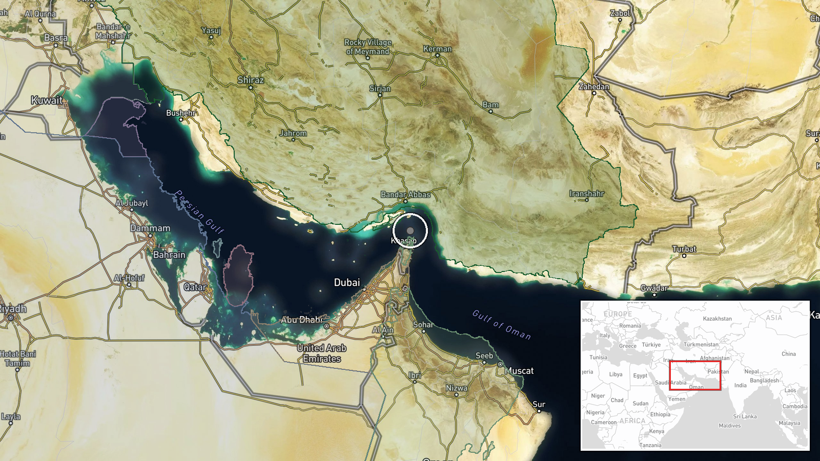
What happened
A container ship carrying approximately 2,500 containers of mobile phones and luxury perfumes sank in the Strait of Hormuz on 15 October after striking a naval mine, according to a report on Telegram channel @AJSyriaNow. The incident resulted in cargo scattering across the water. No details were provided regarding the vessel's identity, casualties, or the source of the mine.
Context and assessment
The sinking occurs amid heightened maritime tensions in the Strait of Hormuz, a critical chokepoint through which roughly one-third of global seaborne oil passes. The incident follows reports of a second oil tanker catching fire in the nearby Gulf of Oman on the same day, and an Iranian naval attack in the Strait on 14 October that damaged or sank one or more merchant vessels. These successive incidents suggest either deliberate targeting of commercial shipping or the presence of unexploded ordnance from earlier military operations. The pattern may reflect escalating efforts to disrupt regional trade or signal control over the waterway.
Sources and confidence
The report originates from a single Telegram source (@AJSyriaNow). No cross-confirmation from maritime authorities, shipping companies, or regional navies is noted. The confidence score of 7.8 reflects the single-source nature and lack of independent verification. Confirmation from Lloyd's List Intelligence, vessel tracking systems, or official statements from Iran or affected shipowners would substantially increase confidence.
Location
The incident is reported in the Strait of Hormuz at the southern entrance to the Persian Gulf (26.55°N, 56.4°E), specifically in the Gulf of Oman region. Precision is regional rather than exact. The strait is approximately 21 nautical miles wide at its narrowest point and represents a heavily trafficked maritime corridor between the Arabian Peninsula and Iran.
Related events nearby
- Second oil tanker caught fire in Gulf of Oman near Strait of Hormuz. Iran's Navy claimed the vessel had disabl2026-10-15 12:55 UTC · Report · Gulf of Oman, Eastern Strait of Hormuz
- Iranian naval attack in Strait of Hormuz results in ship damage/sinking. Reports indicate one or more merchant2026-10-14 16:31 UTC · Naval · Strait of Hormuz, Persian Gulf
▶ View this event on the live map

Intel Mapper aggregates open-source reports from monitored Telegram and X channels, geolocates them, cross-checks duplicates across sources and assigns a confidence score. Entries are updated as new confirmations arrive. Read how we verify events.