Sudanese army reportedly recaptures Bukuri base and Uklili area in Blue Nile from RSF-SPLM-N
What happened
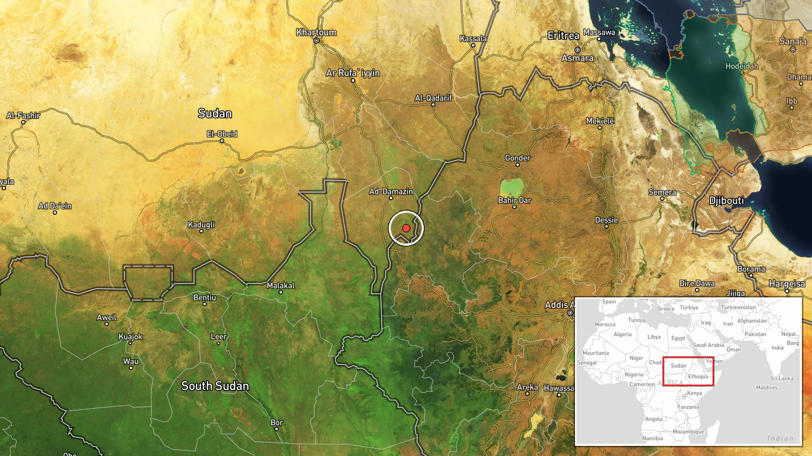
According to a report carried by the Addis Standard English Telegram channel, citing Sudan Tribune, Sudan's army has recaptured the strategic Bukuri military base and the Uklili area in Blue Nile State, close to the border with Ethiopia. The report says the recapture followed clashes with forces of the Rapid Support Forces and the Sudan People's Liberation Movement-North, described as an alliance. The post is dated 23 October 2026 at 06:50 UTC and frames the development as a capture by the Sudanese army. The wording is secondhand: the channel attributes the information to Sudan Tribune, and no direct statement from the army, the RSF or the SPLM-N appears in the material available to this desk. The event is recorded from a single source, and the coordinates reflect the broader Blue Nile region rather than a surveyed position of the base.
Context and assessment
Blue Nile State has become one of the more active fronts in Sudan's wider war, largely because it sits on a border corridor linking Sudanese territory with Ethiopia. A related entry from the previous day reports that the army regained control of Bakuri and Akleili in southeastern Blue Nile, a likely transliteration variant of the same locations, and pursued retreating RSF fighters. The same period included a report that Sudanese air defenses shot down an unidentified drone that reportedly crossed from Ethiopia, with its operator unknown. An RSF claim, unverified, that its forces seized tanks and heavy weapons in the state also appears in the record, alongside reports of civilian arrests in Roseires for suspected collaboration with the SPLA-N. Taken together, these reports may point to a contest over supply routes, border crossings and local loyalties, with control of a fortified base carrying both military and political weight. The cross-border drone report, if accurate, would suggest that the front is also shaped by activity beyond Sudan's frontier, though this cannot be established from the available material.
Sources and confidence
The event rests on one Telegram channel that relays a Sudan Tribune report without quoting the original article, so cross-confirmation is currently absent. The confidence score of 7.1 reflects a plausible, specific claim from a established regional outlet and consistency with nearby entries describing army movements in the same area, but it is held down by the single-source chain and the lack of named officials or independent imagery. Confidence would rise with a direct Sudan Tribune article, an army statement, or corroboration from local media, Blue Nile reporters or verified satellite imagery. It would fall if the RSF or SPLM-N denied the loss of the base or if later reporting described the area as contested rather than held.
Location
The location is recorded at region level, with a low location confidence rating, meaning the coordinates point to approximate Blue Nile State rather than the base itself. Blue Nile lies in southeastern Sudan and borders Ethiopia, with the Blue Nile river and the Roseires reservoir and dam system to its north and west. The terrain is largely flat to gently undulating savannah, with seasonal watercourses that can affect movement and access to the border area.
Related events nearby
- Sudanese army reportedly regained control of Bakuri and Akleili in southeastern Blue Nile state, inflicting he2026-10-22 18:49 UTC · Capture · Bakuri, Blue Nile State, Sudan
- Sudanese air defense shot down an unidentified drone near Bakuri that crossed the border from Ethiopia; operat2026-10-22 18:50 UTC · Air Defense · Bakuri, Blue Nile State, Sudan
- RSF claims its Tasis Forces seized tanks and heavy weapons from SAF (the 'Muslim Brotherhood Army') in Blue Ni2026-10-22 19:56 UTC · Report · Blue Nile State, Sudan
- Joint Security Cell arrested at least eight civilians in Roseires for suspected SPLA-N collaboration; detainee2026-10-22 20:05 UTC · Police Operation · Roseires, Blue Nile State, Sudan
▶ View this event on the live map

Intel Mapper aggregates open-source reports from monitored Telegram and X channels, geolocates them, cross-checks duplicates across sources and assigns a confidence score. Entries are updated as new confirmations arrive. Read how we verify events.