Trump Administration Weighs Limited Strikes on Iranian Air Defenses Near Strait of Hormuz
What happened
The Trump administration is reportedly considering limited U.S. military strikes targeting Iranian radar, air defense systems, and anti-ship missile installations around the Strait of Hormuz, according to reporting by Axios. The proposal, attributed to CENTCOM, comes in response to signs that Iran has been rebuilding military capabilities in the region, including an attempted missile launch directed at a U.S. F-35 fighter aircraft. The strikes, if approved, would reportedly be periodic and designed to deter renewed Iranian attacks on maritime shipping transiting the waterway.
Context and assessment
The Strait of Hormuz, through which roughly one-fifth of global oil traffic passes, has been the focal point of escalating military activity on August 31, 2026. Related incidents the same day include Iranian drone attacks on commercial shipping, the claimed shootdown of two U.S. MQ-9 Reaper drones, and a supertanker struck by naval mines. Iranian ballistic missile fire toward U.S. naval assets was also reported on August 30. The CENTCOM proposal for periodic strikes suggests a shift toward a strategy of sustained degradation of Iranian capabilities rather than singular reactive responses. This pattern may indicate deepening concerns within U.S. military command about Iranian ability to threaten regional shipping and American assets, though the proposal remains under consideration rather than approved policy.
Sources and confidence
Axios reported the CENTCOM proposal via Telegram channel ClashReport on August 31. The report constitutes a single sourced statement rather than independent corroboration, accounting for the moderate confidence score of 7.0. Confirmation would be strengthened by official Pentagon statements, additional news organization reporting, or statements from allied regional partners. Lowered confidence would result from contradictory U.S. government denials or clarifications that the proposal has been rejected or substantially modified.
Location
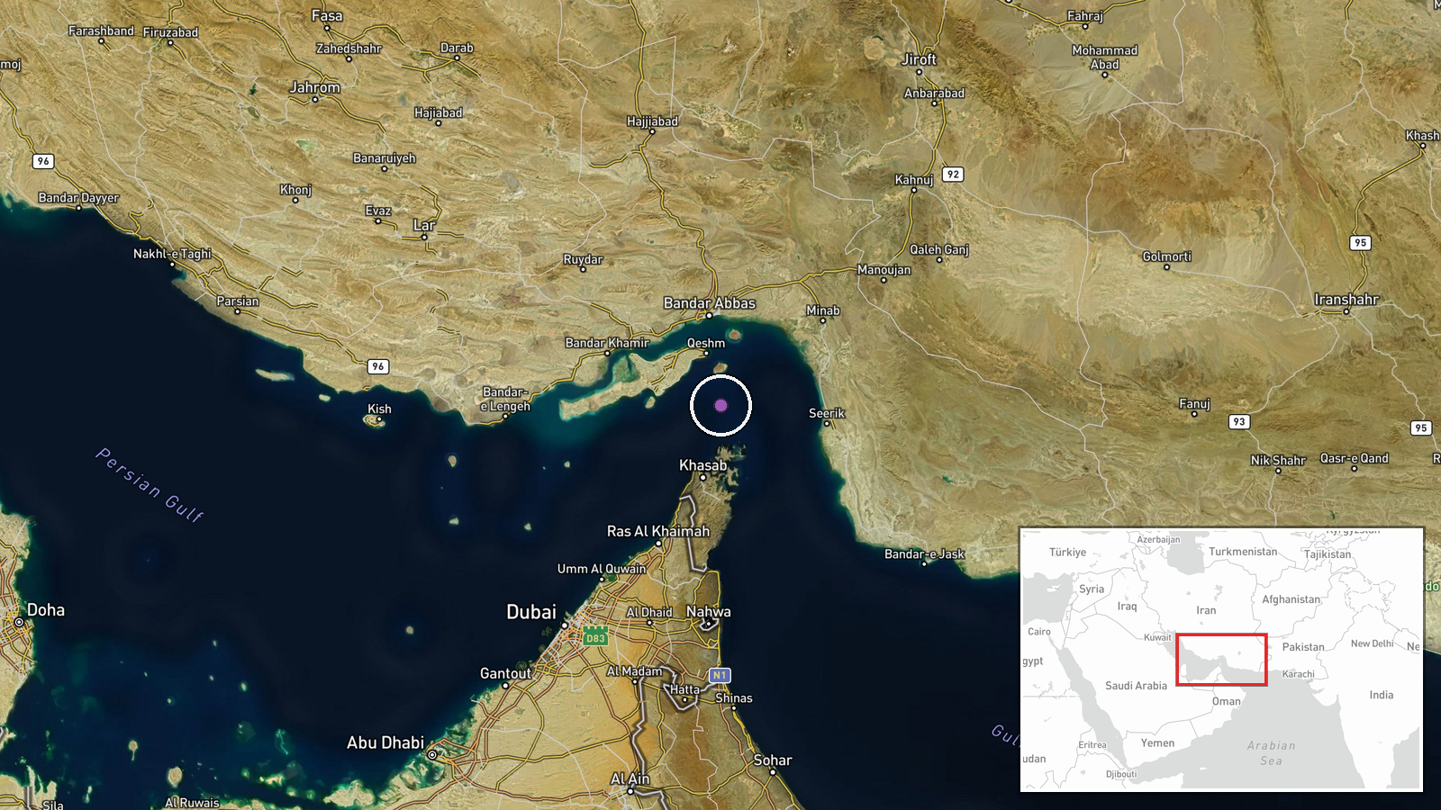
The Strait of Hormuz lies between Iran and Oman in the Persian Gulf, connecting the Gulf to the Gulf of Oman and Arabian Sea. Coordinates place the region near the narrowest point of the waterway, approximately 26.6°N, 56.4°E. The geographic precision reflects regional scope rather than a specific facility, as the proposal targets distributed Iranian air defense and radar installations across the strait's Iranian-controlled approaches and nearby coastal areas.
Related events nearby
- Iran fired anti-aircraft missiles at U.S. F-35 fighters in the Strait of Hormuz. No confirmation of hits or da2026-08-31 18:47 UTC · Air Defense · Strait of Hormuz, Persian Gulf
- Iran reportedly launches kamikaze drone attacks (UAS) against commercial shipping transiting the Strait of Hor2026-08-31 17:44 UTC · UAS Strike · Strait of Hormuz, Persian Gulf
- Iran's IRGC claims its Aerospace Force air defense system shot down a U.S. MQ-9 Reaper drone east of the Strai2026-08-31 16:42 UTC · Drone Shootdown · Strait of Hormuz, Persian Gulf
- Iran's Revolutionary Guards claimed to have shot down a U.S. MQ-9 Reaper drone valued at approximately $30 mil2026-08-31 05:29 UTC · Drone Shootdown · Strait of Hormuz, Iran-Oman Waters
- Iran's Revolutionary Guards confirmed a supertanker struck two naval mines in the Strait of Hormuz, caught fir2026-08-31 04:51 UTC · Naval · Strait of Hormuz, Iran-Oman Waters
▶ View this event on the live map
Intel Mapper aggregates open-source reports from monitored Telegram and X channels, geolocates them, cross-checks duplicates across sources and assigns a confidence score. Entries are updated as new confirmations arrive. Read how we verify events.