Satellite imagery shows Houthis dug 20 km of trenches near Bab al-Mandab strait
What happened
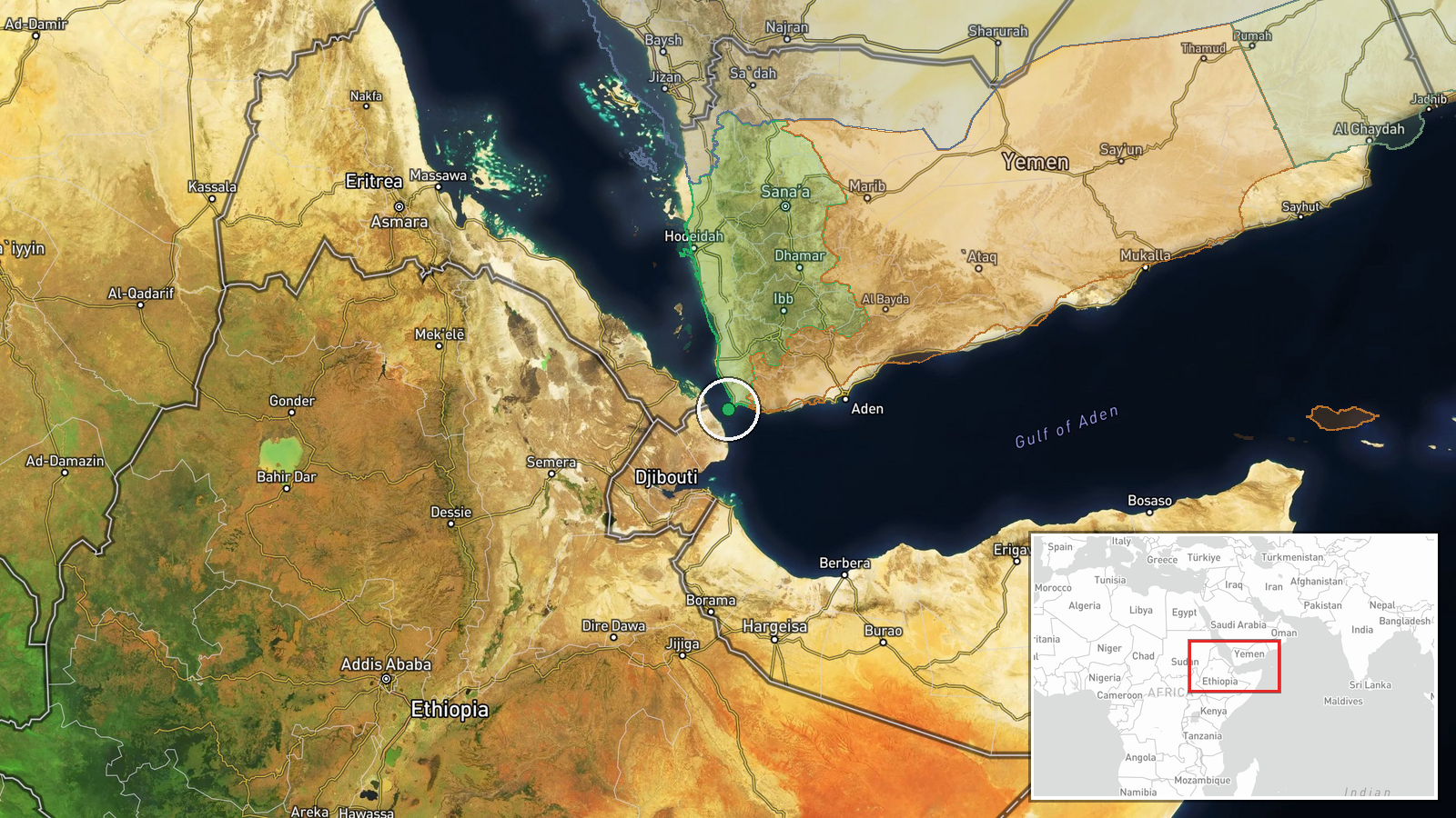
Satellite imagery analyzed between September 8–16 reportedly shows Houthi forces constructed approximately 20 km of defensive trenches in mountainous terrain around Bab al-Mandab, a narrow strait between Yemen and Eritrea controlling access to the Red Sea. According to @ClashReport on Telegram, time-lapse comparisons of satellite data reveal new earthworks appearing across hillsides in the region. The fortifications reportedly serve dual purposes: defending against potential Saudi-backed counteroffensive operations to retake Yemen's southern coast and establishing observation positions overlooking the strategically vital shipping channel.
Context and assessment
Bab al-Mandab is one of the world's most important maritime chokepoints, with roughly 12 percent of global trade passing through the strait. Houthi control of the surrounding coastline and islands gives the group leverage over shipping and commercial traffic. The trench construction appears coordinated with a broader escalation pattern: concurrent reports from mid-September document ongoing ground combat at Kahbub position in the strait itself, Saudi airstrikes against recently captured Al-Mokha port, and Houthi air defense claims in Taiz Governorate. The fortification effort suggests Houthi forces are consolidating territorial gains and preparing defensive positions against anticipated government or Saudi-led counteroffensive operations, indicating possible longer-term Houthi confidence in holding the southern coast.
Sources and confidence
Reported exclusively via Telegram channel @ClashReport with satellite imagery comparison analysis. Single-source reporting lowers confidence to 7.0. Cross-confirmation from independent satellite analysts or government assessments would strengthen confidence. Related combat and airstrike events in the same timeframe from multiple actors provide circumstantial support for an active military escalation phase, though they do not directly confirm the trench construction claim.
Location
Bab al-Mandab strait region between Perim Island and Yemen's Aden Governorate coast. The strait is approximately 30 km wide at its narrowest point and forms the southern gateway to the Red Sea. Mountainous terrain dominates the Yemeni coastline in this area. Precision is marked low due to satellite imagery covering a regional zone rather than specific GPS coordinates; the trenches span multiple hillsides across the broader strait landscape.
Related events nearby
- Yemen Government-aligned Amalika Brigade reports ongoing combat with Houthi forces at Kahbub position in Bab e2026-09-16 18:55 UTC · Combat · Bab el-Mandeb Strait, Red Sea
- Saudi Arabian Air Force conducting large-scale airstrike campaign against Al-Mokha port in Taiz, recently capt2026-09-17 00:05 UTC · Airstrike · Al-Mokha Port, Taiz Governorate, Yemen
- Houthi forces claimed interception of two Saudi F-15 fighter jets over Taiz Governorate using locally-made sur2026-09-16 17:14 UTC · Air Defense · Taiz Governorate, Yemen
- Yemeni Government armed forces launched airstrikes targeting Houthi reinforcements along the Al-Barh-Al-Mukha 2026-09-16 22:22 UTC · Airstrike · Al-Barh-Al-Mukha Road, Taiz Governorate, Yemen
▶ View this event on the live map
Intel Mapper aggregates open-source reports from monitored Telegram and X channels, geolocates them, cross-checks duplicates across sources and assigns a confidence score. Entries are updated as new confirmations arrive. Read how we verify events.