Ukraine reports two airstrikes, five glide bombs and 38 shellings in Sumy and Kursk directions
What happened
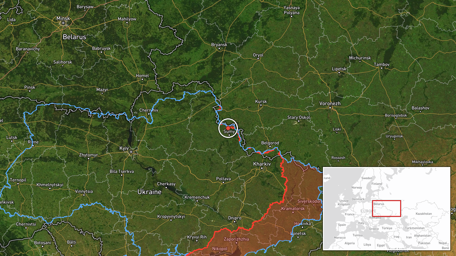
Ukraine's General Staff reported on its Telegram channel that, since the start of the day on 20 October 2026, Russian forces carried out two airstrikes, used five KAB guided glide bombs and conducted 38 shellings against Ukrainian positions and settlements in the Northern Slobozhanskyi and Kursk directions. The original post is in Ukrainian and gives the totals only. It does not break the figures down by individual strike, target, settlement or casualties. The event is pinned to the Sumy area near Kindrativka on an estimated basis, so the count should be read as activity across two sectors rather than at one site. Reportedly, no independent confirmation of the individual strikes was available at the time of writing.
Context and assessment
The Sumy area sits along the border with Russia's Kursk Oblast, a corridor where fighting has been persistent since Ukraine's 2024 cross-border incursion and the Russian effort to push it back. Two named directions in one report suggest the General Staff is describing pressure on more than one sector of the northern front. Related events on the same day show a sequence. Artillery hit a cluster of villages around Khotin in the early morning, a glide bomb was reported heading toward Sumy at 04:46, and Shahed-type drones were tracked toward the city at 10:32 and 13:49. Tactical aviation movements had been flagged the previous evening. Taken together, this points to a pattern of combined artillery, glide bombs and loitering drones applied across several hours. Operationally, such a mix may be intended to fix Ukrainian units in place, wear down fortified positions and settlements near the front, and strain logistics and air defence in the Sumy area. These are plausible readings rather than confirmed intent.
Sources and confidence
The report comes from a single channel, the Telegram account of Ukraine's General Staff, which is an official but interested party to the conflict. No cross-confirmation appears in the event data. The related air-monitoring and artillery reports corroborate the broader pattern in the same area but not the specific totals. The confidence score of 8.0 reflects an official origin and a detailed count, offset by single-source reporting, aggregated figures and an unspecified location. Confidence would rise with independent geolocated imagery, statements from Sumy regional authorities, or corroborating Russian-side reporting. It would fall if the General Staff revises the totals or if local sources contradict the timing.
Location
The location is an estimate placed near Kindrativka in Sumy Oblast, with region-level precision and low location confidence. The coordinates mark an approximate area on the front line, not a specific settlement or facility. The setting is northern Ukraine near the Russian border, characterised by open farmland, small villages and river valleys. Sumy city, the main regional reference point in the related reports, lies to the south.
Related events nearby
- As of 08:00 20.10.2026, Russian artillery shelled Ulanove, Pysarivka, Koren'ok, Khotin, Mala Korchakivka, Yuna2026-10-20 04:08 UTC · Artillery · Khotin, Sumy Oblast, Ukraine
- Ukrainian air monitoring: 1 Russian Shahed-type drone heading toward Sumy; 1 Russian Shahed-type drone heading2026-10-20 13:49 UTC · Drone Transit · Sumy, Ukraine
- Ukrainian air monitoring: 1 Russian Shahed-type drone heading toward Sumy.2026-10-20 10:32 UTC · Drone Transit · Sumy, Ukraine
- Ukrainian air monitoring: 1 Russian guided glide bomb (KAB) heading toward Sumy.2026-10-20 04:46 UTC · Airstrike · Sumy, Ukraine
- Ukrainian air monitoring: Russian tactical aircraft (tac. aviation) heading toward Sumy Oblast.2026-10-19 22:27 UTC · Combat Aircraft · Sumy Oblast, Ukraine
▶ View this event on the live map

Intel Mapper aggregates open-source reports from monitored Telegram and X channels, geolocates them, cross-checks duplicates across sources and assigns a confidence score. Entries are updated as new confirmations arrive. Read how we verify events.