Ukraine reports Russian tactical aviation launching guided bombs toward Sumy Oblast
What happened
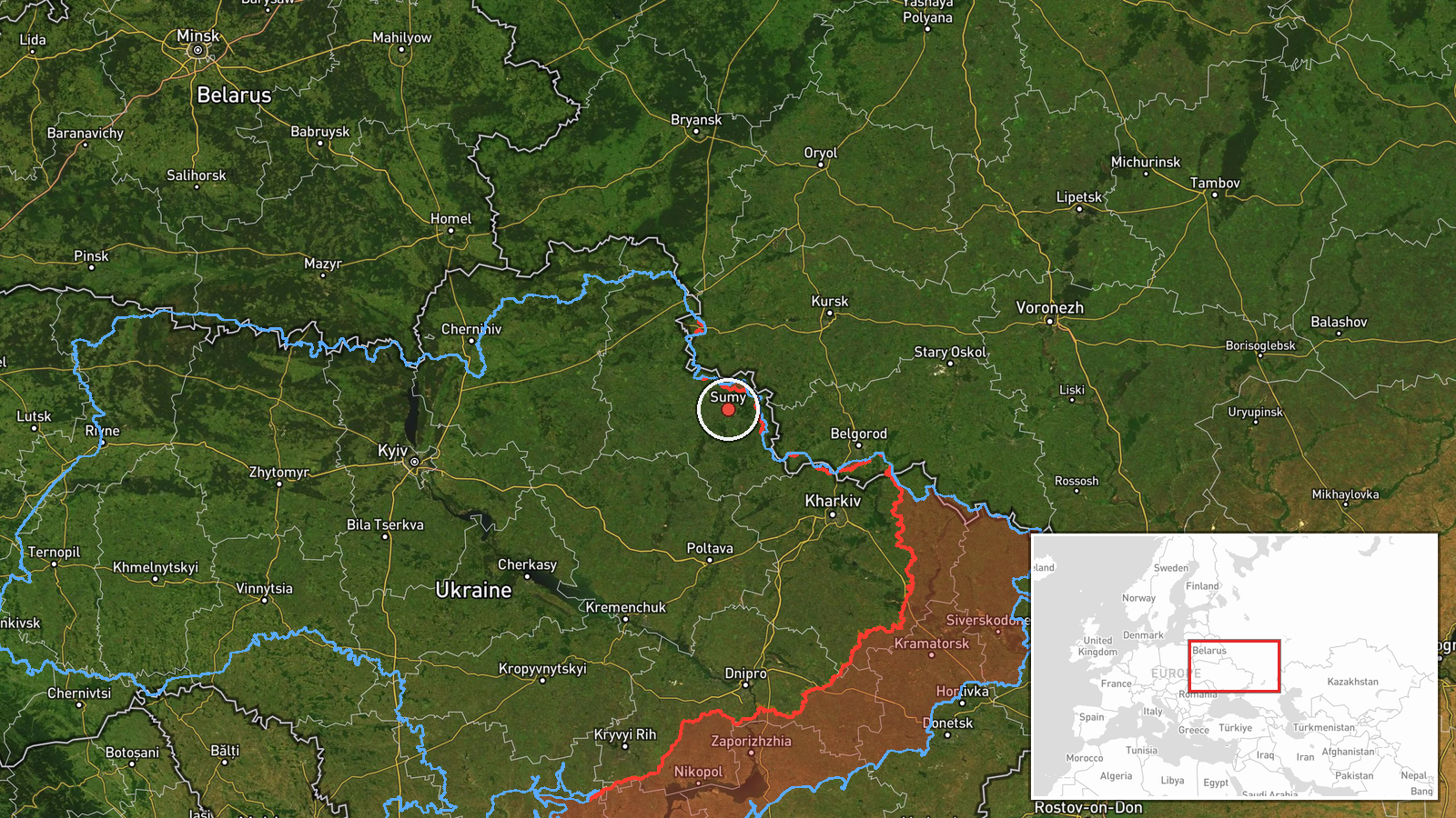
Ukrainian air monitoring reported on Telegram that enemy tactical aviation had launched guided aerial bombs toward Sumy Oblast in northeastern Ukraine. The alert was posted on 19 October 2026 at 22:27 UTC through the channel @kpszsu, which is associated with Ukraine's Air Force. The original Ukrainian wording refers to launches of guided aviation bombs, while the English summary describes aircraft heading toward the oblast, a difference in phrasing that reflects the terse nature of such alerts. The report names no specific settlement, target, aircraft type or outcome. It is a single-channel, real-time warning and has not yet been matched by a second source.
Context and assessment
Sumy Oblast borders the Russian regions of Kursk, Bryansk and Belgorod, which makes it one of the most exposed areas of Ukraine's northeastern front. The same day's related events show sustained pressure there. Between 02:41 and 14:01 UTC, monitoring channels logged at least four Shahed-type drone transits toward Sumy, and one of the 03:02 alerts also mentioned a drone heading toward Kharkiv. At 05:04 UTC, a separate report described shelling of about 27 border settlements and airstrikes on Pustohorod, Koren'ok, Vakalivshchyna, Pysarivka and Mohrytsia. Guided glide bombs are typically released from aircraft at standoff distances, which lets them strike positions and settlements near the front without entering the range of most air defences. If the report is accurate, it would suggest that the combined drone, artillery and air activity is part of a broader effort to pressure the border zone, though a single alert cannot establish intent or the scale of the launch.
Sources and confidence
All information comes from one Telegram channel, @kpszsu, and no independent outlet, regional administration or verified imagery has yet confirmed the alert. The confidence score of 8.0 reflects the channel's institutional association and the consistency of the same day's monitoring reports, but it is held below the top of the scale because the claim is unconfirmed and the location is imprecise. Confidence would rise with corroboration from Sumy regional officials, reports of impacts or damage, or geolocated footage of strikes. It would fall if later reporting indicated that the alert was a routine warning without subsequent launches, or if officials revised the reported weapon type or target area.
Location
The coordinates (50.91, 34.80) were assigned at region level, meaning they mark a reference point for Sumy Oblast rather than a specific settlement or facility, and the location confidence is recorded as low. The point lies close to Sumy city, the oblast's administrative centre. The area is largely flat, with farmland, forest belts and river valleys of the Seym and Psel systems, and the nearby border with Russia is only a short distance north. The true impact or target area could lie anywhere across the oblast.
Related events nearby
- Ukrainian air monitoring: 1 Russian Shahed-type drone heading toward Sumy.2026-10-19 14:01 UTC · Drone Transit · Sumy, Ukraine
- Ukrainian air monitoring: 1 Russian Shahed-type drone heading toward Sumy.2026-10-19 07:47 UTC · Drone Transit · Sumy, Ukraine
- Ukrainian air monitoring: 1 Russian Shahed-type drone heading toward Sumy; 1 Russian Shahed-type drone heading2026-10-19 03:02 UTC · Drone Transit · Sumy, Ukraine
- Ukrainian air monitoring: 1 Russian Shahed-type drone heading toward Sumy.2026-10-19 02:41 UTC · Drone Transit · Sumy, Ukraine
- Russian shelling hit about 27 settlements in Sumy Oblast border areas, and airstrikes hit Pustohorod, Koren'ok2026-10-19 05:04 UTC · Artillery · North Slobozhansky direction border area, Sumy Obl
▶ View this event on the live map

Intel Mapper aggregates open-source reports from monitored Telegram and X channels, geolocates them, cross-checks duplicates across sources and assigns a confidence score. Entries are updated as new confirmations arrive. Read how we verify events.