Ukrainian air monitoring reports one Russian Shahed-type drone heading toward Sumy
What happened
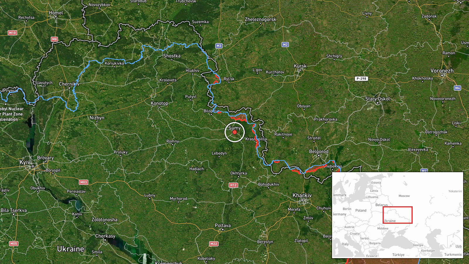
Ukraine's air threat monitoring channel on Telegram, tracked as @kpszsu, reported on 19 October 2026 at 14:01 UTC that one Russian Shahed-type drone was heading toward Sumy. The original Ukrainian wording describes it as an 'ударний БпЛА' (strike UAV) approaching Sumy from the north. The alert is coded as a drone transit rather than an impact, so the report confirms an inbound track and not any strike result. The location is given as Sumy city. No casualty, damage or interception outcome appears in the data. The same channel's earlier alerts that day, at 02:41, 03:02 and 07:47 UTC, also named Sumy as the target, and the 03:02 message added a second drone toward Kharkiv.
Context and assessment
Sumy sits roughly 30 kilometres from the Russian border and has been under sustained pressure in the current cycle. The related reports show a clear pattern: three separate drone transit alerts toward Sumy between 02:41 and 07:47 UTC on the same day, followed by this fourth alert at 14:01. Earlier in the sequence, a 05:04 artillery report described shelling across about 27 settlements in border areas of Sumy Oblast, with airstrikes on villages including Pustohorod, Koren'ok, Vakalivshchyna, Pysarivka and Mohrytsia. The day before, at 16:47 UTC on 18 October, monitoring warned of a possible Iskander or S-400 ballistic missile launch from Kursk, Russia, and civilians were told to take shelter. Operationally, repeated single-drone tracks toward the same city can indicate reconnaissance, probing of air defence and warning systems, or a series of individual launches timed to stretch defenders, though the data alone cannot establish intent. Taken together with the artillery activity and the possible missile launch from nearby Kursk, the pattern suggests sustained pressure on the border zone rather than an isolated incident. Each alert signals a track, not a confirmed hit.
Sources and confidence
The report rests on one channel, the Telegram account @kpszsu, which carries official Ukrainian air threat warnings. No second outlet in the data cross-confirms it, so the source count is one. The 8.0 score reflects an official feed with a specific, geolocated message, tempered by the absence of corroboration and the fact that drone tracks often change course. Confidence would rise with a regional administration statement or independent reporting of the track, and would fall if the warning were revised or withdrawn.
Location
The location is a settlement-level match. The coordinates 50.91 N, 34.80 E correspond to Sumy city, which the report names directly, and location confidence is recorded as high. Sumy is the administrative centre of Sumy Oblast in north-eastern Ukraine, close to the Russian border and set along the Psel River valley. Its northern position makes it a frequent destination for drone tracks entering from Russian territory.
Related events nearby
- Ukrainian air monitoring: 1 Russian Shahed-type drone heading toward Sumy.2026-10-19 07:47 UTC · Drone Transit · Sumy, Ukraine
- Ukrainian air monitoring: 1 Russian Shahed-type drone heading toward Sumy; 1 Russian Shahed-type drone heading2026-10-19 03:02 UTC · Drone Transit · Sumy, Ukraine
- Ukrainian air monitoring: 1 Russian Shahed-type drone heading toward Sumy.2026-10-19 02:41 UTC · Drone Transit · Sumy, Ukraine
- Russian shelling hit about 27 settlements in Sumy Oblast border areas, and airstrikes hit Pustohorod, Koren'ok2026-10-19 05:04 UTC · Artillery · North Slobozhansky direction border area, Sumy Obl
- Ukrainian air monitoring: 1 Russian Banderol mini cruise missile passing Okhtyrka, heading toward Myrhorod.2026-10-18 19:14 UTC · Cruise Missile · Myrhorod, Ukraine
▶ View this event on the live map

Intel Mapper aggregates open-source reports from monitored Telegram and X channels, geolocates them, cross-checks duplicates across sources and assigns a confidence score. Entries are updated as new confirmations arrive. Read how we verify events.