Ukrainian air monitoring reports one Russian Shahed-type drone heading toward Sumy
What happened
Ukrainian air monitoring, relayed through the Telegram channel @kpszsu, reported one Russian Shahed-type drone heading toward Sumy at 10:32 UTC on 20 October 2026. The original Ukrainian-language post reads roughly as 'UAV on course for Sumy from the north' and gives no altitude, speed or estimated time of arrival. It is a transit warning, not a report of impact, so it says nothing about damage or casualties. The post describes the drone as Russian without independent evidence, and it is currently the only source in this dataset.
Context and assessment
Sumy sits roughly 30 to 40 kilometres from the Russian border and has been repeatedly struck since 2022, which makes even a single drone track in the area operationally relevant. The related events from the same period show a dense sequence: a Shahed-type drone flagged toward Sumy at 14:01 UTC on 19 October, tactical aviation heading toward Sumy Oblast that evening at 22:27, an artillery sequence across several villages in the Khotin area at 04:08 on 20 October, a guided glide bomb toward Sumy at 04:46, and a jet-powered Geran-3 from Sumy Oblast toward Buryn at 05:51. Taken together, these entries suggest sustained pressure on the oblast that combines standoff munitions, aviation and artillery rather than one isolated launch. Transit alerts of this kind usually reflect the trajectory of an airframe rather than a confirmed target, so the Sumy warning may indicate a flight path passing over or near the city, or a route toward another district. Analysts would read the pattern as consistent with repeated strikes on border-adjacent towns, although the dataset does not establish intent.
Sources and confidence
Only one channel, Telegram @kpszsu, carries this report in the dataset. The event is recorded with a source count of one and no cross-confirmation. The confidence score of 8.0 reflects a credible official-style monitoring feed with a clear timestamp and location, rather than independent verification of the track. It would rise with corroboration from Ukrainian air force statements, regional military administration posts, or open-source tracking of the airframe. It would fall if later reporting withdraws the track or records the drone as diverted elsewhere.
Location
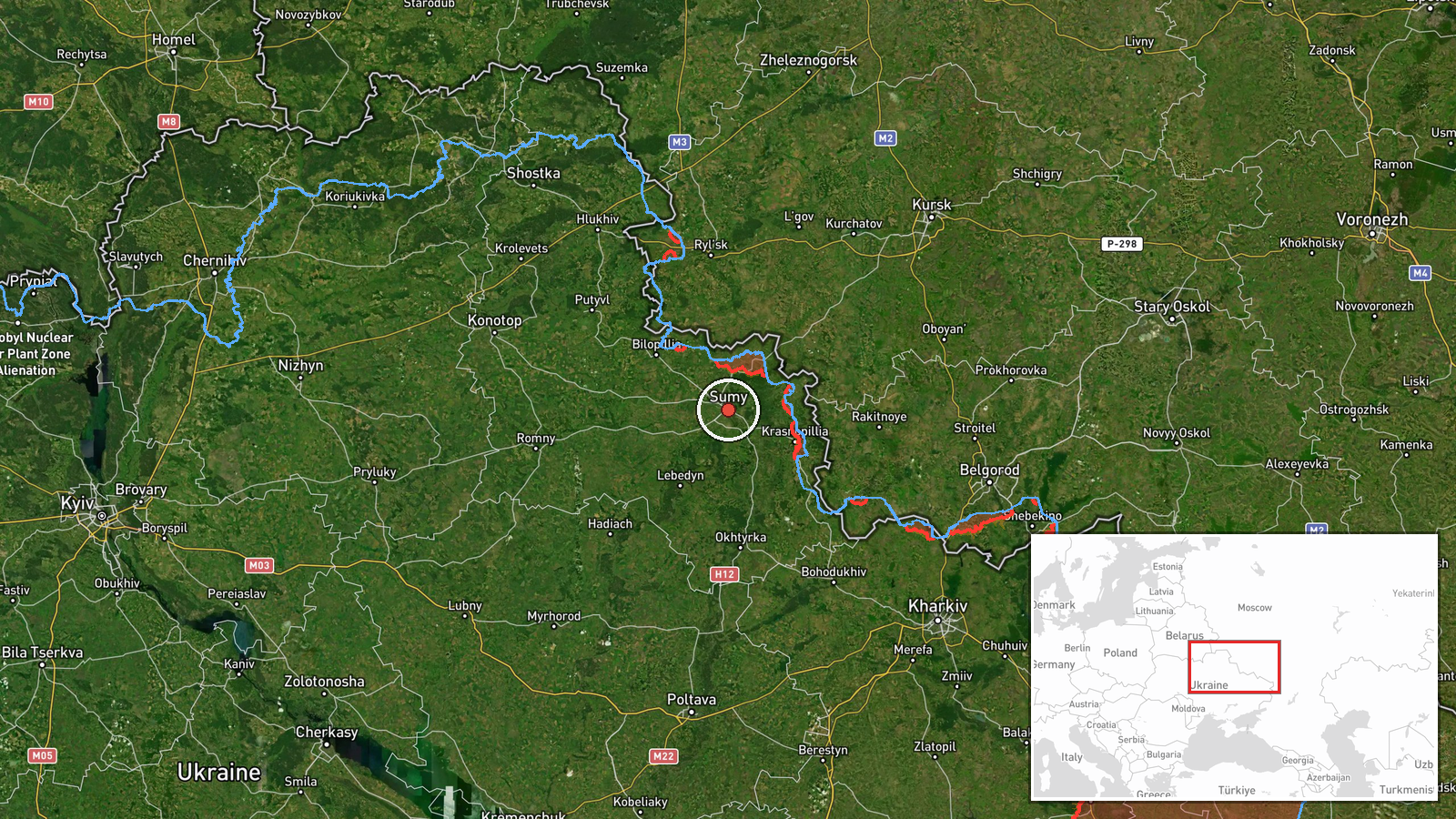
Coordinates place the event at the city of Sumy, at 50.91 N, 34.80 E. The precision is recorded as settlement level with high location confidence, so the marker reflects the city rather than a specific site. Sumy lies in northeastern Ukraine on the Psel River near the Russian border, in a largely flat landscape of farmland and forest belts. The report's reference to a drone coming from the north is consistent with an approach from the Russian side, though no origin point is given.
Related events nearby
- Ukrainian air monitoring: 1 Russian guided glide bomb (KAB) heading toward Sumy.2026-10-20 04:46 UTC · Airstrike · Sumy, Ukraine
- Ukrainian air monitoring: Russian tactical aircraft (tac. aviation) heading toward Sumy Oblast.2026-10-19 22:27 UTC · Combat Aircraft · Sumy Oblast, Ukraine
- Ukrainian air monitoring: 1 Russian Shahed-type drone heading toward Sumy.2026-10-19 14:01 UTC · Drone Transit · Sumy, Ukraine
- As of 08:00 20.10.2026, Russian artillery shelled Ulanove, Pysarivka, Koren'ok, Khotin, Mala Korchakivka, Yuna2026-10-20 04:08 UTC · Artillery · Khotin, Sumy Oblast, Ukraine
- Ukrainian air monitoring: 1 Russian jet-powered Shahed (Geran-3) drone from Sumy Oblast toward Buryn.2026-10-20 05:51 UTC · Drone Transit · Buryn, Ukraine
▶ View this event on the live map

Intel Mapper aggregates open-source reports from monitored Telegram and X channels, geolocates them, cross-checks duplicates across sources and assigns a confidence score. Entries are updated as new confirmations arrive. Read how we verify events.