Ukraine's General Staff reports 187 combat clashes in 24 hours, centered on the Donetsk front
What happened
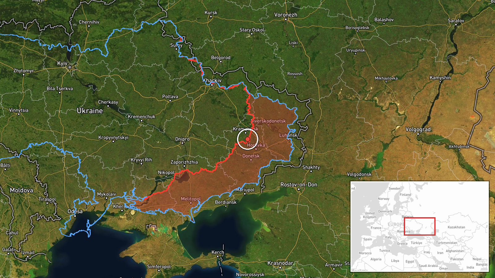
The Ukrainian General Staff, posting on its Telegram channel (@GeneralStaffZSU), published a daily tally of combat activity on 22 October 2026 at 05:04 UTC, covering the preceding 24 hours. The Ukrainian-language statement counted 187 combat clashes. It listed one missile strike, 88 airstrikes involving 289 guided aerial bombs, 10,414 kamikaze drone uses, and 2,604 shelling incidents against settlements and troop positions, 67 of which involved multiple rocket launch systems. The report attributes these actions to Russian forces. It does not give a single location for the totals. The map marker sits in the Kostiantynivka area of Donetsk Oblast, reflecting a separate breakdown in the same update that described seven attacks around Kostiantynivka and toward Novopavlivka. The figures are aggregate claims from one government source.
Context and assessment
Kostiantynivka is a road and rail junction on the approaches to Druzhkivka and the wider Kramatorsk-Sloviansk agglomeration, which makes it a long-standing focus of Russian pressure in Donetsk Oblast. The daily report fits a pattern visible in the related reporting. The previous evening, the General Staff described six Russian assault attempts on the Kostiantynivka axis, all reportedly repelled. Another update logged one assault toward Mykolaivka on the Sloviansk axis and none on the Kramatorsk axis, and a further summary counted 19 attacks on the Pokrovsk direction, including activity near Dobropillia. A single-source claim also described Ukrainian forces reportedly infiltrating Russian positions through underground pipes near Kostiantynivka, capturing several soldiers. Operationally, the heavy use of glide bombs and drones suggests sustained standoff pressure on Ukrainian positions and rear logistics, while repeated small assaults may indicate probing rather than a decisive breakthrough. Because the totals are cumulative, they cannot show which axis drove the volume, so the pattern is best read as a broad, multi-sector campaign rather than a single offensive.
Sources and confidence
The event rests on a single channel, the Ukrainian General Staff's Telegram account, which is the official military reporting body for Ukraine and is generally a primary source for daily front-line tallies. No independent outlet, Russian statement, or geolocated imagery in the data cross-confirms the figures, which are aggregate claims rather than verified incidents. The confidence score of 8.0 reflects an official source with a consistent reporting record, tempered by the lack of corroboration and the absence of verifiable locations. Confidence would rise with independent monitoring by open-source analysts, geolocated footage of specific strikes, or matching accounts from Russian military sources. It would fall if later reporting revised the tallies or if independent trackers found the counts inconsistent with observed activity.
Location
The location is approximate and carries low location confidence, with region-level precision. The coordinates, 48.575 N and 37.661 E, mark an estimated front-line point near Kostiantynivka rather than a confirmed impact site, since the source covers the whole front. The setting is Donetsk Oblast in eastern Ukraine, an area of open steppe, river valleys, and small settlements, with Kostiantynivka serving as a rail and road hub. The marker should be read as an indicator of the sector, not a precise target.
Related events nearby
- Ukraine's 2nd Corps Khartiia (National Guard) reportedly infiltrated Russian positions through underground pip2026-10-21 09:04 UTC · Combat · Near Kostyantynivka, Donetsk, Ukraine (front line,
- Ukrainian General Staff reports six Russian assault attempts on the Kostiantynivka axis near Kostiantynivka an2026-10-21 19:05 UTC · Combat · Kostiantynivka, Donetsk, Ukraine
- Ukrainian air monitoring: 1 Russian guided glide bomb (KAB) heading toward Donetsk Oblast.2026-10-21 18:56 UTC · Airstrike · Donetsk Oblast, Ukraine
- Ukrainian forces on the Sloviansk axis repelled one Russian assault attempt toward Mykolaivka; no assault acti2026-10-21 19:04 UTC · Combat · Mykolaivka, Donetsk Oblast, Ukraine
- Ukrainian General Staff reports 19 Russian attacks on the Pokrovsk direction, with assaults near Sofiivka, Dob2026-10-21 19:05 UTC · Combat · Dobropillia, Donetsk Oblast, Ukraine
▶ View this event on the live map

Intel Mapper aggregates open-source reports from monitored Telegram and X channels, geolocates them, cross-checks duplicates across sources and assigns a confidence score. Entries are updated as new confirmations arrive. Read how we verify events.