Ukraine reports ten Russian attacks on Huliaipole axis near Verkhnya Tersa, 22 Oct 2026
What happened
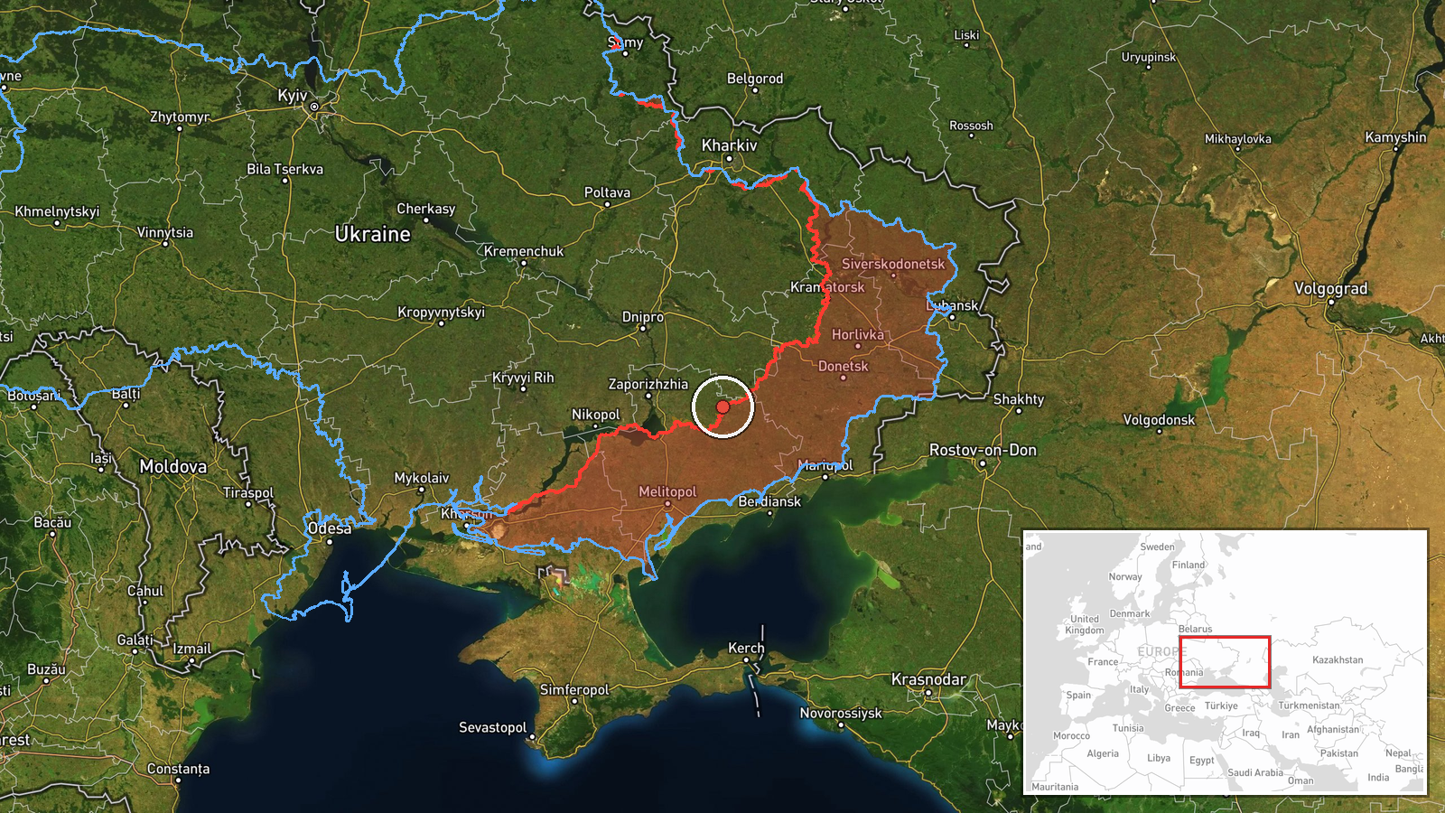
Ukraine's General Staff reported on Telegram that Russian forces carried out ten attacks along the Huliaipole axis in Zaporizhzhia Oblast, naming settlements including Verkhnya Tersa, Kosivtseve, Vozdvyzhivka, Kopani, Charivne, Novoselivka and Bilohir'ya. The update was stated as of 22:00 on 22 October 2026. The original Ukrainian wording refers to attacks by the enemy in the areas of these settlements, without giving outcomes, weapons, or casualty figures. The post is a routine operational summary rather than a detailed incident account, so it does not say which villages were struck directly or whether all ten attacks were ground assaults. The event was logged at 19:05 UTC on 22 October. Because the report names a cluster of villages rather than a single point, the map places its marker at Verkhnya Tersa as a representative location. The summary should be read as a count of reported attacks across a front sector.
Context and assessment
Huliaipole has been one of the more consequential sectors of the southern front in Zaporizhzhia Oblast, and the axis takes its name from the town whose surrounding villages dominate this report. A high attack count along a single axis in one reporting window typically points to sustained Russian pressure, which may aim to fix Ukrainian units in place or probe for weak points rather than represent a one-off raid. The same afternoon, related reporting places other pressure further south, with two combat clashes on the Orikhiv axis near Lukianivske and Pavlivka, one left unresolved at the time of the update. Together these suggest a multi-axis picture in which Russian forces test several sectors of the Zaporizhzhia front at once. The air picture is also active. A group of jet-powered Shahed-type drones was tracked passing Slavhorod heading west, and a guided glide bomb was reported moving toward Zaporizhzhia city earlier that day. Ukrainian units separately reported strikes on a Russian command-observation post near Vyshneve and a UAV control point near Lankove, which may indicate a reciprocal contest in drones and fires. Operationally, a concentrated tally of attacks may reflect either a genuine push or a local intensification of contact, and this single official summary cannot separate the two.
Sources and confidence
This item rests on a single channel, the Telegram account of the Ukrainian General Staff, and the event record contains no independent corroboration. The confidence score of 8.0 reflects that the source is official and publishes timed operational summaries on a regular cycle, but it sits below the top band because the post gives no outcomes, imagery, or independent verification of individual attacks. Confidence would rise with confirmation from regional military administrations, geolocated footage from the named villages, or reporting from an independent monitoring outlet. It would fall if later updates revised the attack count or if the named locations proved inconsistent with other data.
Location
The marker sits on Verkhnya Tersa with low location confidence and region-level precision, because the source names seven settlements and does not say which were targeted. The coordinates place it in the rural Huliaipole area of northern Zaporizhzhia Oblast, an open steppe landscape of farmland, small villages and shallow river valleys. The Haichur river corridor, which runs through the Huliaipole area, lies nearby.
Related events nearby
- Ukrainian General Staff reports two Russian combat clashes on the Orikhiv axis near Lukianivske and Pavlivka a2026-10-22 19:05 UTC · Combat · Lukianivske, Orikhiv Raion, Zaporizhzhia Oblast, U
- Ukrainian air monitoring: 2+ Russian jet-powered Shahed (Geran-3) drones passing Slavhorod, heading west.2026-10-22 17:01 UTC · Drone Transit · Slavhorod, Ukraine
- Ukrainian air monitoring: 1 Russian guided glide bomb (KAB) heading toward Zaporizhzhya.2026-10-22 09:25 UTC · Airstrike · Zaporizhzhya, Ukraine
- Ukrainian Defense Forces struck a Russian command-observation post near Vyshneve, Zaporizhzhia Oblast, on Octo2026-10-22 12:23 UTC · Combat · Vyshneve, Zaporizhzhia, Ukraine
- Ukrainian Defense Forces struck a Russian UAV control point near Lankove, Zaporizhzhia Oblast, on the night of2026-10-22 12:23 UTC · Combat · Lankove, Zaporizhzhia Oblast, Ukraine
▶ View this event on the live map

Intel Mapper aggregates open-source reports from monitored Telegram and X channels, geolocates them, cross-checks duplicates across sources and assigns a confidence score. Entries are updated as new confirmations arrive. Read how we verify events.