Ukraine reports two Russian combat clashes on Orikhiv axis near Lukianivske and Pavlivka
What happened
Ukraine's General Staff reported two Russian combat clashes on the Orikhiv axis in Zaporizhzhia Oblast, in the areas of Lukianivske and Pavlivka, as of 22:00 on 22 October 2026. The original Ukrainian-language statement says one of the attacks had not concluded at the time of reporting. The report, posted on the General Staff's Telegram channel, does not give casualty figures, weapons used, unit identities or the outcome of either engagement. The event is placed at Lukianivske, with Pavlivka named in the same statement but not separately geolocated. Because the wording describes clashes rather than a specific strike, it is best read as a summary of ground activity rather than a verified account of a single incident.
Context and assessment
The Orikhiv axis is one of several Zaporizhzhia sectors where Ukrainian reporting has tracked ground combat. On the same day, the General Staff reported ten Russian attacks on the Huliaipole axis near Verkhnya Tersa and other villages, suggesting sustained pressure across multiple sectors rather than one isolated clash. Separately, Ukrainian air monitoring logged Shahed-type drones over Zaporizhzhia city and heading toward it that afternoon, and jet-powered Geran-3 drones passing Slavhorod heading west. These are long-range strike movements, distinct from front-line combat, but they show the wider oblast under concurrent pressure. A Ukrainian strike on a Russian command-observation post near Vyshneve on 21 to 22 October, also in Zaporizhzhia Oblast, points to reciprocal activity in the same region. Operationally, the pattern may suggest a Russian effort to probe or press several sectors at once, with at least one engagement still active at reporting time. Without further reporting, it is not possible to tell whether these clashes are part of a coordinated push or routine contact along the line.
Sources and confidence
The event rests on a single channel, the Telegram account of the Ukrainian General Staff (@GeneralStaffZSU), and no independent outlet in the data corroborates it. The confidence score of 8.0 out of 10 reflects the official origin of the statement, its specific timestamp and named settlements, offset by the lack of independent confirmation, geolocated imagery or detail on the clashes themselves. The record is not marked as corrected. Confidence would rise with confirmation from regional military administration, independent monitors, geolocated footage or Russian-side accounts. It would fall if the General Staff revised or removed the statement, or if later reporting contradicted the timing or location.
Location
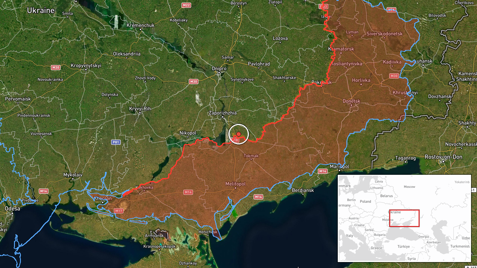
The coordinates correspond to the settlement of Lukianivske, which is assigned at settlement precision rather than facility level. Lukianivske lies in Orikhiv Raion of Zaporizhzhia Oblast in southeastern Ukraine. The surrounding terrain is largely open steppe with farmland, scattered villages and river valleys, and the Orikhiv area sits within the front-line belt. Pavlivka is named but not separately geolocated, so the map point should not be read as its position. Location confidence is recorded as normal.
Related events nearby
- Ukrainian air monitoring: 1 Russian Shahed-type drone heading toward Zaporizhzhia.2026-10-22 17:01 UTC · Drone Transit · Zaporizhzhia, Ukraine
- Ukrainian air monitoring: 1 Russian Shahed-type drone over Zaporizhzhia.2026-10-22 16:59 UTC · Drone Transit · Zaporizhzhia, Ukraine
- Ukrainian Defense Forces struck a Russian command-observation post near Vyshneve, Zaporizhzhia Oblast, on Octo2026-10-22 12:23 UTC · Combat · Vyshneve, Zaporizhzhia, Ukraine
- Ukrainian General Staff reports ten Russian attacks on the Huliaipole axis near Verkhnya Tersa, Kosivtseve, Vo2026-10-22 19:05 UTC · Combat · Verkhnya Tersa, Zaporizhzhia Oblast, Ukraine
- Ukrainian air monitoring: 2+ Russian jet-powered Shahed (Geran-3) drones passing Slavhorod, heading west.2026-10-22 17:01 UTC · Drone Transit · Slavhorod, Ukraine
▶ View this event on the live map

Intel Mapper aggregates open-source reports from monitored Telegram and X channels, geolocates them, cross-checks duplicates across sources and assigns a confidence score. Entries are updated as new confirmations arrive. Read how we verify events.