SAF reportedly repels RSF and SPLM-N attack on Sali in Blue Nile, captures 15 vehicles
What happened
A Telegram channel, @arabicafrica, citing local sources, reports that on 20 October soldiers of the Sudanese Armed Forces' 4th Mechanized Division repelled a new attack on the Sali area in eastern Blue Nile State. The attack was attributed to the Rapid Support Forces (RSF) and the SPLM-N faction led by Abdelaziz al-Hilu. The post says the army inflicted heavy losses on both personnel and equipment, seizing 15 fully equipped combat vehicles and destroying five more. It also notes that for several weeks Blue Nile has seen fierce fighting between the army, the RSF and their allies, as both sides try to expand their areas of control. The post gives no casualty figures, and the event is recorded with a timestamp of 21 October 2026, 10:40 UTC.
Context and assessment
Blue Nile is one of Sudan's southeastern states, bordering Ethiopia, and it has been a secondary front since the war between the army and the RSF began in April 2023. Its towns and dam infrastructure, including Roseires and Damazin, give it strategic weight, and the al-Hilu faction of the SPLM-N has a long insurgent history in the area. The related events show a cluster of activity over the same days. The RSF claimed full control of the Al-Barka area and a military camp on the evening of 20 October, and a later claim on 21 October said it had taken Al Baraka. Both are unverified party claims. On 20 October a drone strike near a displacement site in Wad El Mahi reportedly killed at least 31 civilians, and the UN condemned it, though attribution remains inferred. Security arrests in Roseires and rights concerns over tribal-linked detentions in Damazin and Roseires point to a wider pattern of pressure on civilians. Operationally, the reported capture of vehicles suggests the contest is being fought with armoured and mobile assets, and repeated claims over the same ground imply that control of routes in eastern Blue Nile is still disputed.
Sources and confidence
The report rests on a single Telegram channel, with no independent confirmation in the dataset, and it carries a source count of one. The confidence score of 5.8 reflects this single-channel sourcing, the lack of quantified or photographed evidence for the vehicle figures, and the partisan framing typical of battlefield posts. Related events add context, but the RSF claims are themselves unverified and the UN condemnation concerns a different incident. Confidence would rise with independent reporting from wire services or local monitors, photographs or geolocated video of the captured vehicles, or statements from the army or RSF that corroborate the outcome. It would fall if rival accounts contradict the claimed result or if no visual evidence emerges.
Location
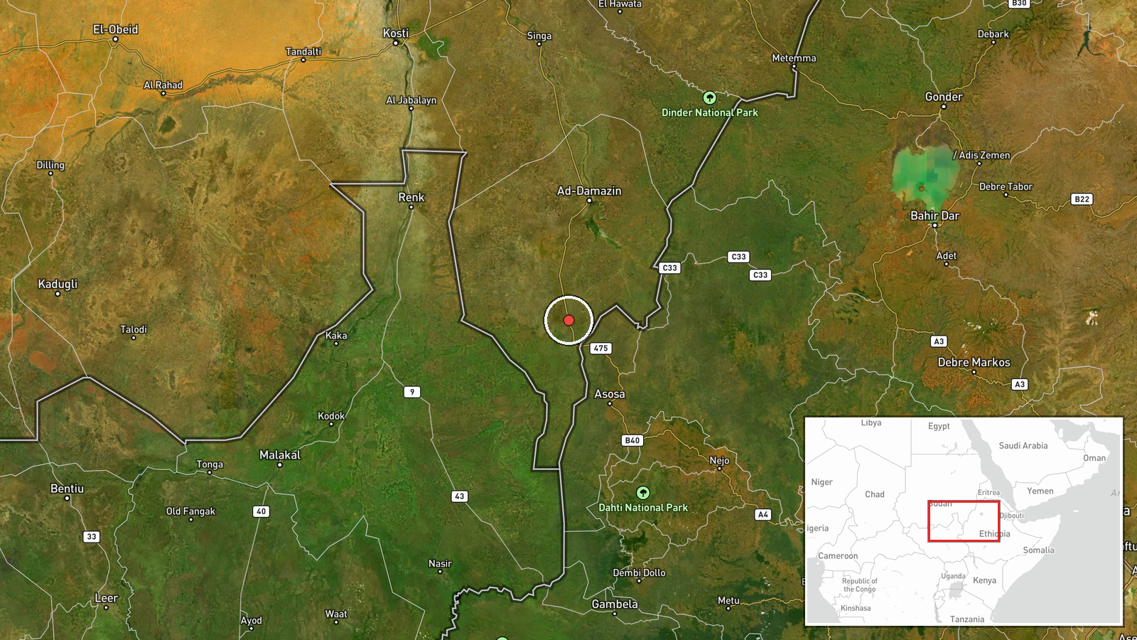
The location is recorded at settlement precision, using coordinates for Sali at roughly 10.78 N, 34.18 E. The position is in the eastern part of Blue Nile State, in the rural south-east of Sudan near the Ethiopian border. The terrain is largely savanna and farmland, with seasonal watercourses and dirt tracks that shape movement. The location is not a precise facility, so the coordinates should be read as the town's approximate centre.
Related events nearby
- RSF claims full control of the Al-Barka area and military camp in Blue Nile State, seizing vehicles and weapon2026-10-20 21:20 UTC · Statement · Al-Barka, Blue Nile State (New Funj), Sudan
- RSF claims it liberated Al Baraka in Blue Nile and inflicted heavy losses on SAF and allied forces in Blue Nil2026-10-21 10:32 UTC · Capture · Al Baraka, Blue Nile State, Sudan
- RSF claims it has liberated the strategic Al-Barka area in Blue Nile State. Claim is unverified and comes from2026-10-20 21:20 UTC · Capture · Al-Barka, Blue Nile State, Sudan
- Drone strike near a displacement site in Wad El Mahi, Blue Nile killed at least 31 civilians, mostly women and2026-10-20 14:03 UTC · UAS Strike · Wad El Mahi, Blue Nile State, Sudan
- Security operatives arrested three civilians in southern Roseires, Blue Nile, amid rising rights concerns over2026-10-20 13:45 UTC · Police Operation · Roseires, Blue Nile State, Sudan
▶ View this event on the live map

Intel Mapper aggregates open-source reports from monitored Telegram and X channels, geolocates them, cross-checks duplicates across sources and assigns a confidence score. Entries are updated as new confirmations arrive. Read how we verify events.