Junta column advances into Myin in Sagaing Region; around 15,000 residents reportedly displaced
What happened
A Telegram post from BNI Online, a Burmese-language news outlet, reports that a Myanmar military column advanced into Myin, a settlement in Sagaing Region, and that an estimated 15,000 local residents have been displaced and remain in displacement. The post is dated 19 October 2026 at 08:06 UTC. The original Burmese text uses the term junta for the forces involved, reflecting the outlet's framing of the State Administration Council. The report gives a displacement estimate but does not say how that figure was derived. It does not describe clashes, casualties, the size or route of the column, or the units involved. Because the claim rests on one channel, the details remain unverified by independent reporting.
Context and assessment
Sagaing Region has been one of the main arenas of fighting between junta forces and armed resistance groups since the 2021 coup, and column movements there have often been followed by mass displacement as villagers flee ahead of ground operations. Two related events from the preceding day suggest broader military activity in the country. On 18 October, junta forces reportedly closed a road in Mandalay as military trucks withdrew toward the city, stranding cargo trucks on the Mandalay-Myitkyina route. That may point to troop or logistics redeployment in the north-central corridor, though the reporting does not link it to Myin. On 19 October, air strikes in Yesagyo, Magway Region, reportedly killed at least 12 civilians, including two children, and the strikes were reportedly aimed at Starlink internet equipment. If accurate, that targeting would indicate an effort to limit communications in contested areas. These events are in different regions and are not confirmed as coordinated, so they should be read as context rather than evidence of a single campaign.
Sources and confidence
The event rests on a single Telegram channel, BNI Online, and no independent outlet in the dataset has confirmed the advance or the displacement figure, which is why the confidence score is low at 6.6. A single-source report from a local outlet carries some value given its access to Sagaing communities, but it cannot be verified from the data alone. Confidence would rise with corroboration from other local media, humanitarian bodies such as OCHA or UNHCR, geolocated imagery, or photographs of the column or displaced families. It would fall if the outlet corrected or withdrew the figure, or if local sources could not confirm the advance.
Location
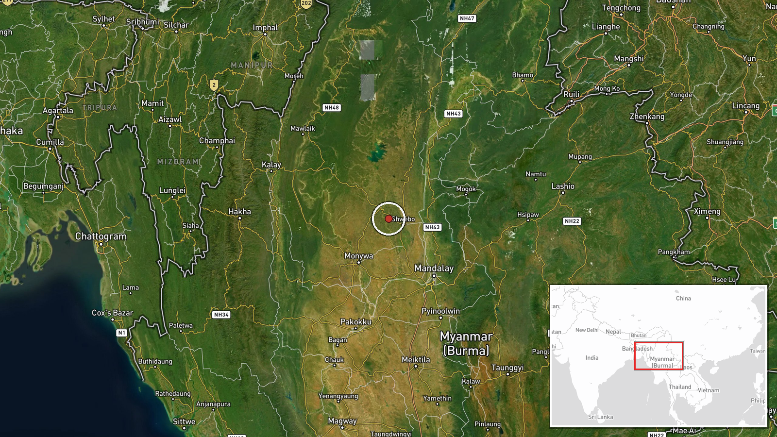
The location is geocoded at settlement level, with high confidence that the point corresponds to Myin in Sagaing Region. The coordinates sit near 22.64 north and 95.51 east. Sagaing Region in north-central Myanmar is marked by hills, forest, and river valleys, which shape movement routes and the placement of roads. The precise extent of the settlement and the surrounding terrain would need local mapping to confirm.
Related events nearby
- Junta forces closed Kasaw Ward No. 3 road to traffic as military trucks withdraw toward Mandalay, stranding th2026-10-18 14:00 UTC · Security · Mandalay, Mandalay Region, Myanmar
- Burma Air Force airstrikes on two villages in Yesagyo killed at least 12 civilians, including two children, an2026-10-19 01:13 UTC · Airstrike · Yesagyo, Magway Region, Myanmar
▶ View this event on the live map

Intel Mapper aggregates open-source reports from monitored Telegram and X channels, geolocates them, cross-checks duplicates across sources and assigns a confidence score. Entries are updated as new confirmations arrive. Read how we verify events.