KIA-led forces reportedly seize two SNA forward camps in Myanmar; exact location unreported
What happened
Democratic Voice of Burma (DVB), posting on its Telegram channel on 21 October 2026 at 09:45 UTC, reported that joint forces of the Kachin Independence Army (KIA) had seized two SNA forward camps. The post is written in Burmese, uses the word for forward camps, and carries a DVB news-break hashtag. It does not name the township, district or individual sites. The report gives no casualty figures, unit sizes or account of how the camps were taken. The summary classifies the event as a capture, and the location is recorded only as Myanmar, with no further detail.
Context and assessment
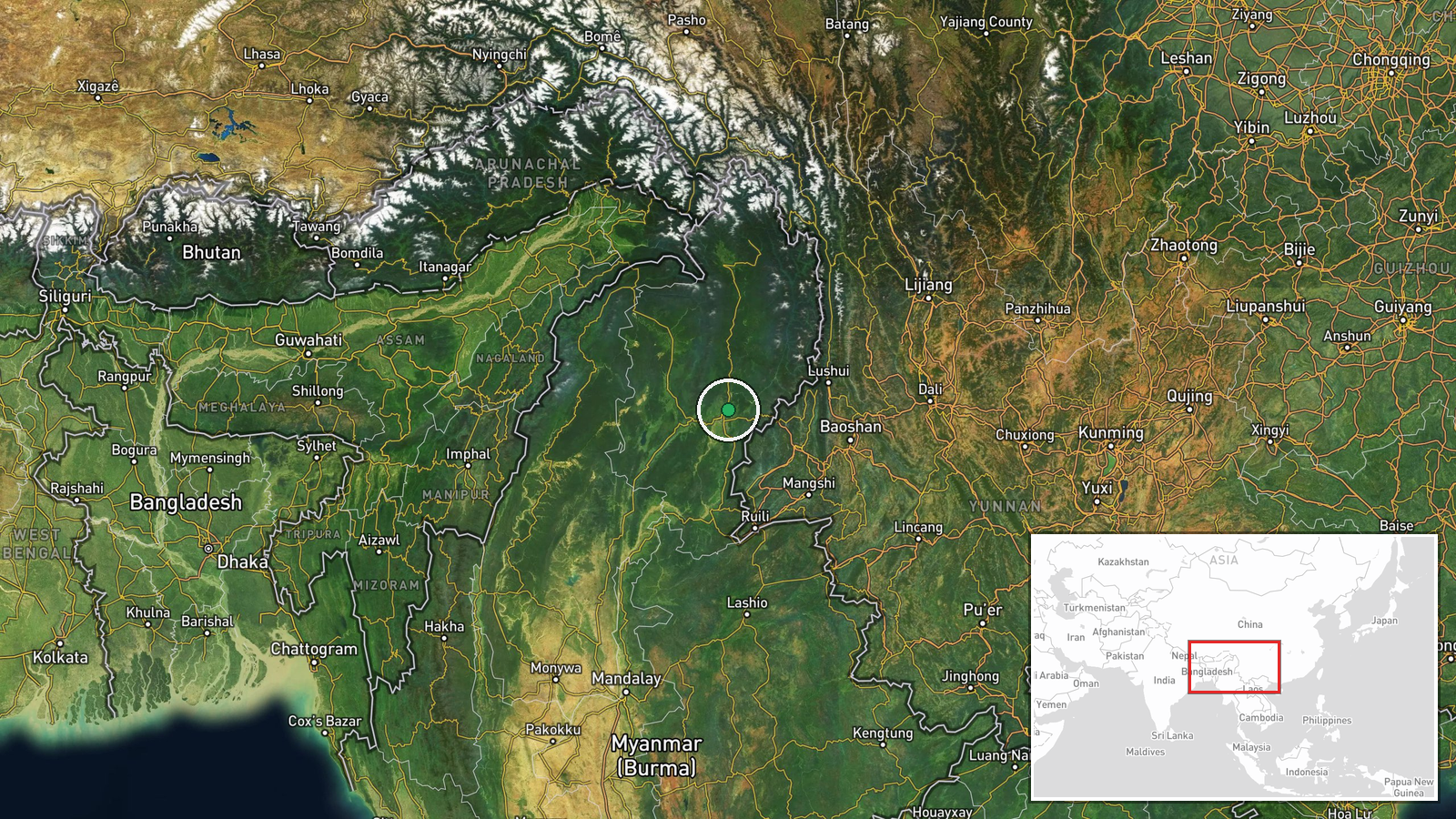
Northern Myanmar, particularly Kachin State, has been a long-running arena of fighting between the KIA and the military, and the KIA is one of the largest and most established ethnic armed organizations in the country. Coordinates attached to the record place the point in northern Kachin State near Myitkyina, but this is a region-level approximation, not a confirmed site. The other events on the same day are in western Myanmar. Junta airstrikes were reported near Kyaukphyu and Oo Zin Taung in Rakhine State, and reports describe abuses in Pauktaw, the detention of over 400 Rakhine returnees and the continued jailing of 18 journalists. These are not linked to Kachin, but together they suggest a broad pattern of military pressure on civilians, the press and armed groups. A BNI report from the previous day describes the same seizure and heavy fighting continuing, which suggests the capture belongs to an active campaign rather than an isolated raid. Taking forward camps would typically give the attacking force better observation, supply routes and staging positions, though the report does not state what the camps were used for or whether they were held.
Sources and confidence
The event rests on a single channel, DVB's Telegram account, which is an established Burmese outlet, but no independent outlet has confirmed the location or details in this record. A related BNI entry dated 20 October reports the same seizure and ongoing heavy fighting, which offers partial corroboration. It may, however, draw on the same local reporting, so it should not be treated as fully independent. The confidence score of 6.5 reflects one source, an imprecise location and the absence of specifics. Confidence would rise with named townships or geolocated imagery, statements from either side, or coverage by independent outlets. It would fall if the claim were disputed or if no follow-up reporting appeared.
Location
The location was determined only at region level, because the report names no township, village or facility. The attached coordinates, 25.4936 N and 97.4857 E, fall in northern Kachin State near Myitkyina, but they mark an approximate point rather than a camp site. The surrounding terrain is mountainous and forested, with river valleys and roads running toward the Chinese border to the north and east. Geographic precision is recorded as region and location confidence as low.
Related events nearby
- Authorities tightened inspections and arrests of unlicensed vehicles in Lashio; residents cannot re-register t2026-10-21 10:56 UTC · Security · Myanmar (location not reported)
- Over 400 Rakhine returnees from Malaysia remain held by junta forces, not yet allowed to return home; no retur2026-10-21 04:40 UTC · Displacement · Myanmar (location not reported)
- Myanmar junta aircraft in a group conducted airstrikes near Kyaukphyu and Oo Zin Taung hill area, Rakhine Stat2026-10-21 04:15 UTC · Airstrike · Myanmar (location not reported)
- Myanmar military reportedly beating and extorting money from residents in Pauktaw who lack household registrat2026-10-21 03:31 UTC · Security · Myanmar (location not reported)
- KIA joint forces seized two SNA camps in Myanmar; heavy fighting continues, per BNI report.2026-10-20 14:01 UTC · Combat · Myanmar (location not reported)
▶ View this event on the live map

Intel Mapper aggregates open-source reports from monitored Telegram and X channels, geolocates them, cross-checks duplicates across sources and assigns a confidence score. Entries are updated as new confirmations arrive. Read how we verify events.