Russian jet-powered Shahed drone tracked toward Dubno in northwestern Ukraine
What happened
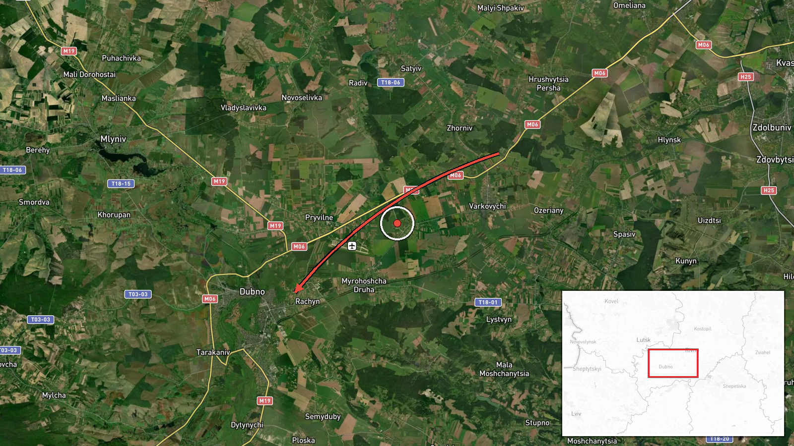
Ukrainian air monitoring reported a single Russian jet-powered Shahed (Geran-3) drone transiting from Rivne Oblast on a course toward Dubno on October 13 at 15:49 UTC. The report was posted by the Kyiv Post Special Operations Forces Unit (@kpszsu) on Telegram. Dubno is a city in Rivne Oblast in northwestern Ukraine, roughly 70 kilometers west of Kyiv. The drone was tracked but no impact or engagement was reported in the available data.
Context and assessment
Dubno lies in Rivne Oblast, a region that has experienced repeated Russian drone activity throughout 2026. Related reports from the same timeframe indicate coordinated or sequential Russian drone transits across northwestern Ukraine, including simultaneous or near-simultaneous Shahed operations toward Lutsk, Volyn Oblast, Bibrka, and Lviv earlier on October 13. This pattern suggests either a multi-target strike wave or sustained reconnaissance and strike operations across the region. Geran-3 drones are jet-powered variants with extended range compared to standard Shaheds, enabling deep penetration into Ukrainian airspace. Such activity typically targets critical infrastructure, though specific impact details remain unreported.
Sources and confidence
Source: Kyiv Post Special Operations Forces Unit Telegram channel (@kpszsu). Single-source report with high location confidence based on Ukrainian air monitoring. Confidence score of 8.0 reflects reliable Ukrainian monitoring infrastructure and corroboration by multiple concurrent regional drone reports, though lack of secondary confirmation and absence of impact details prevent higher confidence. Score would increase with reports of interception or damage; would decrease if broader context contradicts the timing or trajectory.
Location
Dubno, a city in Rivne Oblast, northwestern Ukraine (50.41°N, 25.76°E). Located approximately 70 kilometers west of Kyiv and roughly 80 kilometers south of the Belarus border. The city is situated on the Ikva River and serves as a regional administrative and industrial center. Geographic precision rated as high settlement-level.
Related events nearby
- Ukrainian air monitoring: 1 Russian Shahed-type drone heading toward Lutsk.2026-10-13 15:55 UTC · Drone Transit · Lutsk, Ukraine
- Ukrainian air monitoring: 1 Russian jet-powered Shahed (Geran-3) drone from Rivne Oblast toward Volyn Oblast.2026-10-13 15:51 UTC · Drone Transit · Volyn Oblast, Ukraine
- Ukrainian air monitoring: 1 Russian jet-powered Shahed (Geran-3) drone from Rivne Oblast toward Kostopil.2026-10-13 17:25 UTC · Drone Transit · Kostopil, Ukraine
- Ukrainian air monitoring reports 1 Russian jet-powered Shahed (Geran-3) drone transiting northern Zhytomyr Obl2026-10-13 17:14 UTC · Drone Transit · Rivne Oblast, Ukraine
- Ukrainian air monitoring: 1 Russian jet-powered Shahed (Geran-3) drone heading toward Bibrka.2026-10-13 13:32 UTC · Drone Transit · Bibrka, Ukraine
▶ View this event on the live map

Intel Mapper aggregates open-source reports from monitored Telegram and X channels, geolocates them, cross-checks duplicates across sources and assigns a confidence score. Entries are updated as new confirmations arrive. Read how we verify events.