Russian jet-powered Shahed drone tracked toward Kostopil in northwest Ukraine
What happened
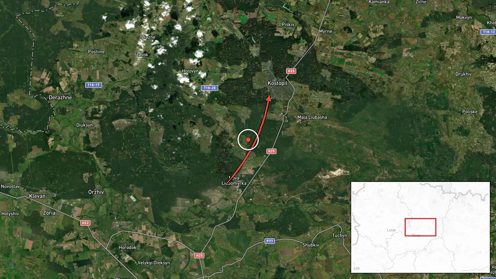
Ukrainian air monitoring systems reported tracking one Russian jet-powered Shahed (Geran-3) drone transiting through Rivne Oblast with a course toward Kostopil on October 13 at 17:25 UTC. The report was published by the Kyiv Post Strategic Situational Awareness service via Telegram. Kostopil is a city in Rivne Oblast in northwestern Ukraine. The drone's intended target or final destination was not specified in the monitoring alert.
Context and assessment
This tracking represents one of multiple Shahed drone detections across northwestern Ukraine on October 13, with related reports documenting similar aircraft moving through Zhytomyr, Rivne, Volyn, and Dubno regions in the preceding hours. Kostopil and surrounding Rivne Oblast have been periodic targets of Russian unmanned aircraft strikes throughout the conflict. The concentration of drone transits across this corridor suggests a possible coordinated attack operation targeting infrastructure or military positions in the northwest, though the scale and specific objectives remain unclear from air monitoring data alone. Such operations typically precede strikes on power facilities, ammunition depots, or other strategic assets.
Sources and confidence
Single source: Telegram channel @kpszsu (Kyiv Post Strategic Situational Awareness). No cross-confirmation from independent sources in the data provided. Confidence score of 8.0 reflects the established reliability of official Ukrainian air monitoring channels, though single-source reporting of transit data without confirmed strike outcome limits certainty. Confirmation from multiple monitoring services or visual evidence of impact would strengthen assessment.
Location
Kostopil, a city in Rivne Oblast, northwestern Ukraine, located approximately 50.88°N, 26.45°E. The settlement sits in the western part of Rivne Oblast near the historical transport corridor connecting Rivne to neighboring regions. The drone was tracked transiting toward this city from the southeast.
Related events nearby
- Ukrainian air monitoring: 2+ Russian jet-powered Shahed (Geran-3) drones heading toward Rivne Oblast.2026-10-13 18:03 UTC · Drone Transit · Rivne Oblast, Ukraine
- Ukrainian air monitoring reports 1 Russian jet-powered Shahed (Geran-3) drone transiting northern Zhytomyr Obl2026-10-13 17:14 UTC · Drone Transit · Rivne Oblast, Ukraine
- Ukrainian air monitoring: 1 Russian jet-powered Shahed (Geran-3) drone from Rivne Oblast toward Dubno.2026-10-13 15:49 UTC · Drone Transit · Dubno, Ukraine
- Ukrainian air monitoring: 1 Russian Shahed-type drone heading toward Lutsk.2026-10-13 15:55 UTC · Drone Transit · Lutsk, Ukraine
- Ukrainian air monitoring: 1 Russian jet-powered Shahed (Geran-3) drone from Rivne Oblast toward Volyn Oblast.2026-10-13 15:51 UTC · Drone Transit · Volyn Oblast, Ukraine
▶ View this event on the live map

Intel Mapper aggregates open-source reports from monitored Telegram and X channels, geolocates them, cross-checks duplicates across sources and assigns a confidence score. Entries are updated as new confirmations arrive. Read how we verify events.