Russian Geran-3 drone transits northern Zhytomyr Oblast toward Rivne
What happened
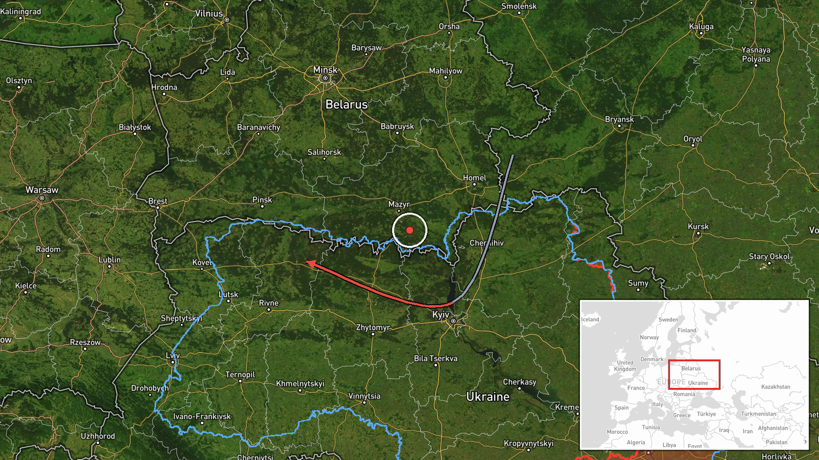
Ukrainian air monitoring detected one Russian jet-powered Shahed-type drone (Geran-3) in transit across northern Zhytomyr Oblast on October 13 at 17:14 UTC, reportedly heading toward Rivne Oblast. The drone originated from northern Kyiv Oblast. The report was issued by the Ukrainian Air Force command via Telegram. No engagement or impact was mentioned in the alert.
Context and assessment
This transit observation is part of a sustained pattern of Russian drone activity across northwestern Ukraine on October 13. Related detections the same day tracked Geran-3 drones approaching Lutsk, Kostopil, Dubno, and Volyn Oblast—all targets in the same operational corridor. Zhytomyr and Rivne Oblasts lie in Ukraine's northwestern sector, roughly 150–200 km from the front lines. The apparent focus on this region may indicate Russian intent to strike infrastructure, military facilities, or supply routes in the north. The clustering of reports within hours suggests either a coordinated multi-drone operation or sustained reconnaissance pressure.
Sources and confidence
Single source: Ukrainian Air Force command channel on Telegram (@kpszsu). No cross-confirmation from independent channels reported. Confidence score of 8.0 reflects the official Ukrainian source and consistency with related events same day, though single-source reporting limits certainty. Confirmation by air defense engagement reports or secondary monitoring would raise confidence; absence of follow-up impact assessment slightly lowers it.
Location
Northern Zhytomyr Oblast, determined at regional precision level (latitude 51.21, longitude 26.52). The oblast sits northwest of Kyiv, bordering Rivne and Volyn Oblasts. The transit corridor spans relatively flat terrain typical of northwestern Ukraine, with mixed forests and agricultural land.
Related events nearby
- Ukrainian air monitoring: 2+ Russian jet-powered Shahed (Geran-3) drones heading toward Rivne Oblast.2026-10-13 18:03 UTC · Drone Transit · Rivne Oblast, Ukraine
- Ukrainian air monitoring: 1 Russian jet-powered Shahed (Geran-3) drone from Rivne Oblast toward Kostopil.2026-10-13 17:25 UTC · Drone Transit · Kostopil, Ukraine
- Ukrainian air monitoring: 1 Russian Shahed-type drone heading toward Lutsk.2026-10-13 15:55 UTC · Drone Transit · Lutsk, Ukraine
- Ukrainian air monitoring: 1 Russian jet-powered Shahed (Geran-3) drone from Rivne Oblast toward Volyn Oblast.2026-10-13 15:51 UTC · Drone Transit · Volyn Oblast, Ukraine
- Ukrainian air monitoring: 1 Russian jet-powered Shahed (Geran-3) drone from Rivne Oblast toward Dubno.2026-10-13 15:49 UTC · Drone Transit · Dubno, Ukraine
▶ View this event on the live map

Intel Mapper aggregates open-source reports from monitored Telegram and X channels, geolocates them, cross-checks duplicates across sources and assigns a confidence score. Entries are updated as new confirmations arrive. Read how we verify events.