Russian jet-powered drones tracked toward Pryluky in central Ukraine
What happened
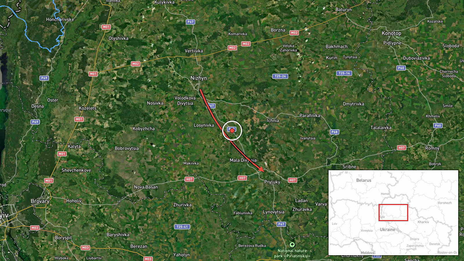
Ukrainian air monitoring detected two or more Russian jet-powered Shahed (Geran-3) drones originating from Chernihiv Oblast on a course toward Pryluky, a city in central Poltava Oblast, on 13 October at 15:58 UTC. The report was posted by the General Staff of the Armed Forces of Ukraine on Telegram. Shahed drones are cruise missiles with extended range and loitering capability, commonly used in Russian strikes against Ukrainian infrastructure and urban areas.
Context and assessment
Pryluky hosts a significant Ukrainian air force base and industrial facilities, making it a recurring Russian target. This detection is part of a broader pattern of Shahed drone operations across central Ukraine on 13 October, with concurrent reports of similar aircraft heading toward Pyryatyn, Pereiaslav, Kozelets, Velyka Dymerka, and Kyiv proper earlier that day. The geographic spread—from Chernihiv in the north to targets across Poltava and Kyiv regions—suggests coordinated multi-vector strikes. Such operations typically precede kinetic impacts by minutes to hours, depending on flight distance and weapon type.
Sources and confidence
Single source: Telegram channel of Ukraine's General Staff (@kpszsu), an official military communications outlet. Corroboration comes from temporally adjacent reports of similar drones on parallel flight paths the same morning, though this specific Pryluky report has not been independently cross-confirmed. Confidence score of 8.0 reflects official sourcing and consistency with known Russian doctrine, offset by single-channel reporting of this particular sighting.
Location
Pryluky is a city of approximately 50,000 in central Poltava Oblast, roughly 280 km southeast of Kyiv. Located on the Supiy River, it sits near a strategic airfield and railroad hub. The settlement-level precision indicates the monitoring network identified the drone corridor or impact zone but not necessarily a specific target within the city.
Related events nearby
- Ukrainian air monitoring: 1 Russian jet-powered Shahed (Geran-3) drone from Poltava Oblast toward Pyryatyn.2026-10-13 13:30 UTC · Drone Transit · Pyryatyn, Ukraine
- Ukrainian air defense monitoring alerts of active Russian tactical fighter aircraft activity and threat of avi2026-10-13 16:56 UTC · Combat Aircraft · Northeastern Ukraine (Sumy, Chernihiv, Kyiv Oblast
- Ukrainian air monitoring: 1 Russian jet-powered Shahed (Geran-3) drone from Chernihiv Oblast toward Bobrovytsi2026-10-13 16:07 UTC · Drone Transit · Bobrovytsia, Ukraine
- Ukrainian air monitoring: 1 Russian jet-powered Shahed (Geran-3) drone heading toward Pereiaslav.2026-10-13 13:32 UTC · Drone Transit · Pereiaslav, Ukraine
- Ukrainian air monitoring: 1 Russian jet-powered Shahed (Geran-3) drone from Chernihiv Oblast toward Kozelets.2026-10-13 13:49 UTC · Drone Transit · Kozelets, Ukraine
▶ View this event on the live map

Intel Mapper aggregates open-source reports from monitored Telegram and X channels, geolocates them, cross-checks duplicates across sources and assigns a confidence score. Entries are updated as new confirmations arrive. Read how we verify events.