Russian Geran-3 drone tracked toward Lubny in Poltava Oblast
What happened
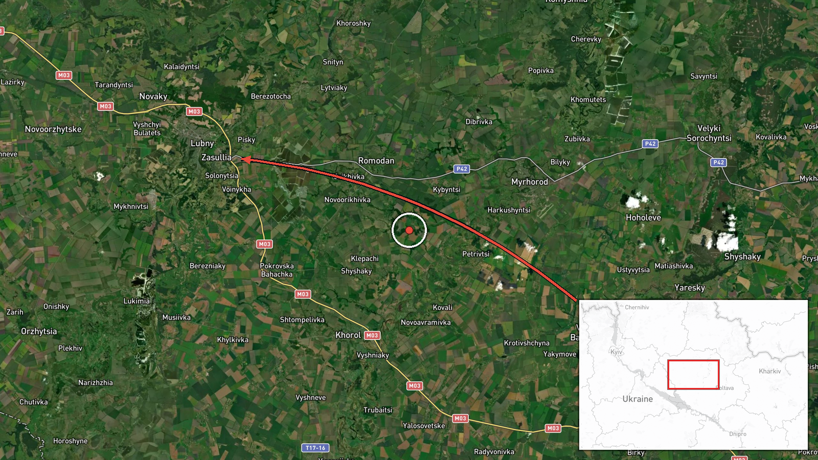
Ukrainian air monitoring reported detecting one Russian jet-powered Shahed (Geran-3) drone transiting from Poltava Oblast in the direction of Lubny on October 13 at 17:02 UTC. The report was issued by the Ukrainian command air alert system (@kpszsu). No impact or interception was reported in the available data. This detection occurred as part of a broader pattern of Russian drone activity across central Ukraine on the same date.
Context and assessment
Lubny is a city of roughly 40,000 residents in central Poltava Oblast, approximately 350 kilometers southeast of Kyiv. The settlement lies in an area that has seen repeated Russian reconnaissance and strike drone operations throughout the conflict. The Geran-3 (export designation Shahed) is a jet-powered loitering munition with extended range and endurance compared to earlier variants. On October 13 alone, Ukrainian air monitoring tracked multiple Geran-3 drones across Poltava, Chernihiv, and other central oblasts, alongside concurrent fighter-bomber activity in the northeast, suggesting a coordinated air campaign targeting infrastructure or military positions in rear areas.
Sources and confidence
Single source: Ukrainian command air alert system (@kpszsu on Telegram). No corroborating reports from independent observers or other Ukrainian monitoring channels are included in the data. Confidence score of 8.0 reflects the credibility of the source but limited redundancy. Cross-confirmation from additional air monitoring channels or impact reports would raise confidence; absence of subsequent air defense engagement reports lowers certainty of outcome.
Location
Lubny, a city settlement in Poltava Oblast, central Ukraine, located at approximately 50.01°N, 32.99°E. Situated in relatively flat terrain typical of the Poltava lowlands, roughly 60 kilometers north of the oblast capital. No specific facility targeting was indicated; the detection point represents the drone's reported flight path direction toward the city.
Related events nearby
- Ukrainian air monitoring: 1 Russian jet-powered Shahed (Geran-3) drone from Poltava Oblast toward Pyryatyn.2026-10-13 17:07 UTC · Drone Transit · Pyryatyn, Ukraine
- Ukrainian air monitoring: 1 Russian jet-powered Shahed (Geran-3) drone from Poltava Oblast toward Pyryatyn.2026-10-13 13:30 UTC · Drone Transit · Pyryatyn, Ukraine
- Ukrainian air monitoring: 1 Russian jet-powered Shahed (Geran-3) drone from Poltava Oblast toward Myrhorod.2026-10-13 17:47 UTC · Drone Transit · Myrhorod, Ukraine
- Ukrainian air monitoring: 1 Russian jet-powered Shahed (Geran-3) drone heading toward Semenivka.2026-10-13 14:37 UTC · Drone Transit · Semenivka, Ukraine
- Ukrainian air monitoring: 2+ Russian jet-powered Shahed (Geran-3) drones from Chernihiv Oblast toward Pryluky.2026-10-13 15:58 UTC · Drone Transit · Pryluky, Ukraine
▶ View this event on the live map

Intel Mapper aggregates open-source reports from monitored Telegram and X channels, geolocates them, cross-checks duplicates across sources and assigns a confidence score. Entries are updated as new confirmations arrive. Read how we verify events.