Russian Shahed drones transit toward Khmelnytskyi Oblast in continued overnight strikes
What happened
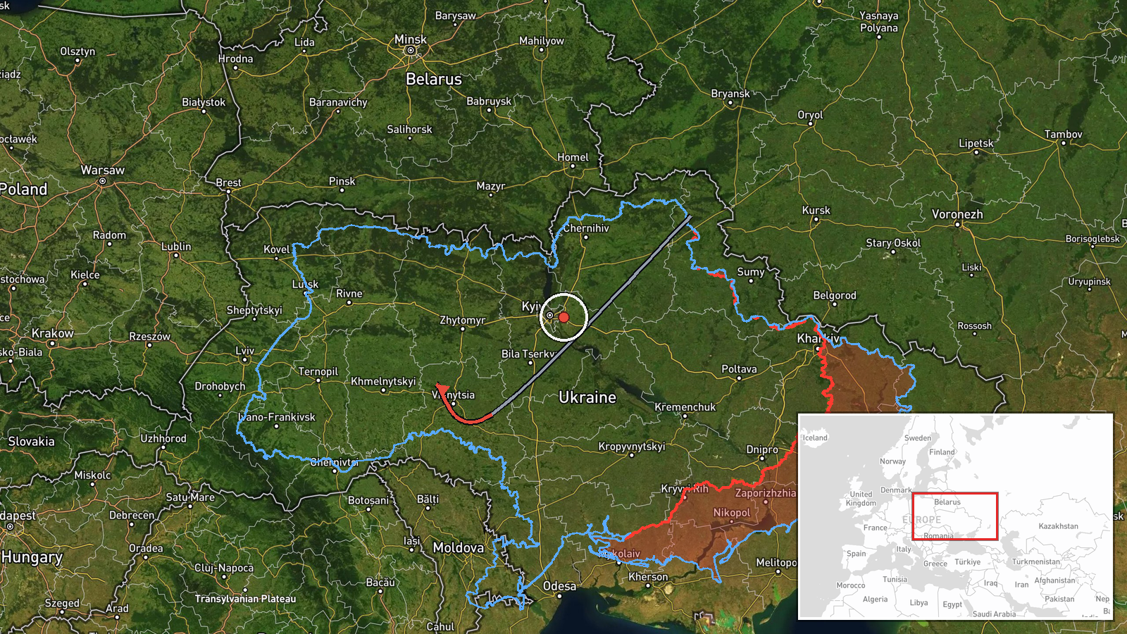
Ukrainian air monitoring reported at least two Russian jet-powered Shahed (Geran-3) drones transiting from Vinnytsia Oblast toward Khmelnytskyi Oblast on October 13, passing through the Derazhnia area. The report was posted by the Kyiv Post independent monitoring channel at 18:24 UTC. Shahed drones are Russian-operated loitering munitions designed for strikes on fixed and area targets.
Context and assessment
Khmelnytskyi Oblast in western Ukraine has been under sustained pressure from Russian air operations throughout October 13. The transit of multiple Shahed drones suggests a coordinated attack pattern, with related monitoring reports documenting similar drone movements toward the oblast at 15:18, 15:41, 17:18, and 17:27 UTC the same day. The Derazhnia checkpoint represents the approach corridor through which drones transit toward regional targets. These strikes may indicate Russian intent to degrade critical infrastructure, military logistics, or civilian morale in a western region relatively distant from active ground fighting, consistent with Russia's ongoing attrition campaign.
Sources and confidence
Single source: Telegram channel @kpszsu (Kyiv Post). Confidence of 8.0 reflects Ukrainian air monitoring credibility but limited independent cross-confirmation in available data. Multiple related events the same day corroborate the operational pattern. Confirmation by Ukrainian Air Force official statements or secondary monitoring would raise confidence; absence of intercept claims would lower it.
Location
Derazhnia is a settlement in Khmelnytskyi Oblast, western Ukraine, approximately 200 km from the Russian border. Located in a region of rolling terrain used as transit corridor for drones approaching targets in the oblast's industrial and administrative centers. Coordinate precision is regional.
Related events nearby
- Ukrainian air monitoring: 2+ Russian jet-powered Shahed (Geran-3) drones heading toward Bar.2026-10-13 18:21 UTC · Drone Transit · Bar, Ukraine
- Russian jet-powered Shahed (Geran-3) drone transiting from Vinnytsia Oblast toward Khmelnytskyi Oblast, passin2026-10-13 19:10 UTC · Drone Transit · Vinkivtsi, Khmelnytskyi Oblast, Ukraine
- Ukrainian air monitoring: 1 Russian jet-powered Shahed (Geran-3) drone over Khmelnytskyi.2026-10-13 18:59 UTC · Drone Transit · Khmelnytskyi, Ukraine
- Ukrainian air monitoring: 1 Russian jet-powered Shahed (Geran-3) drone heading toward Khmelnytskyi.2026-10-13 17:27 UTC · Drone Transit · Khmelnytskyi, Ukraine
- Ukrainian air monitoring: 1 Russian jet-powered Shahed (Geran-3) drone heading toward Khmelnytskyi Oblast.2026-10-13 17:18 UTC · Drone Transit · Khmelnytskyi Oblast, Ukraine
▶ View this event on the live map

Intel Mapper aggregates open-source reports from monitored Telegram and X channels, geolocates them, cross-checks duplicates across sources and assigns a confidence score. Entries are updated as new confirmations arrive. Read how we verify events.