Russian Shahed drone transits southern Chernihiv Oblast toward Kyiv region
What happened
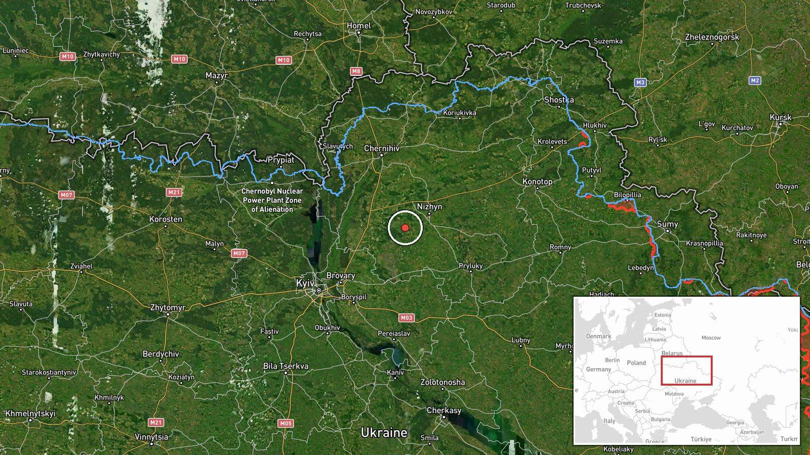
Ukrainian air monitoring detected one Russian Shahed-type drone over Nosivka in southern Chernihiv Oblast on the evening of 13 October, reportedly tracking northwestward toward Kyiv region. The sighting was logged by the Telegram channel of Ukraine's Main Directorate of Intelligence at 20:14 UTC. Nosivka lies approximately 140 kilometers northeast of Kyiv. The drone's intended target and whether it was engaged remain unreported in the available data.
Context and assessment
Nosivka sits along a well-documented drone transit corridor from Russian-held territory in Chernihiv Oblast toward populated areas in central Ukraine. On 13 October alone, Ukrainian monitors tracked multiple Shahed variants crossing the same operational space—near Nizhyn, Bobrovytsia, Kozelets, and Ichnia—suggesting a coordinated or sustained air campaign. Shahed-type drones, including the longer-range Geran-3 variant, have been employed repeatedly throughout the conflict for strikes against infrastructure and civilian targets. The frequency and geographic spread of these sightings on a single day may indicate either a massed drone wave or routine attrition-replacement operations, though casualty and damage reports are absent from current sources.
Sources and confidence
Reported exclusively by Ukraine's Main Directorate of Intelligence (@kpszsu) via Telegram. No cross-confirmation from independent monitors or Russian sources. Confidence score of 8.0 reflects the established credibility of official Ukrainian air monitoring channels and consistency with the day's pattern of related drone detections, though single-source reporting and absence of post-strike assessment limit certainty of outcome.
Location
Nosivka is a settlement in Chernihiv Oblast, southern Ukraine, at coordinates 50.938°N, 31.580°E. It lies in open terrain east of the Desna River, roughly 25 kilometers south of Chernihiv city. The settlement sits directly along the primary drone ingress route from Russian positions toward Kyiv region, making it a frequent waypoint in air monitoring reports.
Related events nearby
- Ukrainian air monitoring: 1 Russian jet-powered Shahed (Geran-3) drone from Chernihiv Oblast toward Nizhyn.2026-10-13 19:34 UTC · Drone Transit · Nizhyn, Ukraine
- Ukrainian air monitoring: 1 Russian jet-powered Shahed (Geran-3) drone from Chernihiv Oblast toward Bobrovytsi2026-10-13 16:07 UTC · Drone Transit · Bobrovytsia, Ukraine
- Ukrainian air monitoring: 1 Russian jet-powered Shahed (Geran-3) drone heading toward Kozelets; 1 Russian jet-2026-10-13 19:51 UTC · Drone Transit · Kozelets, Ukraine
- Ukrainian air monitoring: 1 Russian jet-powered Shahed (Geran-3) drone from Chernihiv Oblast toward Kozelets.2026-10-13 13:49 UTC · Drone Transit · Kozelets, Ukraine
- Ukrainian air monitoring: 1 Russian jet-powered Shahed (Geran-3) drone passing Nizhyn, heading toward Ichnia.2026-10-13 19:14 UTC · Drone Transit · Ichnia, Ukraine
▶ View this event on the live map

Intel Mapper aggregates open-source reports from monitored Telegram and X channels, geolocates them, cross-checks duplicates across sources and assigns a confidence score. Entries are updated as new confirmations arrive. Read how we verify events.