Russian Shahed drone reported heading toward Vapnyarka in central Ukraine
What happened
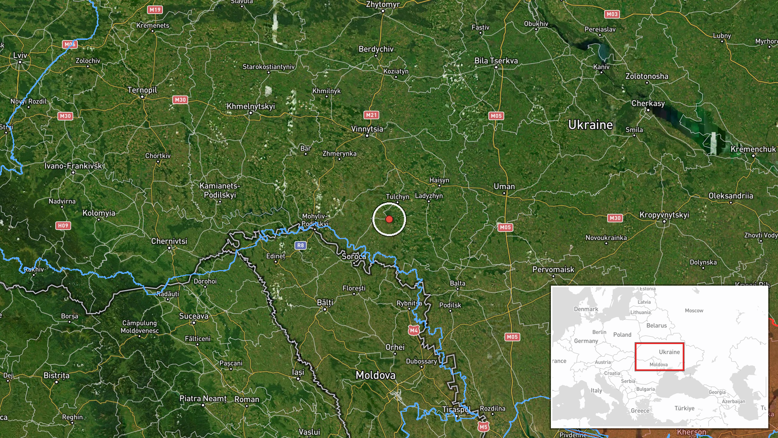
Ukrainian air monitoring reported a single Russian jet-powered Shahed (Geran-3) drone transiting toward Vapnyarka in Vinnytsia Oblast on the early morning of 14 October 2026. The report was issued by the Kyiv Post Special Operations Unit (@kpszsu) on Telegram. Vapnyarka is a settlement in central Ukraine approximately 200 km southwest of Kyiv. No impact assessment or interception status was provided in the initial notification.
Context and assessment
The sighting fits an established pattern of Russian Shahed drone activity across Vinnytsia Oblast during 13-14 October. Related reports documented similar jet-powered drones targeting or transiting toward nearby settlements including Kryzhopil, Tulchyn, and Nemyriv. These long-range cruise drones typically target civilian infrastructure, military installations, or logistics nodes. The concentration of reports within a single region over several hours may indicate a coordinated strike series or harassment campaign, though individual drones may have been launched from the same origin at intervals. Vinnytsia Oblast remains a recurring target zone despite its distance from active ground combat.
Sources and confidence
Single-source reporting from @kpszsu Telegram channel, which operates as the official Ukrainian air monitoring outlet. No cross-confirmation from other channels or independent verification included. Confidence score of 8.0 reflects the authoritative status of the source and high location precision, but single-source data limits certainty on interception outcome. Corroboration from Ukraine's Air Force or reports of the drone's impact would strengthen confidence; retraction or contradictory reporting would lower it.
Location
Vapnyarka is a settlement in Vinnytsia Oblast, central Ukraine, located at approximately 48.53°N, 28.75°E. The town lies in the agricultural heartland roughly 200 km southwest of Kyiv and 120 km north of the Moldovan border. Nearby settlements include Tulchyn to the south and Kryzhopil to the southeast, both also reported as drone targets on 13 October.
Related events nearby
- Ukrainian air monitoring: 1 Russian jet-powered Shahed (Geran-3) drone heading toward Tomashpil.2026-10-14 00:47 UTC · Drone Transit · Tomashpil, Ukraine
- Ukrainian air monitoring: 1 Russian jet-powered Shahed (Geran-3) drone heading toward Tulchyn.2026-10-13 19:37 UTC · Drone Transit · Tulchyn, Ukraine
- Ukrainian air monitoring: 2+ Russian jet-powered Shahed (Geran-3) drones heading toward Kryzhopil.2026-10-14 01:14 UTC · Drone Transit · Kryzhopil, Ukraine
- Ukrainian air monitoring: 2+ Russian jet-powered Shahed (Geran-3) drones heading toward Kryzhopil.2026-10-13 18:11 UTC · Drone Transit · Kryzhopil, Ukraine
- Ukrainian air monitoring: 1 Russian jet-powered Shahed (Geran-3) drone heading toward Kryzhopil.2026-10-13 17:01 UTC · Drone Transit · Kryzhopil, Ukraine
▶ View this event on the live map

Intel Mapper aggregates open-source reports from monitored Telegram and X channels, geolocates them, cross-checks duplicates across sources and assigns a confidence score. Entries are updated as new confirmations arrive. Read how we verify events.