Russian Shahed drone reported transiting toward Borodianka in northern Kyiv region
What happened
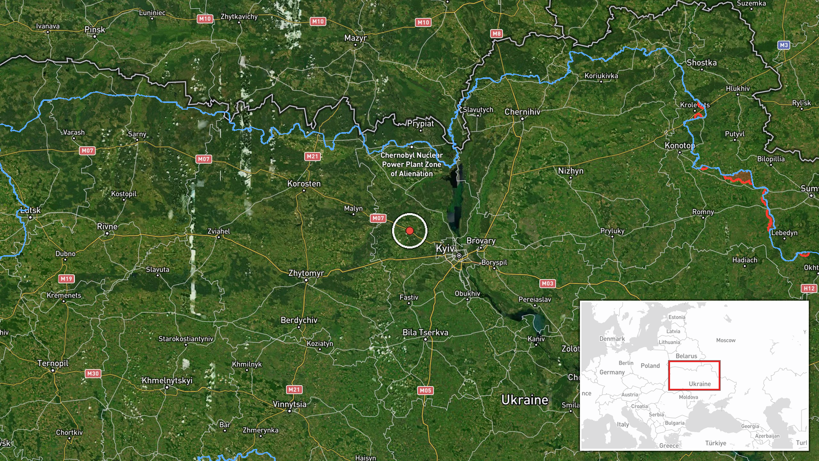
Ukrainian air monitoring reported one Russian jet-powered Shahed (Geran-3) drone heading toward Borodianka from the north on the morning of October 15, 2026. The alert was issued by the Kyiv regional military administration via Telegram at 01:53 UTC. Borodianka, a settlement northwest of Kyiv, lies within the typical corridor for Russian drone strikes on the capital region and surrounding areas.
Context and assessment
Borodianka sits in the Kyiv region approximately 60 kilometers northwest of central Kyiv and has been a recurring target throughout the conflict. The detection occurred amid a broader wave of Russian drone activity across northern Ukraine—simultaneous reports logged drones transiting toward Makariv, Dymer, and Ivankiv in the same timeframe. The Shahed-136/Geran-3 is a loitering munition capable of sustained flight and precision strikes on infrastructure. This pattern of multi-directional drone approaches toward settlements near Kyiv suggests a coordinated nighttime strike package, consistent with Russian tactics of targeting civilian and military infrastructure across the region.
Sources and confidence
Single source: Kyiv regional military administration (@kpszsu) on Telegram. The report represents official Ukrainian air monitoring but lacks independent cross-confirmation from other Ukrainian or international monitoring channels at the time of publication. Confidence score of 8.0 reflects the credibility of the source channel but the absence of corroborating reports. Confirmation of impact or interception would raise confidence; alternative reporting channels or pattern confirmation would strengthen assessment.
Location
Borodianka, a settlement in Kyiv Oblast located at approximately 50.64°N, 29.92°E, sits in the northern approaches to greater Kyiv, roughly 60 km northwest of the capital. The area has known civilian infrastructure and lies within range of Russian strike aircraft and loitering munitions operating from Belarus and Russian territory to the north.
Related events nearby
- Ukrainian air monitoring: 1 Russian jet-powered Shahed (Geran-3) drone passing Pivdennyi, heading toward Makar2026-10-15 02:45 UTC · Drone Transit · Makariv, Ukraine
- Ukrainian air monitoring: 1 Russian jet-powered Shahed (Geran-3) drone heading toward Makariv.2026-10-15 01:53 UTC · Drone Transit · Makariv, Ukraine
- Ukrainian air monitoring: 1 Russian jet-powered Shahed (Geran-3) drone passing Pivnichnyi, heading toward Dyme2026-10-15 01:52 UTC · Drone Transit · Dymer, Ukraine
- Ukrainian air monitoring: 2+ Russian jet-powered Shahed (Geran-3) drones heading toward Ivankiv.2026-10-15 01:54 UTC · Drone Transit · Ivankiv, Ukraine
- President Zelensky expresses disappointment that President Trump has not chosen Ukraine's side, criticizing th2026-10-14 19:49 UTC · Statement · Kyiv, Ukraine
▶ View this event on the live map

Intel Mapper aggregates open-source reports from monitored Telegram and X channels, geolocates them, cross-checks duplicates across sources and assigns a confidence score. Entries are updated as new confirmations arrive. Read how we verify events.