Ukrainian air monitoring reports 2+ Russian jet drones transiting Belarus toward northern Kyiv region
What happened
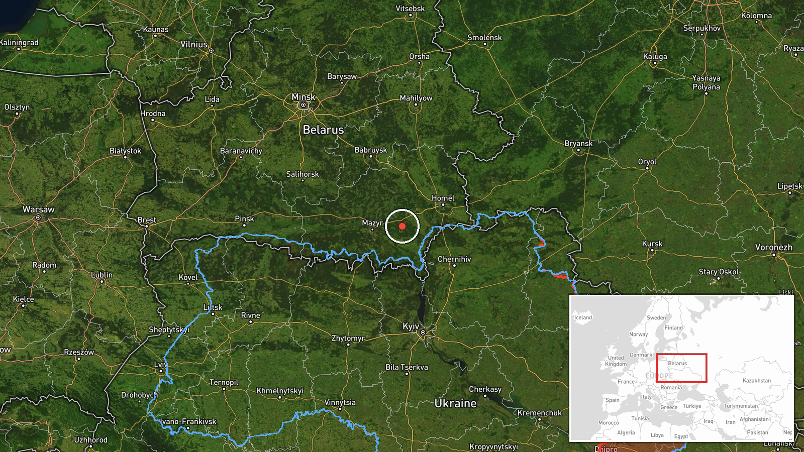
Ukraine's air command reportedly detected two or more Russian jet-powered Shahed (Geran-3) drones along the Belarus–Ukraine border, heading toward the northern Kyiv region, according to a Telegram post from the Kyiv Police Special Forces Unit (@kpszsu) on 15 October at 03:25 UTC. The report places the drones over Belarusian airspace at the time of observation. Shahed drones are long-range loitering munitions capable of striking targets deep within Ukrainian territory.
Context and assessment
This observation is consistent with a broader reported Russian drone operation unfolding across Ukraine's north during the same early morning period on 15 October. Related Ukrainian air monitoring reports indicate multiple Shahed drones transiting simultaneously toward targets or positions across Chernihiv, Zhytomyr, and Rivne oblasts, including settlements such as Slavutych, Ripky, Ivankiv, and Dymer. The use of Belarusian airspace for approach routes is a recurring Russian tactic, as it extends the engagement corridor and complicates Ukrainian air defence responses. The concentration and timing of these reports may suggest a coordinated multi-vector attack or surveillance probe targeting Ukraine's northern flank.
Sources and confidence
Single source: Telegram channel @kpszsu (Kyiv Police Special Forces Unit). No independent cross-confirmation reported from other Ukrainian military channels or international monitors. Confidence score of 8 reflects the source's institutional credibility but limited corroboration. Cross-confirmation from other Ukrainian air defence channels or NATO signals would substantially raise confidence; absence of follow-up reports on intercepts would lower it.
Location
Belarusian airspace near the Ukraine border, determined by region-level precision (lat 52.1, lng 30.0) rather than specific settlement or facility. The coordinates place the observation in southern Belarus, directly north of Ukraine's Kyiv region. Belarus's geographic position as a corridor for Russian drone operations is well-established, given its proximity to northern Ukrainian population centres and military infrastructure.
Related events nearby
- Ukrainian air monitoring: 2+ Russian jet-powered Shahed (Geran-3) drones heading toward Slavutych.2026-10-15 01:52 UTC · Drone Transit · Slavutych, Ukraine
- Ukrainian air monitoring: 1 Russian jet-powered Shahed (Geran-3) drone from Chernihiv Oblast toward Ripky.2026-10-15 02:21 UTC · Drone Transit · Ripky, Ukraine
- Ukrainian air monitoring: 1 Russian jet-powered Shahed (Geran-3) drone transiting northern Zhytomyr Oblast hea2026-10-15 03:44 UTC · Drone Transit · Northern Zhytomyr Oblast, Ukraine
- Ukrainian air monitoring: 1 Russian jet-powered Shahed (Geran-3) drone transiting from northern Zhytomyr Oblas2026-10-15 01:57 UTC · Drone Transit · Northern Zhytomyr Oblast to Northern Rivne Oblast,
- Ukrainian air monitoring: 1 Russian jet-powered Shahed (Geran-3) drone heading toward Krasiatychi.2026-10-15 03:36 UTC · Drone Transit · Krasiatychi, Ukraine
▶ View this event on the live map

Intel Mapper aggregates open-source reports from monitored Telegram and X channels, geolocates them, cross-checks duplicates across sources and assigns a confidence score. Entries are updated as new confirmations arrive. Read how we verify events.