Russian Shahed drones detected heading toward Slavutych in northern Ukraine
What happened
Ukrainian air monitoring reported two or more Russian jet-powered Shahed (Geran-3) drones transiting toward Slavutych from the north on the morning of 15 October at 01:52 UTC. The alert was posted by the Ukrainian Air Force command (@kpszsu) on Telegram. Slavutych lies approximately 50 kilometers north of Kyiv. No strike confirmation or damage reports were included in the initial air monitoring alert.
Context and assessment
Slavutych is a closed city and the administrative center for Ukraine's nuclear power sector, home to personnel managing the Chornobyl nuclear station. The reported drone activity occurs within a broader pattern of Russian drone strikes across northern Ukraine detected in the same timeframe, with simultaneous or near-concurrent Shahed transits reported toward Ivankiv, Dymer, and Borodianka—all settlements in the Kyiv region. This follows a Russian ballistic missile strike on a residential building in central Kyiv on 14 October that caused civilian casualties. The convergent timing and multiple vectors suggest a coordinated strike operation targeting the greater Kyiv area and nearby critical infrastructure.
Sources and confidence
Single source: Ukrainian Air Force command (@kpszsu) Telegram channel. No independent cross-confirmation or impact reports available at time of posting. Confidence score of 8.0 reflects the credibility of official Ukrainian air monitoring but is tempered by the absence of secondary confirmation and lack of strike outcome data. Corroborating drone detections in adjacent areas and consistent with recent Russian targeting patterns would raise confidence; absence of subsequent damage or strike reports would lower it.
Location
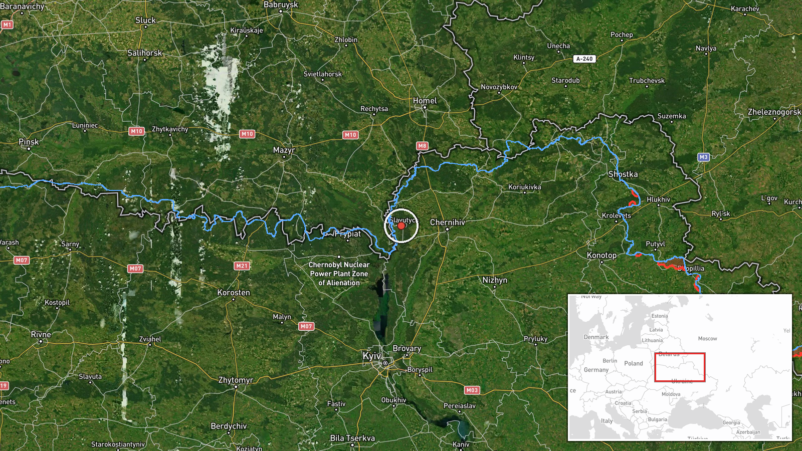
Slavutych, a closed city in northern Kyiv Oblast approximately 50 km north-northeast of central Kyiv. The settlement sits near the northern bank of the Pripyat River in an area of mixed forest and agricultural terrain. Precision: settlement level (high confidence). Geographic coordinates: 51.52°N, 30.72°E.
Related events nearby
- Ukrainian air monitoring: 1 Russian jet-powered Shahed (Geran-3) drone from Chernihiv Oblast toward Ripky.2026-10-15 02:21 UTC · Drone Transit · Ripky, Ukraine
- Ukrainian air monitoring: 2+ Russian jet-powered Shahed (Geran-3) drones heading toward Ivankiv.2026-10-15 01:54 UTC · Drone Transit · Ivankiv, Ukraine
- Ukrainian air monitoring: 1 Russian jet-powered Shahed (Geran-3) drone passing Pivnichnyi, heading toward Dyme2026-10-15 01:52 UTC · Drone Transit · Dymer, Ukraine
- Ukrainian air monitoring: 1 Russian Shahed-type drone over Kalynivka.2026-10-14 08:54 UTC · Drone Transit · Kalynivka, Ukraine
- Ukrainian air monitoring: 1 Russian jet-powered Shahed (Geran-3) drone heading toward Borodianka.2026-10-15 01:53 UTC · Drone Transit · Borodianka, Ukraine
▶ View this event on the live map

Intel Mapper aggregates open-source reports from monitored Telegram and X channels, geolocates them, cross-checks duplicates across sources and assigns a confidence score. Entries are updated as new confirmations arrive. Read how we verify events.