Russian Shahed-type drone tracked heading toward Sumy city
What happened
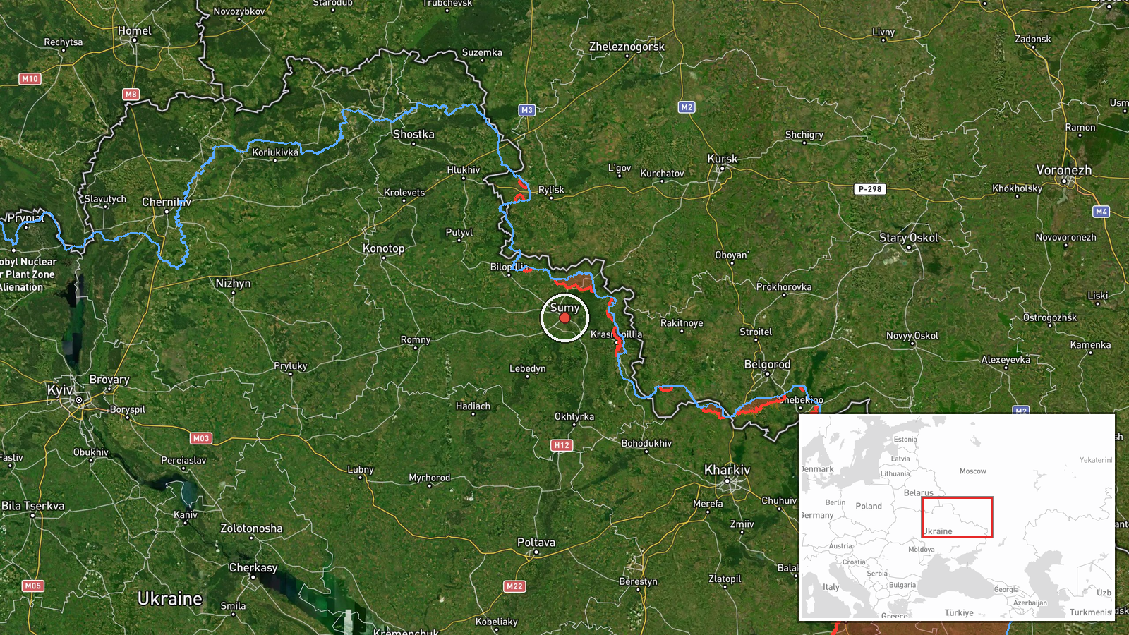
Ukrainian air monitoring reported one Russian Shahed-type unmanned aerial vehicle in transit toward Sumy on the morning of October 15. The drone was detected by the State Emergency Service of Ukraine and tracked via Telegram. This sighting follows multiple other drone transits across northeastern Ukraine detected earlier the same day, including separate reports of Shahed variants and jet-powered Geran-3 drones moving through Sumy and Poltava oblasts.
Context and assessment
Sumy city, located roughly 40 kilometers from the Russian border in northeastern Ukraine, has been regularly targeted throughout the conflict as Russian forces conduct sustained air operations across the region. The October 15 detections represent part of a broader pattern of massed Russian drone activity spanning multiple northeastern oblasts on a single day. Earlier strikes that morning included a guided glide bomb impact near Bilopillia on the front line, suggesting coordinated air pressure rather than isolated probing. Shahed-type drones typically carry smaller payloads suited for area targets; their repeated routing toward Sumy may indicate targeting of civil infrastructure, military facilities, or logistical nodes.
Sources and confidence
Single source: Telegram channel @kpszsu (State Emergency Service of Ukraine). Confidence score of 8.0 reflects official Ukrainian monitoring infrastructure but limited cross-confirmation in available data. Score would increase with independent verification from other Ukrainian emergency services or visual/damage reports; it would lower if subsequent related events contradict the flight path or detection.
Location
Sumy city center, Sumy Oblast, northeastern Ukraine. Located approximately 40 kilometers south of the Russian border and east of the Dnieper River. The settlement is a major regional hub; nearby features include the Desna River to the southeast and relatively open terrain favoring drone approach routes from Russian-held areas to the north and east.
Related events nearby
- Ukrainian air monitoring: 1 Russian Shahed-type drone passing Pivnichnyi, heading toward Sumy.2026-10-15 05:27 UTC · Drone Transit · Sumy, Ukraine
- Russian guided glide bomb (KAB) strike reported in northern Sumy Oblast. Part of ongoing massed Russian air ca2026-10-15 05:00 UTC · Airstrike · Near Bilopillia, Sumy, Ukraine (front line, estima
- Ukrainian air monitoring: 1 Russian jet-powered Shahed (Geran-3) drone from Sumy Oblast toward Okhtyrka.2026-10-15 01:53 UTC · Drone Transit · Okhtyrka, Ukraine
- Ukrainian air monitoring: 1 Russian Shahed-type drone from Sumy Oblast toward Buryn.2026-10-15 03:10 UTC · Drone Transit · Buryn, Ukraine
- Ukrainian air monitoring: 1 Russian jet-powered Shahed (Geran-3) drone from Poltava Oblast toward Hadyach.2026-10-15 01:54 UTC · Drone Transit · Hadyach, Ukraine
▶ View this event on the live map

Intel Mapper aggregates open-source reports from monitored Telegram and X channels, geolocates them, cross-checks duplicates across sources and assigns a confidence score. Entries are updated as new confirmations arrive. Read how we verify events.