Russian jet-powered Shahed drone tracked transiting northern Kyiv Oblast toward Zhytomyr
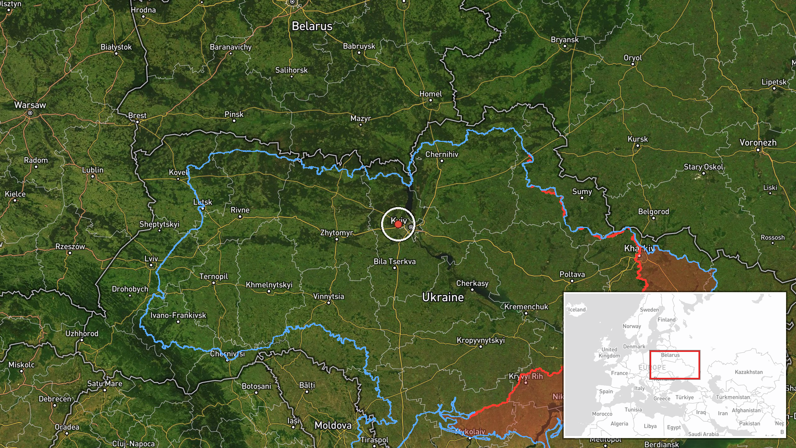
What happened
Ukrainian air monitoring reported at least one Russian jet-powered Shahed (Geran-3) drone transiting northern Kyiv Oblast with a reported heading toward Zhytomyr Oblast on 15 October at 11:51 UTC. The report was posted by the Kyiv air defense command (@kpszsu) via Telegram. Geran-3 drones are kamikaze-capable systems typically used for strikes against critical infrastructure and civilian targets across Ukrainian territory.
Context and assessment
The sighting fits a pattern of sustained Russian drone operations observed throughout 15 October, with multiple Shahed transits tracked across northern Kyiv Oblast and approaches to Kyiv city itself beginning from early morning. President Zelensky reported over 850 Shahed drones launched by Russia in the preceding 24 hours. Zhytomyr Oblast, lying west of Kyiv, hosts significant infrastructure and remains a recurring target of Russian drone campaigns. The concentration of reported sightings in the northern corridor suggests either a coordinated multi-axis attack or continuation of rolling strike waves, consistent with established Russian operational patterns targeting logistics, energy, and military installations.
Sources and confidence
Single-source report from official Kyiv air defense command Telegram channel (@kpszsu). No cross-confirmation from independent monitors or alternative Ukrainian sources provided in available data. Confidence score of 8.0 reflects source credibility but limited corroboration. Confirmation via secondary Ukrainian air defense statements or visual evidence would increase confidence; conflicting reports from Russian sources or absence in follow-up Ukrainian assessments would lower it.
Location
Northern Kyiv Oblast at approximate coordinates (50.5°N, 30.2°E), determined from regional air monitoring with low geographic precision. The region lies north of Kyiv city in the direction of Chernihiv and abuts Belarus. Zhytomyr Oblast lies to the west; the drone's reported trajectory suggests transit across open terrain toward major western-central Ukrainian settlements and infrastructure.
Related events nearby
- Ukrainian air monitoring: Multiple Russian jet-powered Shahed (Geran-3) kamikaze drones tracked transiting fro2026-10-15 04:42 UTC · Drone Transit · Northern Kyiv Oblast, Ukraine
- Ukrainian air monitoring: 2+ Russian jet-powered Shahed (Geran-3) drones heading toward Vyshhorod.2026-10-15 05:36 UTC · Drone Transit · Vyshhorod, Ukraine
- President Zelensky reports 850+ Shahed drones launched by Russia in past 24 hours. Claims Russia escalated str2026-10-15 08:44 UTC · Statement · Kyiv, Ukraine
- Ukrainian air monitoring: 1 Russian jet-powered Shahed (Geran-3) drone passing Kozyn, heading toward Kyiv.2026-10-15 08:20 UTC · Drone Transit · Kyiv, Ukraine
- Ukrainian air monitoring: 2+ Russian jet-powered Shahed (Geran-3) drones passing Slavutych, heading toward Kyi2026-10-15 07:42 UTC · Drone Transit · Kyiv Oblast, Ukraine
▶ View this event on the live map

Intel Mapper aggregates open-source reports from monitored Telegram and X channels, geolocates them, cross-checks duplicates across sources and assigns a confidence score. Entries are updated as new confirmations arrive. Read how we verify events.