Russian Shahed drones tracked toward Sharhorod in Vinnytsia Oblast
What happened
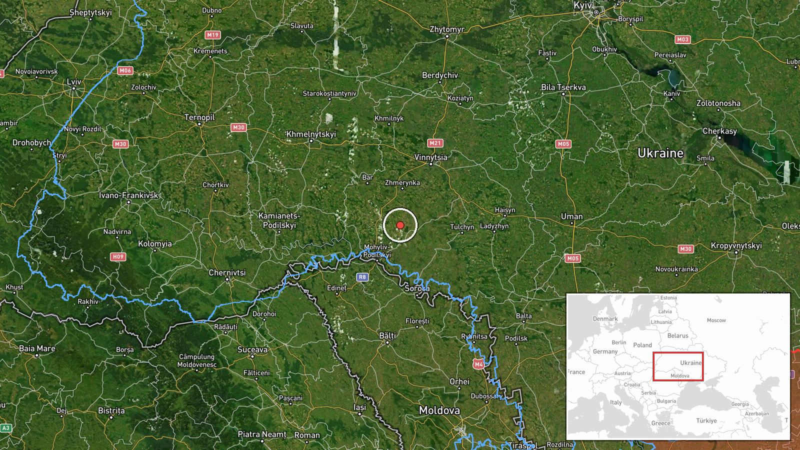
Ukrainian air monitoring reported two or more Russian jet-powered Shahed (Geran-3) drones in transit toward Sharhorod, a settlement in Vinnytsia Oblast, on October 15 at 11:54 UTC. The alert was issued by the Kyiv Post air raid channel (@kpszsu) via Telegram. The drones were observed during daylight hours as part of ongoing Russian drone operations across central Ukraine.
Context and assessment
Sharhorod lies in central Vinnytsia Oblast, an area that has experienced repeated drone strikes throughout 2026. On the same day, Ukrainian monitoring detected at least five separate Shahed transit events across the oblast—at Tomashpil, Tulchyn, Tyvriv, and Voronovytsya—suggesting a coordinated or persistent campaign. The clustering of reports within hours indicates Russian forces may be targeting multiple objectives simultaneously or probing air defenses across the region. Vinnytsia Oblast, located roughly 240 kilometers southwest of Kyiv, remains a recurring target for stand-off drone attacks, likely due to its infrastructure, logistics hubs, and military installations. The pattern suggests Russia is sustaining pressure on civilian and military assets in central Ukraine.
Sources and confidence
Single source: Telegram channel @kpszsu (Kyiv Post air monitoring). No cross-confirmation from other Ukrainian or international tracking channels noted. Confidence score of 8.0 reflects the established reliability of official Ukrainian air monitoring channels, high geo-precision to settlement level, and consistency with the day's broader drone activity pattern. Confirmation by independent tracking accounts or visual evidence would strengthen assessment.
Location
Sharhorod is a settlement in Vinnytsia Oblast, central Ukraine, located at approximately 48.74°N, 28.08°E. The town sits in the agricultural heartland of the oblast, roughly 35 kilometers north-northeast of the oblast's capital. Its position on regional transport routes and proximity to military-relevant infrastructure makes it a recurrent target in Russian drone campaigns targeting central Ukraine.
Related events nearby
- Ukrainian air monitoring: 2+ Russian jet-powered Shahed (Geran-3) drones heading toward Tomashpil.2026-10-15 11:49 UTC · Drone Transit · Tomashpil, Ukraine
- Ukrainian air monitoring: 1 Russian jet-powered Shahed (Geran-3) drone from Vinnytsia Oblast toward Tyvriv.2026-10-15 02:22 UTC · Drone Transit · Tyvriv, Ukraine
- Ukrainian air monitoring: 1 Russian jet-powered Shahed (Geran-3) drone from Vinnytsia Oblast toward Tulchyn.2026-10-15 09:29 UTC · Drone Transit · Tulchyn, Ukraine
- Ukrainian air monitoring: 1 Russian jet-powered Shahed (Geran-3) drone from Vinnytsia Oblast toward Voronovyts2026-10-15 02:16 UTC · Drone Transit · Voronovytsya, Ukraine
- Ukrainian air monitoring: 1 Russian jet-powered Shahed (Geran-3) drone from Kirovohrad Oblast toward Vinnytsia2026-10-15 08:58 UTC · Drone Transit · Vinnytsia Oblast, Ukraine
▶ View this event on the live map

Intel Mapper aggregates open-source reports from monitored Telegram and X channels, geolocates them, cross-checks duplicates across sources and assigns a confidence score. Entries are updated as new confirmations arrive. Read how we verify events.