Russian Banderol cruise missile tracked toward Poltava Oblast
What happened
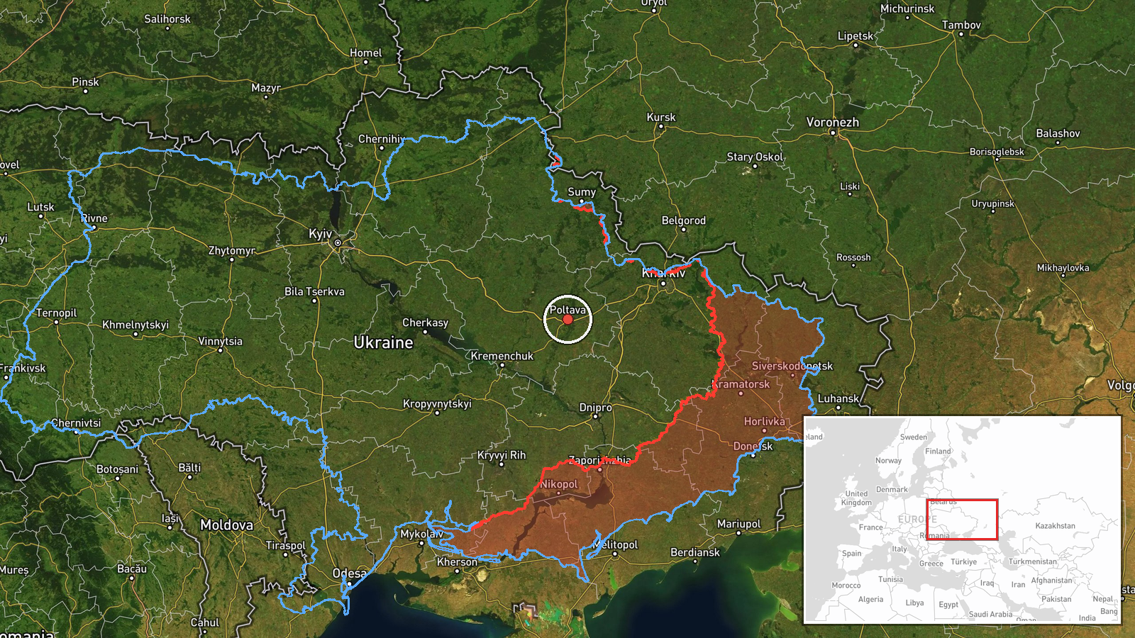
Ukrainian air monitoring detected one Russian Banderol mini cruise missile heading toward Poltava Oblast on the morning of 15 October 2026. The missile was tracked at approximately 12:05 UTC in a westward trajectory. A follow-up report at 12:08 UTC indicated the missile had reached airspace over Poltava Oblast itself. The observation was reported by the Kyiv-based air monitoring channel Kpszsu via Telegram.
Context and assessment
Poltava Oblast, located in central-eastern Ukraine, has been under sustained Russian airstrike pressure throughout 2026. The Banderol is a short-range loitering munition designed for precision strikes on fixed targets. This morning's attack occurred amid a broader pattern of Russian air operations in the region: three separate Shahed drone transits were tracked over Poltava between 04:00 and 08:49 UTC, moving through or toward the oblast from various directions. The combination of multiple drone sorties followed by a cruise missile suggests a coordinated strike package, possibly targeting military or critical infrastructure installations. Poltava's central location and existing industrial base make it a recurring focus of Russian strikes aimed at supply lines and logistics hubs supporting Ukrainian defensive operations.
Sources and confidence
Only Kpszsu (a Ukrainian air monitoring Telegram channel) reported this specific detection. A nearly simultaneous follow-up report at 12:08 UTC provides minimal independent corroboration of impact or outcome. The confidence score of 8.0 reflects source reliability but single-source reporting and lack of cross-confirmation from other monitoring channels. Confirmation of impact or damage would strengthen confidence; contradictory impact reports or source retraction would lower it.
Location
Poltava Oblast is a region in central Ukraine, approximately 300 km southeast of Kyiv. Geolocation precision is marked as regional rather than point-specific, reflecting the broad tracking corridor. The related drone sightings near Shyshaky and Pivnichnyi suggest approach vectors from the northeast. Poltava city and surrounding industrial areas lie within the oblast's southwestern portion.
Related events nearby
- Ukrainian air monitoring: 1 Russian Banderol mini cruise missile over Poltava Oblast.2026-10-15 12:08 UTC · Cruise Missile · Poltava Oblast, Ukraine
- Ukrainian air monitoring: 1 Russian jet-powered Shahed (Geran-3) drone passing Shyshaky, heading toward Poltav2026-10-15 07:25 UTC · Drone Transit · Poltava, Ukraine
- Ukrainian air monitoring: 1 Russian jet-powered Shahed (Geran-3) drone passing Pivnichnyi, heading toward Polt2026-10-15 06:13 UTC · Drone Transit · Poltava, Ukraine
- Ukrainian air monitoring: 1 Russian jet-powered Shahed (Geran-3) drone passing Poltava Oblast, heading northwe2026-10-15 04:00 UTC · Drone Transit · Poltava Oblast, Ukraine
- Ukrainian air monitoring: 1 Russian jet-powered Shahed (Geran-3) drone from Poltava Oblast toward Bilyky.2026-10-15 08:49 UTC · Drone Transit · Bilyky, Ukraine
▶ View this event on the live map

Intel Mapper aggregates open-source reports from monitored Telegram and X channels, geolocates them, cross-checks duplicates across sources and assigns a confidence score. Entries are updated as new confirmations arrive. Read how we verify events.