Russian Geran-3 drone tracked toward central Poltava Oblast settlement
What happened
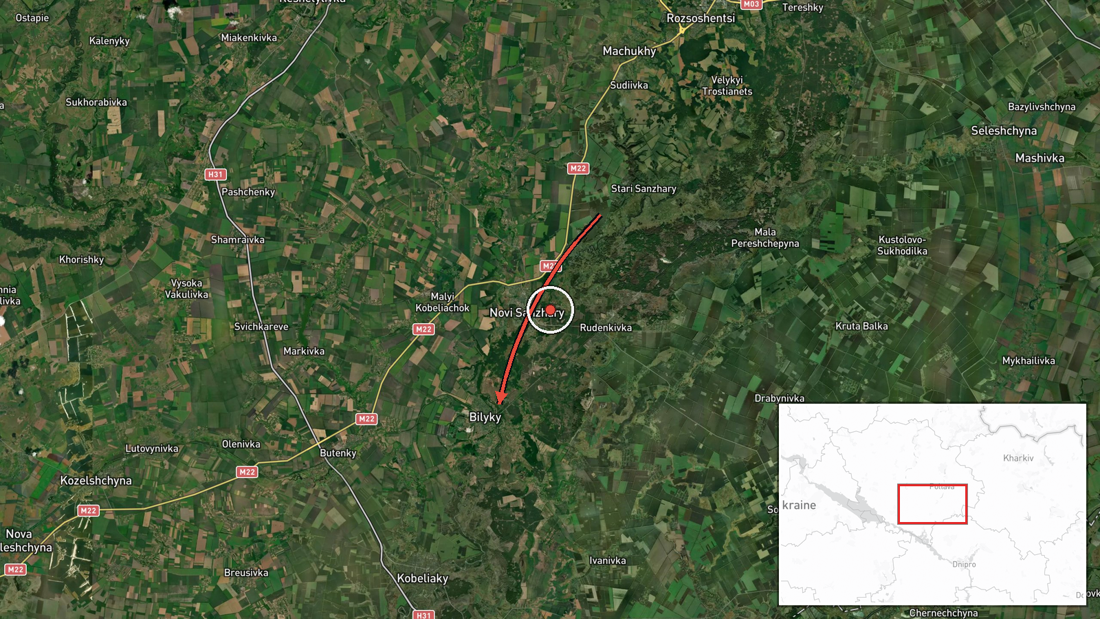
Ukrainian air monitoring detected a single Russian jet-powered Shahed (Geran-3) drone transiting toward Bilyky in Poltava Oblast on the morning of October 15, 2026. The drone was tracked as it moved through the region at 08:49 UTC. The report comes from official Ukrainian air defense channels monitoring inbound aerial activity in real time.
Context and assessment
Bilyky is a small settlement in central Poltava Oblast, located in Ukraine's industrial heartland. The detection represents part of a sustained pattern of Russian drone operations across the region over the preceding hours. Related Ukrainian monitoring reports show the same or similar Geran-3 aircraft transiting through multiple waypoints in Poltava Oblast since 04:00 UTC, passing through Pivnichnyi and Shyshaky before heading toward Poltava city and subsequently toward Bilyky. Geran-3 drones, Russia's jet-powered variant of the Shahed platform, are used primarily for standoff strikes on infrastructure and military targets. The northwestern trajectory and timing suggest potential targeting of communication, energy, or logistics nodes in the oblast.
Sources and confidence
Report sourced to the official Telegram channel of Ukraine's Command of Air Forces (@kpszsu). Single-source report with no cross-confirmation from independent monitoring or Ukrainian military spokespeople. Confidence score of 8.0 reflects the official nature of the source and consistency with related simultaneous detections in the same operational corridor, though lack of secondary confirmation and absence of reported impact assessment introduce moderate uncertainty.
Location
Bilyky is a small settlement in central Poltava Oblast, approximately 25 kilometers south of Poltava city. The settlement lies in flat agricultural terrain characteristic of the region. Geographic coordinates place it at the reported detection point; precision is assessed as high at settlement level, though the drone's actual destination or impact location may differ from transit coordinates.
Related events nearby
- Ukrainian air monitoring: 1 Russian jet-powered Shahed (Geran-3) drone passing Shyshaky, heading toward Poltav2026-10-15 07:25 UTC · Drone Transit · Poltava, Ukraine
- Ukrainian air monitoring: 1 Russian jet-powered Shahed (Geran-3) drone passing Pivnichnyi, heading toward Polt2026-10-15 06:13 UTC · Drone Transit · Poltava, Ukraine
- Ukrainian air monitoring: 1 Russian jet-powered Shahed (Geran-3) drone passing Poltava Oblast, heading northwe2026-10-15 04:00 UTC · Drone Transit · Poltava Oblast, Ukraine
- Ukrainian air monitoring: 8 Russian Shahed-type drones over Horishni Plavni.2026-10-14 12:16 UTC · Drone Transit · Horishni Plavni, Ukraine
- Ukrainian air monitoring: 1 Russian jet-powered Shahed (Geran-3) drone from Cherkasy Oblast toward Kalynopil.2026-10-15 01:57 UTC · Drone Transit · Kalynopil, Ukraine
▶ View this event on the live map

Intel Mapper aggregates open-source reports from monitored Telegram and X channels, geolocates them, cross-checks duplicates across sources and assigns a confidence score. Entries are updated as new confirmations arrive. Read how we verify events.