Russian jet-powered Shahed drone tracked approaching Poltava from northeast
What happened
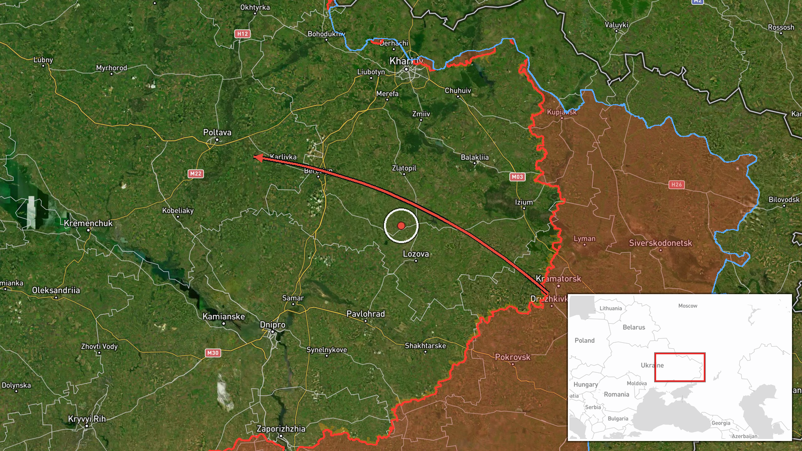
Ukrainian air monitoring reported a single Russian jet-powered Shahed (Geran-3) drone passing through Pivnichnyi and heading toward Poltava on the morning of 15 October at 06:13 UTC. The report was issued by the Kyiv Public Safety Communications Centre via Telegram. No impact or interception was noted in the monitoring alert itself.
Context and assessment
Poltava, a major city in central-eastern Ukraine and regional administrative hub, has been subject to repeated Russian drone activity over recent days. Related reports from 15 October document multiple Shahed transits across Poltava Oblast and neighbouring areas including Okhtyrka, Hadyach, and Horishni Plavni, suggesting a pattern of drone operations targeting or passing through the region. The jet-powered Geran-3 variant is capable of longer range and potentially greater payload than standard Shahed drones. The frequency of single-aircraft sightings interspersed with larger group formations indicates Russia may be conducting reconnaissance, harassment, or targeting operations against military and civilian infrastructure in central Ukraine.
Sources and confidence
Report sourced solely from Kyiv Public Safety Communications Centre Telegram channel (@kpszsu). Single-source reporting with no stated cross-confirmation limits confidence. Confidence score of 8.0 reflects official Ukrainian air monitoring as credible source but absence of corroboration from independent sensors or second channels. Confirmation of interception, damage, or final drone disposition would raise confidence; contradictory reports would lower it.
Location
Poltava city, Poltava Oblast, central-eastern Ukraine (49.59°N, 34.55°E), determined at settlement level. The drone reportedly transited from the northeast approaching the city proper. Poltava is a significant transport and industrial centre approximately 350 km east-southeast of Kyiv and lies in a region of active drone transit corridors.
Related events nearby
- Ukrainian air monitoring: 1 Russian jet-powered Shahed (Geran-3) drone passing Poltava Oblast, heading northwe2026-10-15 04:00 UTC · Drone Transit · Poltava Oblast, Ukraine
- Ukrainian air monitoring: 12 Russian Shahed-type drones passing Bohodukhiv, heading toward Kolomak.2026-10-14 13:02 UTC · Drone Transit · Kolomak, Ukraine
- Ukrainian air monitoring: 1 Russian jet-powered Shahed (Geran-3) drone from Sumy Oblast toward Okhtyrka.2026-10-15 01:53 UTC · Drone Transit · Okhtyrka, Ukraine
- Ukrainian air monitoring: 8 Russian Shahed-type drones over Horishni Plavni.2026-10-14 12:16 UTC · Drone Transit · Horishni Plavni, Ukraine
- Ukrainian air monitoring: 1 Russian jet-powered Shahed (Geran-3) drone from Poltava Oblast toward Hadyach.2026-10-15 01:54 UTC · Drone Transit · Hadyach, Ukraine
▶ View this event on the live map

Intel Mapper aggregates open-source reports from monitored Telegram and X channels, geolocates them, cross-checks duplicates across sources and assigns a confidence score. Entries are updated as new confirmations arrive. Read how we verify events.