Russian jet-powered Shahed drone tracked toward central Ukraine settlement
What happened
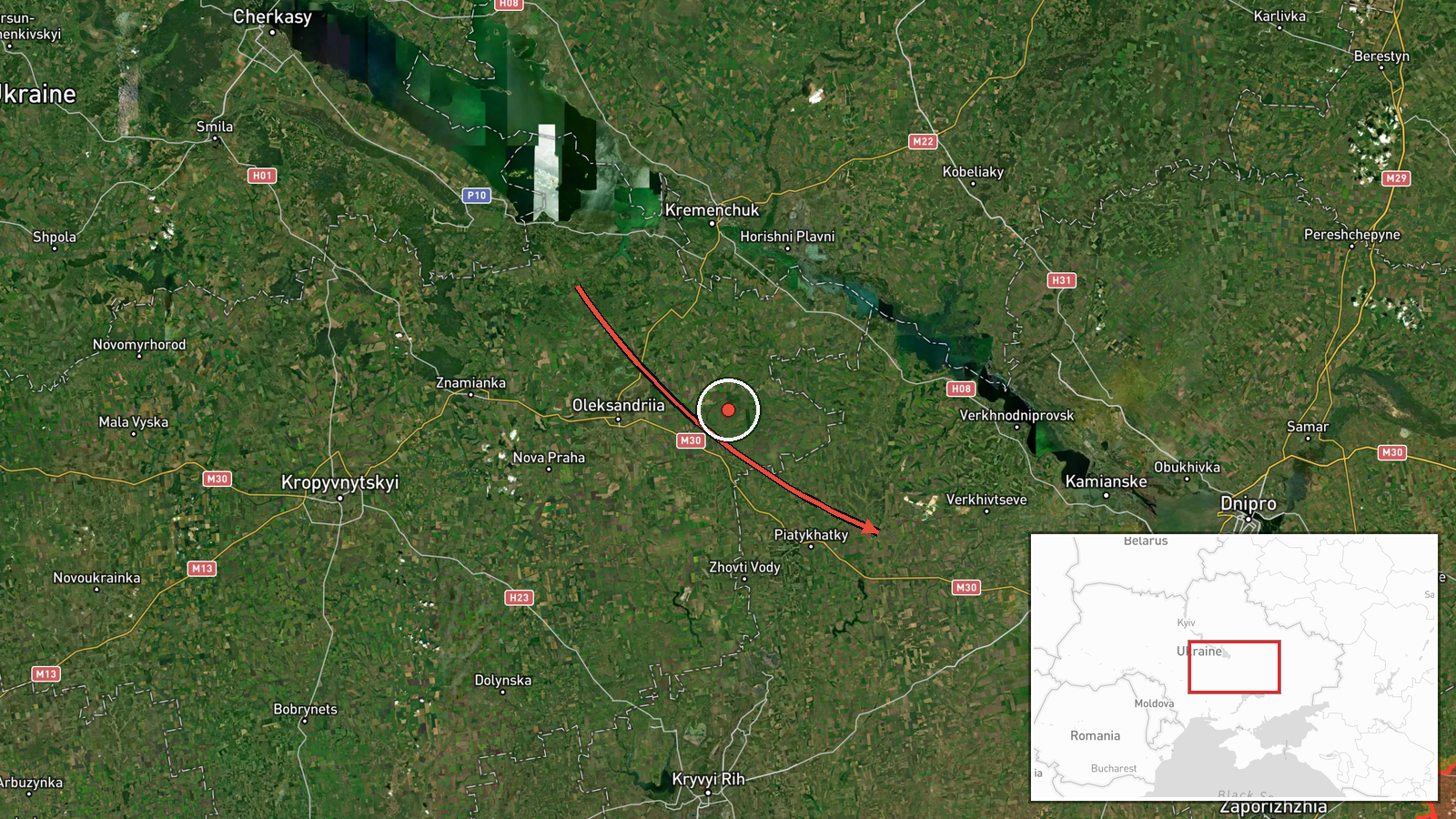
Ukrainian air monitoring reported one Russian jet-powered Shahed (Geran-3) drone transiting from Cherkasy Oblast toward Kalynopil on 15 October at 01:57 UTC. The report, issued by Telegram channel @kpszsu, characterizes the unmanned system as a jet-powered variant, distinguishing it from the turboprop models more commonly observed in recent strikes. The drone's trajectory and intended target remain unclear from available reporting.
Context and assessment
Kalynopil lies in central Cherkasy Oblast, a region that has experienced sustained Russian drone operations over the past 24 hours. Related Ukrainian air monitoring reports document significant drone activity across nearby regions—including eight Shahed-type drones over Horishni Plavni and over Oleksandriya on 14 October, alongside cruise missile variants. This latest transit suggests a continuation of Russian aerial reconnaissance or strike missions across central Ukraine's rear areas. The appearance of the jet-powered Geran-3 variant may indicate testing of different delivery platforms or concentration of effort against particular target sets in the region.
Sources and confidence
Report sourced solely from Telegram channel @kpszsu (Kyiv Post), which monitors Ukrainian air defense alerts. Single-source reporting limits independent confirmation; no corroborating civilian or military accounts are presently available. Confidence score of 8.0 reflects reliance on a known Ukrainian monitoring channel but absence of cross-confirmation. Additional independent verification or air defense interception reports would strengthen confidence; contradictory reports or silence from other monitors would lower it.
Location
Kalynopil is a settlement in Cherkasy Oblast, central Ukraine, located approximately 185 kilometers southeast of Kyiv. The settlement sits in relatively flat agricultural terrain within the Dnieper River basin region. Nearby Talne and Oleksandriya represent regional reference points for Russian drone operations tracked over the past day.
Related events nearby
- Ukrainian air monitoring: 1 Russian Shahed-type drone passing Bohodukhiv, heading toward Oleksandriya.2026-10-14 14:49 UTC · Drone Transit · Oleksandriya, Ukraine
- Ukrainian air monitoring: 3 Russian Shahed-type drones over Oleksandriya; 3 Russian Banderol mini cruise missi2026-10-14 13:02 UTC · Cruise Missile · Oleksandriya, Ukraine
- Ukrainian air monitoring: 8 Russian Shahed-type drones over Oleksandriya.2026-10-14 12:28 UTC · Drone Transit · Oleksandriya, Ukraine
- Ukrainian air monitoring: 8 Russian Shahed-type drones over Horishni Plavni.2026-10-14 12:16 UTC · Drone Transit · Horishni Plavni, Ukraine
- Ukrainian air monitoring: 1 Russian guided glide bomb (KAB) heading toward Dnipropetrovsk Oblast.2026-10-15 01:59 UTC · Airstrike · Dnipropetrovsk Oblast, Ukraine
▶ View this event on the live map

Intel Mapper aggregates open-source reports from monitored Telegram and X channels, geolocates them, cross-checks duplicates across sources and assigns a confidence score. Entries are updated as new confirmations arrive. Read how we verify events.