Russia strikes Oleksandriya with Shahed drones and Banderol cruise missiles
What happened
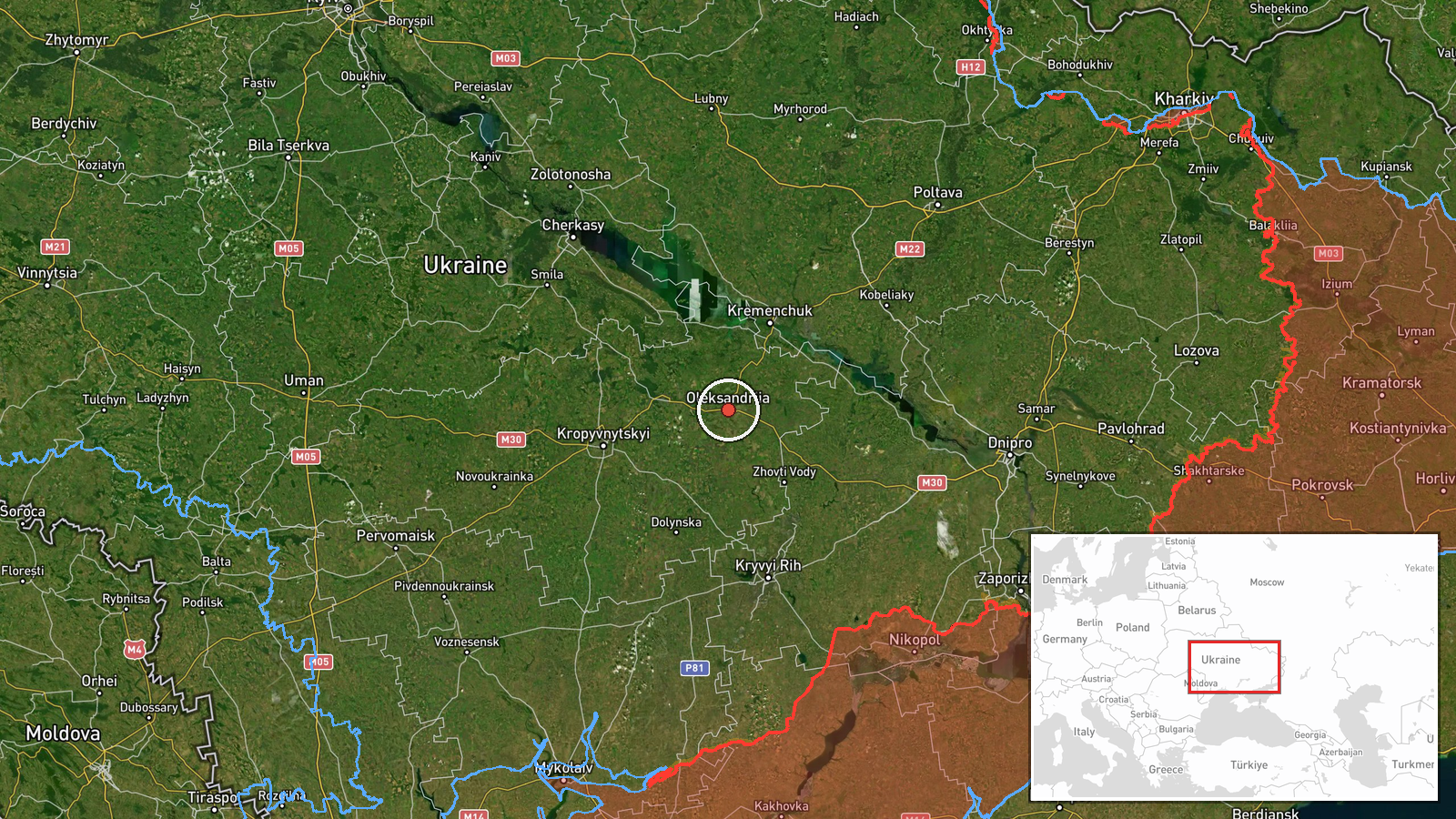
Ukrainian air monitoring reportedly detected three Russian Shahed-type drones and three Banderol mini cruise missiles over Oleksandriya on the morning of October 14. The report was posted to Telegram by @war_monitor at 13:02 UTC. Oleksandriya is a city of approximately 235,000 in central Kirovohrad Oblast. No immediate damage or casualty reports were included in the monitoring alert.
Context and assessment
Oleksandriya has been a repeated target of Russian drone and cruise missile operations in recent days, with eight Shahed drones detected over the city earlier the same morning at 12:28 UTC. The broader pattern shows sustained Russian strikes across central Ukraine's infrastructure corridor, with concurrent drone activity over Horishni Plavni and ongoing pressure toward Kremenchuk district. Banderol cruise missiles represent a relatively newer addition to Russian strike inventory. The concentration of multiple drone waves and cruise missiles within hours suggests possible coordination against stationary infrastructure or logistical hubs in the region, though Ukrainian defenses reportedly intercept a significant portion of such attacks.
Sources and confidence
Single source: Telegram channel @war_monitor, which monitors Ukrainian official air-raid alerts. No cross-confirmation from independent sources or competing channels reported. Confidence score of 6.0 reflects sole-source reporting; Ukrainian air monitoring data is generally reliable for detection but does not confirm strikes or impacts. Confirmation from damage reports, official statements, or secondary monitoring would raise confidence.
Location
Oleksandriya, a city in Kirovohrad Oblast in central Ukraine (48.67°N, 33.12°E). Located approximately 180 kilometers southwest of Kyiv and 110 kilometers west of Kremenchuk, it sits on the Inhul River in the southern Poltava steppe. The city is a regional transport hub and industrial center.
Related events nearby
- Ukrainian air monitoring: 8 Russian Shahed-type drones over Oleksandriya.2026-10-14 12:28 UTC · Drone Transit · Oleksandriya, Ukraine
- Ukrainian air monitoring: 6 Russian Shahed-type drones passing Donetsk, heading toward Kremenchuk district.2026-10-14 07:39 UTC · Drone Transit · Kremenchuk district, Ukraine
- Ukrainian air monitoring: 1 Russian Shahed-type drone heading toward Kremenchuk.2026-10-13 17:40 UTC · Drone Transit · Kremenchuk, Ukraine
- Ukrainian air monitoring: 8 Russian Shahed-type drones over Horishni Plavni.2026-10-14 12:16 UTC · Drone Transit · Horishni Plavni, Ukraine
- Ukrainian air monitoring: 1 Russian Shahed-type drone heading toward Kropyvnytskyi.2026-10-13 19:09 UTC · Drone Transit · Kropyvnytskyi, Ukraine
▶ View this event on the live map

Intel Mapper aggregates open-source reports from monitored Telegram and X channels, geolocates them, cross-checks duplicates across sources and assigns a confidence score. Entries are updated as new confirmations arrive. Read how we verify events.