Russian Geran-3 drone reported heading toward Sarny in northern Rivne Oblast
What happened
Ukrainian air monitoring reported a single Russian jet-powered Shahed (Geran-3) unmanned aerial vehicle transiting toward Sarny, a settlement in northern Rivne Oblast, on the morning of 15 October 2026. The sighting was logged at 16:17 UTC. The report comes from the official Telegram channel of Ukraine's air defence command (@kpszsu), which routinely tracks incoming aerial threats across Ukrainian airspace.
Context and assessment
Sarny lies in the northwestern portion of Rivne Oblast, approximately 160 kilometres from the Russian border. The reported drone transit fits into a broader pattern observed on 15 October, with multiple Geran-3 sightings across northern and central Ukrainian settlements including Berezne, Rokytne, Kostopil, and Olevsk. This clustering suggests either a coordinated multi-vector attack or routine reconnaissance operations. The Geran-3 is a long-range, jet-powered loitering munition capable of striking infrastructure and military targets at significant distance. Repeated drone activity in the Rivne region may indicate sustained Russian pressure on Ukrainian logistics, power systems, or civilian infrastructure in the north.
Sources and confidence
Single source: Ukraine's official air defence command (@kpszsu) on Telegram. No corroborating reports from independent sources, other Ukrainian military channels, or international monitoring agencies are provided. The confidence score of 8.0 reflects the official status of the source and typical accuracy of air monitoring reports, though independent confirmation would strengthen it. Cross-verification from additional Ukrainian channels or NATO intelligence would raise confidence; absence of follow-up impact reports or air defence engagement notices may suggest interception or track loss.
Location
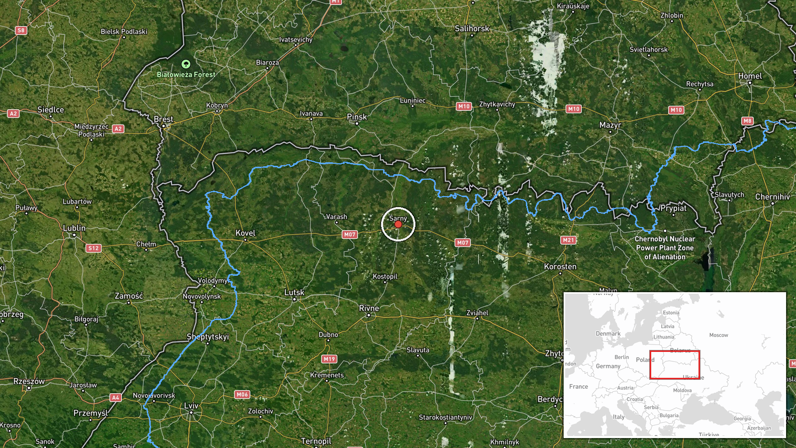
Sarny is located in the Rivne Oblast of northwestern Ukraine (51.34°N, 26.62°E), approximately 40 kilometres south of the Belarusian border. The settlement sits on the Sluch River in a region characterised by mixed woodland and agricultural terrain. It is a regional administrative centre with civilian and potentially military-related infrastructure, lying within Ukrainian air defence coverage but at distance from major urban population centres.
Related events nearby
- Ukrainian air monitoring: 1 Russian jet-powered Shahed (Geran-3) drone heading toward Berezne.2026-10-15 05:10 UTC · Drone Transit · Berezne, Ukraine
- Ukrainian air monitoring: 1 Russian jet-powered Shahed (Geran-3) drone from Kyiv Oblast toward Rokytne.2026-10-15 02:24 UTC · Drone Transit · Rokytne, Ukraine
- Ukrainian air monitoring: 1 Russian jet-powered Shahed (Geran-3) drone from Rivne Oblast toward Kostopil.2026-10-15 06:28 UTC · Drone Transit · Kostopil, Ukraine
- Ukrainian air monitoring: 1 Russian jet-powered Shahed (Geran-3) drone over Olevsk.2026-10-15 03:59 UTC · Drone Transit · Olevsk, Ukraine
- Ukrainian air monitoring: 1 Russian Shahed-type drone from Volyn Oblast toward Manevychi.2026-10-15 16:47 UTC · Drone Transit · Manevychi, Ukraine
▶ View this event on the live map

Intel Mapper aggregates open-source reports from monitored Telegram and X channels, geolocates them, cross-checks duplicates across sources and assigns a confidence score. Entries are updated as new confirmations arrive. Read how we verify events.