Russian jet-powered Shahed drone tracked toward Kostopil in northern Ukraine
What happened
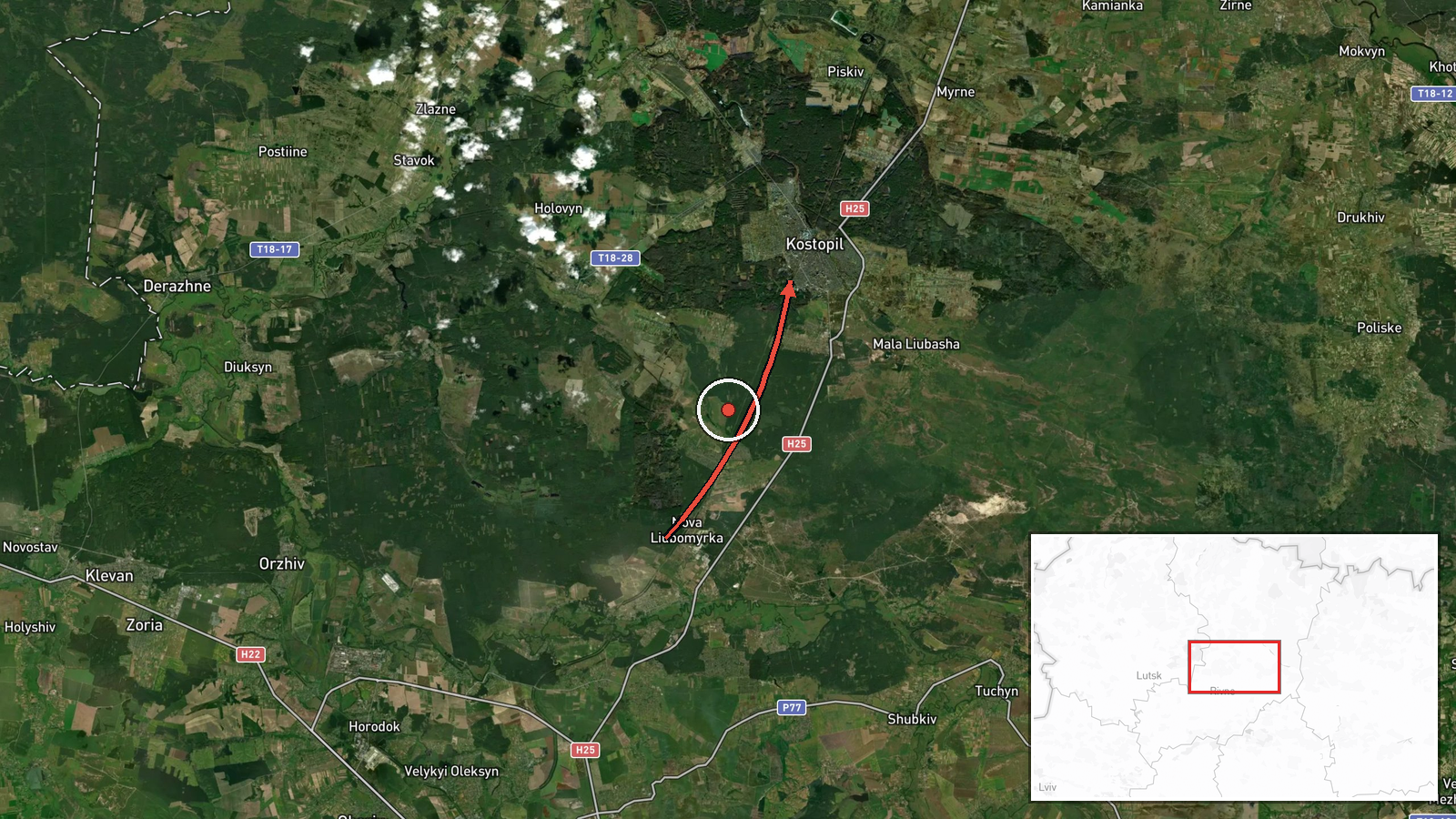
Ukrainian air monitoring reported tracking a single Russian jet-powered Shahed (Geran-3) drone heading toward Kostopil in Rivne Oblast on the morning of 15 October at 06:28 UTC. The drone was detected in transit from within Rivne Oblast. The report was issued by the Kyiv Post Special Monitoring Unit via Telegram and carries a confidence rating of 8.0, indicating a credible single-source detection by established Ukrainian air defense monitoring channels.
Context and assessment
Kostopil, a town of roughly 20,000 residents in northwestern Ukraine, lies within repeated drone transit corridors identified across Rivne Oblast on 15 October. Related events from the same date show a pattern of jet-powered Shaheds moving through the region—detected near Berezne, Kivertsi, and Rivne itself within a five-hour window. This concentration suggests either a coordinated multi-drone strike package routed through the oblast or sequential waves targeting infrastructure across the region. Jet-powered variants of the Shahed carry larger payloads than earlier models and are typically used against strategic targets including energy facilities, military installations, or transport hubs.
Sources and confidence
Report sourced exclusively from Telegram channel @kpszsu (Kyiv Post Special Monitoring Unit), a Ukrainian official air monitoring feed. Single-source reporting at this stage; no cross-confirmation from other monitoring channels or Ukrainian military statements yet noted. Confidence of 8.0 reflects established credibility of the monitoring unit and precise geolocation data, but would be strengthened by secondary confirmation or follow-up reporting of impacts.
Location
Kostopil is a town located at approximately 50.88°N, 26.45°E in Rivne Oblast, northwestern Ukraine, roughly 50 km south of the Belarusian border. The settlement sits in flat terrain typical of the western Ukrainian plain. Geographic precision is high (settlement-level), based on air monitoring track data. Nearby towns include Kivertsi to the south and Berezne to the west, both also reported in the morning's drone detections.
Related events nearby
- Ukrainian air monitoring: 1 Russian jet-powered Shahed (Geran-3) drone heading toward Berezne.2026-10-15 05:10 UTC · Drone Transit · Berezne, Ukraine
- Ukrainian air monitoring: 1 Russian jet-powered Shahed (Geran-3) drone heading toward Rivne.2026-10-15 02:29 UTC · Drone Transit · Rivne, Ukraine
- Ukrainian air monitoring: 1 Russian jet-powered Shahed (Geran-3) drone passing Rivne Oblast, heading southwest2026-10-15 01:54 UTC · Drone Transit · Rivne Oblast, Ukraine
- Ukrainian air monitoring: 1 Russian jet-powered Shahed (Geran-3) drone heading toward Rivne.2026-10-15 01:52 UTC · Drone Transit · Rivne, Ukraine
- Ukrainian air monitoring: 1 Russian jet-powered Shahed (Geran-3) drone heading toward Kivertsi.2026-10-15 04:15 UTC · Drone Transit · Kivertsi, Ukraine
▶ View this event on the live map

Intel Mapper aggregates open-source reports from monitored Telegram and X channels, geolocates them, cross-checks duplicates across sources and assigns a confidence score. Entries are updated as new confirmations arrive. Read how we verify events.