Russian Shahed drone detected heading toward Rokytne in Kyiv Oblast
What happened
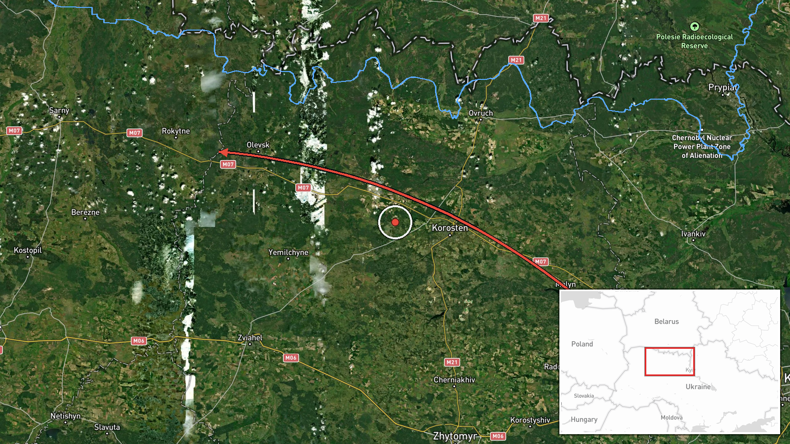
Ukrainian air monitoring reported one Russian jet-powered Shahed (Geran-3) drone transiting toward Rokytne, Kyiv Oblast, on the morning of October 15 at 02:24 UTC. The drone was detected approaching from the southeast. The report originates from the Kyiv Post Telegram channel (@kpszsu), which monitors air activity across Ukrainian territory.
Context and assessment
Rokytne lies in northwestern Kyiv Oblast near the Belarusian border, an area that has faced repeated drone activity in recent months. The detection fits a pattern of sustained Russian cruise-missile and Shahed drone strikes across northern Ukraine. Related events from the same timeframe show multiple Geran-3 drones tracked simultaneously toward settlements in Rivne Oblast and Rivne city between October 14–15, suggesting a coordinated overnight strike campaign. Geran-3 drones, which have extended range compared to earlier Shahed variants, allow Russia to strike targets across much of Ukrainian territory. This activity may indicate a renewed focus on northwestern population centers or military infrastructure.
Sources and confidence
The report comes from a single source, the Kyiv Post Telegram channel (@kpszsu), a Ukrainian monitoring account. No cross-confirmation from independent open-source air defense trackers or official Ukrainian military statements is noted in the dataset. Confidence of 8.0 reflects a credible Ukrainian monitoring source but limited redundancy. Confirmation from official SES or military channels would strengthen confidence; satellite or third-party radar confirmation would be highest validation.
Location
Rokytne is a settlement in northwestern Kyiv Oblast, approximately 180 kilometers northwest of central Kyiv, near the Belarusian border. The settlement sits in terrain characterized by forests and agricultural areas. Coordinates place it at 51.28°N, 27.22°E. The drone's approach from the southeast indicates transit across occupied or contested airspace before reaching this location.
Related events nearby
- Ukrainian air monitoring: 1 Russian jet-powered Shahed (Geran-3) drone heading toward Rivne.2026-10-15 02:29 UTC · Drone Transit · Rivne, Ukraine
- Ukrainian air monitoring: 1 Russian jet-powered Shahed (Geran-3) drone passing Rivne Oblast, heading southwest2026-10-15 01:54 UTC · Drone Transit · Rivne Oblast, Ukraine
- Ukrainian air monitoring: 1 Russian jet-powered Shahed (Geran-3) drone heading toward Rivne.2026-10-15 01:52 UTC · Drone Transit · Rivne, Ukraine
- Ukrainian air monitoring: 1 Russian jet-powered Shahed (Geran-3) drone heading toward Rivne.2026-10-14 03:44 UTC · Drone Transit · Rivne, Ukraine
- Ukrainian air monitoring: 1 Russian jet-powered Shahed (Geran-3) drone transiting from northern Zhytomyr Oblas2026-10-15 01:57 UTC · Drone Transit · Northern Zhytomyr Oblast to Northern Rivne Oblast,
▶ View this event on the live map

Intel Mapper aggregates open-source reports from monitored Telegram and X channels, geolocates them, cross-checks duplicates across sources and assigns a confidence score. Entries are updated as new confirmations arrive. Read how we verify events.