Russian jet-powered Shahed drone transiting northern Zhytomyr Oblast toward Narodychi
What happened
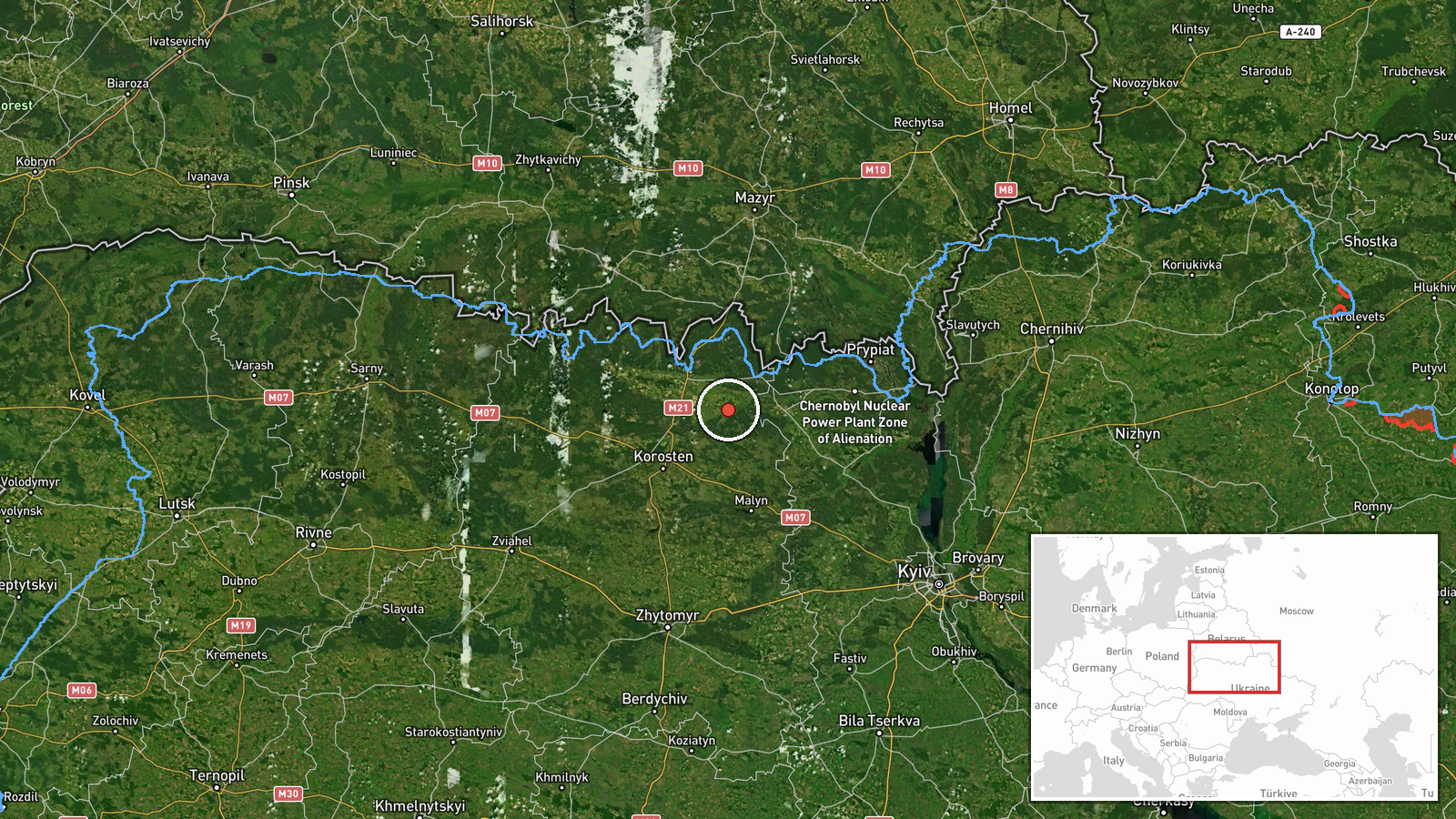
Ukrainian air monitoring reported a single Russian jet-powered Shahed (Geran-3) drone in flight over northern Zhytomyr Oblast on 15 October at 17:06 UTC, heading toward Narodychi settlement. The report was issued by the Kyiv Post Situational Awareness Centre via Telegram. No strike or interception was reported in the available data.
Context and assessment
Narodychi lies in sparsely populated northern Zhytomyr Oblast, roughly 100 km northwest of Kyiv and near the Pripyat River marshlands. The settlement has limited military or civilian infrastructure of obvious strategic value. This sighting is part of a sustained pattern of Russian Shahed (Geran-3) drone transits through northern Zhytomyr and adjacent Rivne Oblast on 15 October, with multiple tracked flights occurring between 01:57 and 17:06 UTC that day. Such transit operations typically indicate either probing of Ukrainian air defences, targeting of infrastructure further north or west, or demonstrations of sustained reach into Ukrainian airspace. The concentration of sightings in this corridor on a single day suggests a coordinated campaign rather than isolated incidents.
Sources and confidence
Reported by Ukrainian official air monitoring (Telegram @kpszsu). Single source, no independent cross-confirmation in available data. Confidence score of 8.0 reflects Ukrainian institutional credibility and consistent methodology, but the absence of secondary confirmation and lack of reported outcome (interception, strike) moderates confidence. Confirmation of impact or interception, or corroborating reports from independent monitors, would raise confidence further.
Location
Narodychi settlement, northern Zhytomyr Oblast, Ukraine (51.20°N, 29.08°E). Located in the sparsely settled forest and marsh region of north-central Ukraine, approximately 100 km northwest of Kyiv, near the Pripyat River system. The area is characterized by low population density and limited urban infrastructure.
Related events nearby
- Ukrainian air monitoring: 2+ Russian jet-powered Shahed (Geran-3) drones over Ovruch.2026-10-15 07:38 UTC · Drone Transit · Ovruch, Ukraine
- Ukrainian air monitoring: 1 Russian jet-powered Shahed (Geran-3) drone heading toward Krasiatychi.2026-10-15 03:36 UTC · Drone Transit · Krasiatychi, Ukraine
- Ukrainian air monitoring: 1 Russian jet-powered Shahed (Geran-3) drone transiting northern Zhytomyr Oblast hea2026-10-15 03:44 UTC · Drone Transit · Northern Zhytomyr Oblast, Ukraine
- Ukrainian air monitoring: 1 Russian jet-powered Shahed (Geran-3) drone transiting from northern Zhytomyr Oblas2026-10-15 01:57 UTC · Drone Transit · Northern Zhytomyr Oblast to Northern Rivne Oblast,
- Ukrainian air monitoring: 1 Russian jet-powered Shahed (Geran-3) drone from Zhytomyr Oblast toward Chopovychi.2026-10-15 05:52 UTC · Drone Transit · Chopovychi, Ukraine
▶ View this event on the live map

Intel Mapper aggregates open-source reports from monitored Telegram and X channels, geolocates them, cross-checks duplicates across sources and assigns a confidence score. Entries are updated as new confirmations arrive. Read how we verify events.