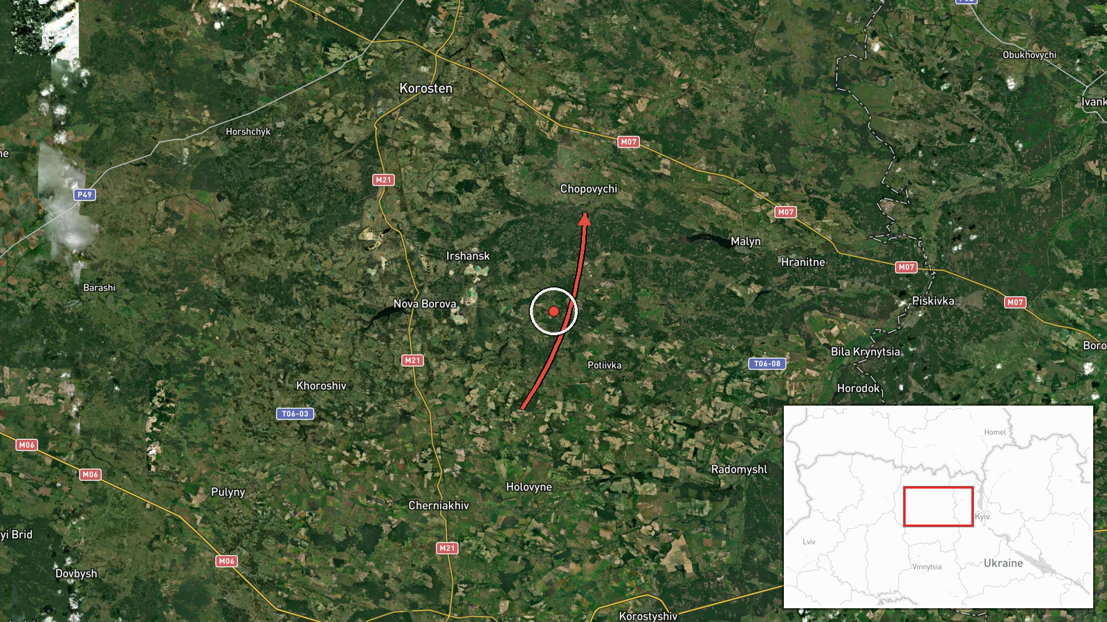
Russian Geran-3 drone tracked toward Chopovychi in Zhytomyr Oblast
What happened
Ukrainian air monitoring reported a single Russian jet-powered Shahed (Geran-3) drone transiting toward Chopovychi in Zhytomyr Oblast on the morning of 15 October at 05:52 UTC. The report was posted by the Kyiv Public Safety Service on Telegram. The drone was detected approaching from the northwest. No intercept or strike outcome was reported in this alert.
Context and assessment
Chopovychi lies in northwestern Zhytomyr Oblast, part of a region that has experienced sustained Russian drone operations throughout the conflict. The Geran-3 is a Russian jet-powered loitering munition derived from the Iranian Shahed design, capable of striking targets at significant range. Related reports from the same morning show multiple Geran-3 sorties tracked across the region—toward Korostyshiv, Krasiatychi, and Ivankiv—suggesting a coordinated or multi-vector attack wave. The northern Zhytomyr-Rivne corridor remains a regular corridor for Russian drone ingress. Such transit reports typically precede strikes on civilian or military infrastructure.
Sources and confidence
Only the Kyiv Public Safety Service (@kpszsu) reported this specific detection via Telegram. Confidence is 8.0/10, reflecting the official Ukrainian military source but singular reporting. Cross-confirmation through independent monitoring, interception reports, or damage assessment would raise confidence. Lower confidence if the drone was subsequently intercepted and the report not updated, or if Ukrainian detection systems later assessed the track as false.
Location
Chopovychi is a settlement in Zhytomyr Oblast in northwestern Ukraine, approximately 100 km northwest of Kyiv. The location was pinpointed to settlement-level precision (high confidence). The area lies in relatively open agricultural terrain between the larger towns of Korostyshiv and the Pripyat River valley, typical drone transit country.
Related events nearby
- Ukrainian air monitoring: 1 Russian jet-powered Shahed (Geran-3) drone heading toward Krasiatychi.2026-10-15 03:36 UTC · Drone Transit · Krasiatychi, Ukraine
- Ukrainian air monitoring: 1 Russian jet-powered Shahed (Geran-3) drone from Zhytomyr Oblast toward Korostyshiv2026-10-15 02:38 UTC · Drone Transit · Korostyshiv, Ukraine
- Russian jet-powered Shahed (Geran-3) drone tracked transiting from northern Zhytomyr Oblast toward northern Ri2026-10-15 01:52 UTC · Drone Transit · Zhytomyr Oblast, Ukraine
- Ukrainian air monitoring: 1 Russian jet-powered Shahed (Geran-3) drone heading toward Ivankiv.2026-10-15 05:16 UTC · Drone Transit · Ivankiv, Ukraine
- Ukrainian air monitoring: 1 Russian jet-powered Shahed (Geran-3) drone passing Pivnichnyi, heading toward Ivan2026-10-15 04:51 UTC · Drone Transit · Ivankiv, Ukraine
▶ View this event on the live map

Intel Mapper aggregates open-source reports from monitored Telegram and X channels, geolocates them, cross-checks duplicates across sources and assigns a confidence score. Entries are updated as new confirmations arrive. Read how we verify events.